Trail Moto cross Fénols - La route des seigneurs et chateaux Aveyronnais - Photo

La route des seigneurs et chateaux Aveyronnais

© OpenStreetMap contributors
Length
Length
269 km
Max alt
Max alt
837 m
Uphill gradient
Uphill gradient
4441 m
Km-Effort
Km-Effort  
328 km
Min alt
Min alt
182 m
Downhill gradient
Downhill gradient
4440 m
Boucle
Boucle
Yes
Creation date :
2023-10-07 15:39:47.453
Updated on :
2023-10-09 12:39:26.119

(0 Reviews)

Moto cross
Moto cross
7h00
Difficulty : Easy

Scan this QR Code to open this trail in the SityTrail application

FREE GPS app for hiking

Logo SityTrail SityTrail

IGN / Geographical institutes

Download SityTrail from the App Store Download SityTrail from Google Play

Logo SityTrail SityTrail World

The world is yours!

Download SityTrail from the App Store Download SityTrail from Google Play Download SityTrail on Huawei AppGallery

About

Trail Moto cross of 269 km to be discovered at Occitania, Tarn, Fénols. This trail is proposed by jpipacific.

Description

Magnifique route (uniquement asphalte) faite avec Honda Africa Twin CRF 1000 DCT.
Avec Christian en BMW 850 GS.
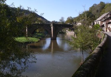
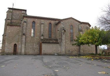
Des paysages très changeants tantôt au bord du Tarn, tantôt en crête, en sous bois, des petits villages, etc...Un régal.
Les routes sont en très bon état.
Route facile et le restaurant à Brousse le Château (Logis Hôtel le Relays du Chasteau) est à recommander. Pas trop cher et très bon.

Elevation profile

Photos

Positioning

Country:
France
Region :
Occitania
Department/Province :
Tarn
Municipality :
Fénols
Location:
Unknown
Start:(UTM)
424366 ; 4856756 (31T) N.

Trails nearby

Trail Moto cross Aussac - Balade à Bozouls - Photo
Moto cross
jpipacific

Moto cross

Medium
Aussac, Occitania, Tarn, France
379 km | 465 km-effort
7h 37min
No
Trail Walking Poulan-Pouzols - Pouzols chemin d'agros variante - Photo
Walking
jpipacific

Walking

Medium
Poulan-Pouzols, Occitania, Tarn, France
7.9 km | 9.3 km-effort
2h 0min
Yes
Trail Nordic walking Florentin - Sentier des colombes Florentin - Photo
Nordic walking
chripaci

Nordic walking

Medium
Florentin, Occitania, Tarn, France
10.9 km | 13.7 km-effort
2h 22min
Yes
Trail Walking Orban - SityTrail - 3061378 - orban-chemin-des-cretes - Photo
Walking
chripaci

Walking

Medium
Orban, Occitania, Tarn, France
5.9 km | 7.5 km-effort
1h 42min
Yes
Trail 4x4 Fénols - Vabre Anglés Parc du haut Languedoc - Photo
4x4
jpipacific

4x4

Medium
Fénols, Occitania, Tarn, France
181 km | 243 km-effort
7h 43min
No
Trail Mountain bike Rouffiac - Circuit du Puech de Mourens - Rouffiac - Photo
Mountain bike
tracegps

Mountain bike

Easy
Rouffiac, Occitania, Tarn, France
9.5 km | 11.8 km-effort
45min
Yes
Trail Walking Rouffiac - Circuit du Puech de Mourens - Rouffiac - Photo
Walking
tracegps

Walking

Medium
(1)
Rouffiac, Occitania, Tarn, France
9.5 km | 11.8 km-effort
2h 19min
Yes
Trail Walking Aussac - La Martinié Aussac Fenols  - Photo
Walking
jpipacific

Walking

Easy
Aussac, Occitania, Tarn, France
7.8 km | 9.5 km-effort
2h 9min
Yes
Trail Walking Aussac - Aussac Fenols  - Photo
Walking
tercla

Walking

Medium
Aussac, Occitania, Tarn, France
9.9 km | 11.8 km-effort
2h 42min
Yes


Close
My subscriptions