![](/images/other/stat-length.png)
![Trail Walking Allan - 2023_10_01_Transclavienne - Photo](https://media.geolcdn.com/t/1900/400/ext.pjpeg?maxdim=2&url=https%3A%2F%2Fstatic1.geolcdn.com%2Fsiteimages%2Fupload%2Ffiles%2F1553511878bg_sport_marche.png)
2023_10_01_Transclavienne
Chamois30
User
![Length](/images/other/stat-length.png)
Length
19.1 km
![Max alt](https://static1.geolcdn.com/siteimages/upload/files/1508320355ic_sort_altitude_max_24dp.png)
Max alt
389 m
![Uphill gradient](https://static1.geolcdn.com/siteimages/upload/files/1508320355ic_sort_den_pos_24dp.png)
Uphill gradient
514 m
![Km-Effort](/images/other/stat-length.png)
Km-Effort
26 km
![Min alt](https://static1.geolcdn.com/siteimages/upload/files/1508320355ic_sort_altitude_min_24dp.png)
Min alt
151 m
![Downhill gradient](https://static1.geolcdn.com/siteimages/upload/files/1508320355ic_sort_den_neg_24dp.png)
Downhill gradient
575 m
![Boucle](https://static1.geolcdn.com/siteimages/upload/files/16400158638029165_repeat_loop_refresh_sync_direction_icon.png)
Boucle
No
Creation date :
2023-10-01 06:51:32.946
Updated on :
2023-10-07 12:38:13.435
![Walking](https://static1.geolcdn.com/sitytour/trail-icons/101.png)
3h54
Difficulty : Medium
![Scan this QR Code to open this trail in the SityTrail application](https://capi.geolives.com/qq0zvz2zws4bq2lad0pu/sitytour/trails/3831786/qr.png?size=200)
FREE GPS app for hiking
About
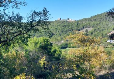
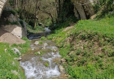
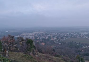
Trail Walking of 19.1 km to be discovered at Auvergne-Rhône-Alpes, Drôme, Allan. This trail is proposed by Chamois30.
Description
Rando de pays organisée par le foyer Rural d'Allan.
Attention on s'est trompé au retour après le R2 (côte 382), il faut passer par Forlaye (à droite près de la côte 236) et rejoindre le vieux château.
Positioning
Country:
France
Region :
Auvergne-Rhône-Alpes
Department/Province :
Drôme
Municipality :
Allan
Location:
Unknown
Start:(Dec)
Start:(UTM)
642692 ; 4928565 (31T) N.
Comments
Trails nearby
![Trail Walking Espeluche - 2022-10-20_15h14m37_GPX-Bois-Jamot-Espeluche - Photo](https://media.geolcdn.com/t/375/260/799cda92-0993-44e5-bfc9-d42f9f871bf2.jpg&format=jpg&maxdim=2)
![Walking Walking](https://static1.geolcdn.com/sitytour/trail-icons/101.png)
2022-10-20_15h14m37_GPX-Bois-Jamot-Espeluche
Walking
Medium
(1)
Espeluche,
Auvergne-Rhône-Alpes,
Drôme,
France
![](/images/other/stat-length.png)
11.3 km | 15.4 km-effort
3h 28min
![](https://static1.geolcdn.com/siteimages/upload/files/16400158638029165_repeat_loop_refresh_sync_direction_icon.png)
Yes
![Trail Walking Rochefort-en-Valdaine - Rochefort-en-Valdaine Le Janeston 7km5 - Photo](https://media.geolcdn.com/t/375/260/c37954dd-2a13-465c-a79c-9622f5a3d882.jpg&format=jpg&maxdim=2)
![Walking Walking](https://static1.geolcdn.com/sitytour/trail-icons/101.png)
Rochefort-en-Valdaine Le Janeston 7km5
Walking
Medium
(1)
Rochefort-en-Valdaine,
Auvergne-Rhône-Alpes,
Drôme,
France
![](/images/other/stat-length.png)
7.3 km | 10.3 km-effort
2h 23min
![](https://static1.geolcdn.com/siteimages/upload/files/16400158638029165_repeat_loop_refresh_sync_direction_icon.png)
Yes
![Trail Walking Allan - allan transclavienne rac - Photo](https://media.geolcdn.com/t/375/260/ext.jpg?maxdim=2&url=https%3A%2F%2Fservices.sitytrail.com%2FGeolivesWS%2FDownloadMedia.ashx%3FTrailID%3D649381%26Media%3Dfix__20161022171755.jpg)
![Walking Walking](https://static1.geolcdn.com/sitytour/trail-icons/101.png)
allan transclavienne rac
Walking
Very easy
(1)
Allan,
Auvergne-Rhône-Alpes,
Drôme,
France
![](/images/other/stat-length.png)
19.1 km | 26 km-effort
5h 11min
![](https://static1.geolcdn.com/siteimages/upload/files/16400158638029165_repeat_loop_refresh_sync_direction_icon.png)
Yes
![Walking Walking](https://static1.geolcdn.com/sitytour/trail-icons/101.png)
2022-10-10_11h21m09_tmpWriteApidae_259847_fr
Walking
Medium
Allan,
Auvergne-Rhône-Alpes,
Drôme,
France
![](/images/other/stat-length.png)
10.7 km | 15.2 km-effort
3h 27min
![](https://static1.geolcdn.com/siteimages/upload/files/16400158638029165_repeat_loop_refresh_sync_direction_icon.png)
Yes
![Trail Walking Espeluche - 2022-10-10_11h19m57_9875258 - Photo](https://media.geolcdn.com/t/375/260/7d9cd8c2-7377-40ec-9100-181655b047cd.jpg&format=jpg&maxdim=2)
![Walking Walking](https://static1.geolcdn.com/sitytour/trail-icons/101.png)
2022-10-10_11h19m57_9875258
Walking
Medium
Espeluche,
Auvergne-Rhône-Alpes,
Drôme,
France
![](/images/other/stat-length.png)
8 km | 10.2 km-effort
2h 9min
![](https://static1.geolcdn.com/siteimages/upload/files/16400158638029165_repeat_loop_refresh_sync_direction_icon.png)
Yes
![Trail sport Allan - SityTrail - Les Villages Perchés. - Photo](https://media.geolcdn.com/t/375/260/ext.jpg?maxdim=2&url=https%3A%2F%2Fsecurestorage.geolives.com%2Fsitytour%2Ftrail-bg%2Fdefault.jpg)
SityTrail - Les Villages Perchés.
sport
Very easy
(1)
Allan,
Auvergne-Rhône-Alpes,
Drôme,
France
![](/images/other/stat-length.png)
19.5 km | 27 km-effort
Unknown
![](https://static1.geolcdn.com/siteimages/upload/files/16400158638029165_repeat_loop_refresh_sync_direction_icon.png)
Yes
![Trail Walking Réauville - Aiguebelle Le Fraysse 12km. - Photo](https://media.geolcdn.com/t/375/260/b7c9ed57-8717-457b-b253-1af0c3694b1f.jpg&format=jpg&maxdim=2)
![Walking Walking](https://static1.geolcdn.com/sitytour/trail-icons/101.png)
Aiguebelle Le Fraysse 12km.
Walking
Medium
Réauville,
Auvergne-Rhône-Alpes,
Drôme,
France
![](/images/other/stat-length.png)
12.2 km | 15.6 km-effort
3h 33min
![](https://static1.geolcdn.com/siteimages/upload/files/16400158638029165_repeat_loop_refresh_sync_direction_icon.png)
Yes
![Trail Walking Allan - Allan Monastère de Aiguebelle19km. - Photo](https://media.geolcdn.com/t/375/260/188cd057-0a68-4056-ab4b-d71cffa1cc79.jpg&format=jpg&maxdim=2)
![Walking Walking](https://static1.geolcdn.com/sitytour/trail-icons/101.png)
Allan Monastère de Aiguebelle19km.
Walking
Very difficult
Allan,
Auvergne-Rhône-Alpes,
Drôme,
France
![](/images/other/stat-length.png)
19.1 km | 26 km-effort
5h 48min
![](https://static1.geolcdn.com/siteimages/upload/files/16400158638029165_repeat_loop_refresh_sync_direction_icon.png)
Yes
![Trail Walking Allan - Allan Rochefort-en-Valdaine 19km. - Photo](https://media.geolcdn.com/t/375/260/d1734170-d5dd-4233-8809-72094606c88c.jpg&format=jpg&maxdim=2)
![Walking Walking](https://static1.geolcdn.com/sitytour/trail-icons/101.png)
Allan Rochefort-en-Valdaine 19km.
Walking
Very difficult
Allan,
Auvergne-Rhône-Alpes,
Drôme,
France
![](/images/other/stat-length.png)
18.6 km | 27 km-effort
6h 11min
![](https://static1.geolcdn.com/siteimages/upload/files/16400158638029165_repeat_loop_refresh_sync_direction_icon.png)
Yes