


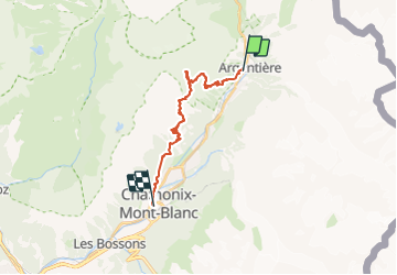

6.1 km | 8.7 km-effort


User


FREE GPS app for hiking
 SityTrail
IGN / Geographical institutes
SityTrail World
The world is yours!
Trail Walking of 21 km to be discovered at Auvergne-Rhône-Alpes, Upper Savoy, Chamonix-Mont-Blanc. This trail is proposed by Boubouc77.
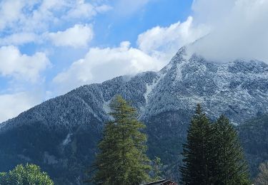
superbe randonnée avec une vue sur le massif du Mont Blanc! Tout simplement grandiose

Walking

Walking

Walking

Winter sports

Walking

Walking

Walking
Walking

Walking