Trail Walking Unknown - Autour du Peak Mangsan  - Photo
 dudu42
dudu42

User

© OpenStreetMap contributors
Length
Length
7.8 km
Max alt
Max alt
360 m
Uphill gradient
Uphill gradient
493 m
Km-Effort
Km-Effort  
14.5 km
Min alt
Min alt
0 m
Downhill gradient
Downhill gradient
557 m
Boucle
Boucle
No
Creation date :
2023-09-29 00:38:04.318
Updated on :
2023-09-29 06:25:53.293

(0 Reviews)

Walking
Walking
3h31
Difficulty : Difficult

Scan this QR Code to open this trail in the SityTrail application

FREE GPS app for hiking

Logo SityTrail SityTrail

IGN / Geographical institutes

Download SityTrail from the App Store Download SityTrail from Google Play

Logo SityTrail SityTrail World

The world is yours!

Download SityTrail from the App Store Download SityTrail from Google Play Download SityTrail on Huawei AppGallery

About

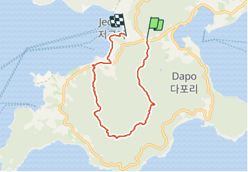
Trail Walking of 7.8 km to be discovered at Gyeongsangnam-do, Geoje-si. This trail is proposed by dudu42.

Description

Itinéraire penté au départ, passage sur les crêtes, en sous bois la plupart du temps. Quelques escaliers en bois pour les accès au sommets. Belles vues panoramiques a chaque Peak. Vraiment peu de monde ( férié). Redescente vers la plage.

Elevation profile

Photos

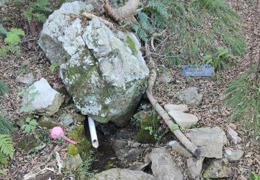
31 photos in total. Please click on a photo to see them all in the gallery.

Positioning

Country:
Korea, Republic of
Region :
Gyeongsangnam-do
Department/Province :
Geoje-si
Municipality :
Unknown
Location:
Unknown
Start:(UTM)
464647 ; 3843156 (52S) N.

Trails nearby

Trail Walking  - Randonnée au Peak Garasan  - Photo
Walking
dudu42

Walking

Difficult
, Gyeongsangnam-do, Geoje-si, Korea, Republic of
6.6 km | 13.1 km-effort
2h 38min
Yes


Close
My subscriptions