26 km | 37 km-effort
Branceilles - Curemonte
jpblimond
User
Length
10.2 km
Max alt
246 m
Uphill gradient
261 m
Km-Effort
13.7 km
Min alt
135 m
Downhill gradient
257 m
Boucle
Yes
Creation date :
2023-09-27 11:01:21.0
Updated on :
2023-09-28 08:09:23.273
3h06
Difficulty : Difficult
FREE GPS app for hiking
About
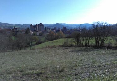
Trail Walking of 10.2 km to be discovered at New Aquitaine, Corrèze, Branceilles. This trail is proposed by jpblimond.
Positioning
Country:
France
Region :
New Aquitaine
Department/Province :
Corrèze
Municipality :
Branceilles
Location:
Unknown
Start:(Dec)
Start:(UTM)
398356 ; 4985039 (31T) N.
Comments
Trails nearby
Circuit des sentes
Mountain bike
Difficult
(1)
Curemonte,
New Aquitaine,
Corrèze,
France
3h 4min
Yes
Entre vignes et noyers - Queyssac les Vignes
Walking
Medium
(1)
Queyssac-les-Vignes,
New Aquitaine,
Corrèze,
France
8 km | 10.7 km-effort
2h 0min
Yes
Le bois de l'empire
Mountain bike
Difficult
(1)
Chauffour-sur-Vell,
New Aquitaine,
Corrèze,
France
26 km | 34 km-effort
3h 0min
Yes
Le vin paillé
Walking
Easy
(1)
Queyssac-les-Vignes,
New Aquitaine,
Corrèze,
France
10.4 km | 13.8 km-effort
2h 30min
Yes
Aux confins du Quercy - Chauffour sur Vell - Pays de la vallée de la Dordogne...
Mountain bike
Medium
(1)
Chauffour-sur-Vell,
New Aquitaine,
Corrèze,
France
15.5 km | 18.7 km-effort
1h 19min
Yes
Boucle de Meyssac à Beynat
Mountain bike
Very difficult
(1)
Meyssac,
New Aquitaine,
Corrèze,
France
40 km | 53 km-effort
3h 41min
Yes
Circuit VTT Meyssac -Saillac-Ligneyrac-Collonges
Mountain bike
Very difficult
(1)
Meyssac,
New Aquitaine,
Corrèze,
France
34 km | 44 km-effort
2h 54min
Yes
2019-12-28_17h26m41_L'Hôpital(32km)
Mountain bike
Difficult
(1)
Chauffour-sur-Vell,
New Aquitaine,
Corrèze,
France
32 km | 41 km-effort
2h 48min
Yes
curemonte/Collonges:la boucle verte
Mountain bike
Medium
(1)
Chauffour-sur-Vell,
New Aquitaine,
Corrèze,
France
31 km | 39 km-effort
2h 31min
Yes