![](/images/other/stat-length.png)
![Trail Walking Beaujeu - Beaujeu (15 km - D. 675 m)](https://media.geolcdn.com/t/1900/400/ext.pjpeg?maxdim=2&url=https%3A%2F%2Fstatic1.geolcdn.com%2Fsiteimages%2Fupload%2Ffiles%2F1553511878bg_sport_marche.png)
Beaujeu (15 km - D. 675 m) "La croix de Rochefort"
Thomasdanielle
User
![Length](/images/other/stat-length.png)
Length
14.7 km
![Max alt](https://static1.geolcdn.com/siteimages/upload/files/1508320355ic_sort_altitude_max_24dp.png)
Max alt
891 m
![Uphill gradient](https://static1.geolcdn.com/siteimages/upload/files/1508320355ic_sort_den_pos_24dp.png)
Uphill gradient
674 m
![Km-Effort](/images/other/stat-length.png)
Km-Effort
24 km
![Min alt](https://static1.geolcdn.com/siteimages/upload/files/1508320355ic_sort_altitude_min_24dp.png)
Min alt
305 m
![Downhill gradient](https://static1.geolcdn.com/siteimages/upload/files/1508320355ic_sort_den_neg_24dp.png)
Downhill gradient
674 m
![Boucle](https://static1.geolcdn.com/siteimages/upload/files/16400158638029165_repeat_loop_refresh_sync_direction_icon.png)
Boucle
Yes
Creation date :
2023-09-25 07:23:54.0
Updated on :
2023-09-27 09:40:55.908
![Walking](https://static1.geolcdn.com/sitytour/trail-icons/101.png)
5h22
Difficulty : Very difficult
![Scan this QR Code to open this trail in the SityTrail application](https://capi.geolives.com/qq0zvz2zws4bq2lad0pu/sitytour/trails/3817974/qr.png?size=200)
FREE GPS app for hiking
About
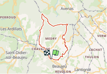
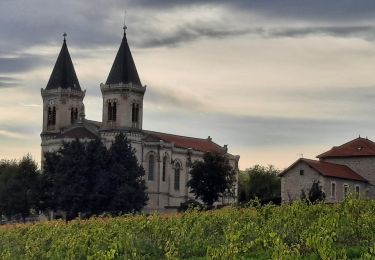
Trail Walking of 14.7 km to be discovered at Auvergne-Rhône-Alpes, Rhône, Beaujeu. This trail is proposed by Thomasdanielle.
Description
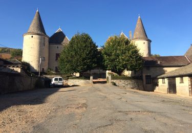
D/A : Parking Ave du Dr. Giraud
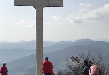
Randonnée difficile.
Attention au retour la descente est difficile, beaucoup de cailloux (ils roulent sous les pieds il faut être bien chaussé et vigilant).
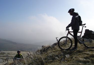
Positioning
Country:
France
Region :
Auvergne-Rhône-Alpes
Department/Province :
Rhône
Municipality :
Beaujeu
Location:
Unknown
Start:(Dec)
Start:(UTM)
622574 ; 5112390 (31T) N.
Comments
Trails nearby
![Trail Mountain bike Lantignié - 19e Rando des Primeurs - Photo](https://media.geolcdn.com/t/375/260/ext.jpg?maxdim=2&url=https%3A%2F%2Fservices.sitytrail.com%2FGeolivesWS%2FDownloadMedia.ashx%3FTrailID%3D101810%26Media%3D2084_2.jpg)
![Mountain bike Mountain bike](https://static1.geolcdn.com/sitytour/trail-icons/202.png)
19e Rando des Primeurs
Mountain bike
Difficult
(1)
Lantignié,
Auvergne-Rhône-Alpes,
Rhône,
France
![](/images/other/stat-length.png)
30 km | 45 km-effort
3h 0min
![](https://static1.geolcdn.com/siteimages/upload/files/16400158638029165_repeat_loop_refresh_sync_direction_icon.png)
Yes
![Trail Walking Beaujeu - Itinérant Beaujolais rouge étape 4 . Malval - Chiroubles - Photo](https://media.geolcdn.com/t/375/260/7e353f10-ae9e-4e5c-a303-dba8e616c8c7.jpg&format=jpg&maxdim=2)
![Walking Walking](https://static1.geolcdn.com/sitytour/trail-icons/101.png)
Itinérant Beaujolais rouge étape 4 . Malval - Chiroubles
Walking
Medium
Beaujeu,
Auvergne-Rhône-Alpes,
Rhône,
France
![](/images/other/stat-length.png)
26 km | 34 km-effort
5h 40min
![](https://static1.geolcdn.com/siteimages/upload/files/16400158638029165_repeat_loop_refresh_sync_direction_icon.png)
No
![Trail Horseback riding Quincié-en-Beaujolais - Quincié CxRozier Court - Photo](https://media.geolcdn.com/t/375/260/ext.jpg?maxdim=2&url=https%3A%2F%2Fstatic1.geolcdn.com%2Fsiteimages%2Fupload%2Ffiles%2F1524743154cheval.jpg)
![Horseback riding Horseback riding](https://static1.geolcdn.com/sitytour/trail-icons/301.png)
Quincié CxRozier Court
Horseback riding
Very difficult
(1)
Quincié-en-Beaujolais,
Auvergne-Rhône-Alpes,
Rhône,
France
![](/images/other/stat-length.png)
28 km | 42 km-effort
5h 33min
![](https://static1.geolcdn.com/siteimages/upload/files/16400158638029165_repeat_loop_refresh_sync_direction_icon.png)
Yes
![Trail Horseback riding Quincié-en-Beaujolais - Quincié Croix ROZEIR - Photo](https://media.geolcdn.com/t/375/260/ext.jpg?maxdim=2&url=https%3A%2F%2Fstatic1.geolcdn.com%2Fsiteimages%2Fupload%2Ffiles%2F1524743154cheval.jpg)
![Horseback riding Horseback riding](https://static1.geolcdn.com/sitytour/trail-icons/301.png)
Quincié Croix ROZEIR
Horseback riding
Very difficult
(1)
Quincié-en-Beaujolais,
Auvergne-Rhône-Alpes,
Rhône,
France
![](/images/other/stat-length.png)
31 km | 46 km-effort
6h 3min
![](https://static1.geolcdn.com/siteimages/upload/files/16400158638029165_repeat_loop_refresh_sync_direction_icon.png)
Yes
![Trail Walking Chiroubles - circuit des crêtes du fût d'Avenas - Photo](https://media.geolcdn.com/t/375/260/5ef15404-af20-4f2b-8081-8ca495b203b9.jpg&format=jpg&maxdim=2)
![Walking Walking](https://static1.geolcdn.com/sitytour/trail-icons/101.png)
circuit des crêtes du fût d'Avenas
Walking
Difficult
Chiroubles,
Auvergne-Rhône-Alpes,
Rhône,
France
![](/images/other/stat-length.png)
13.8 km | 20 km-effort
3h 20min
![](https://static1.geolcdn.com/siteimages/upload/files/16400158638029165_repeat_loop_refresh_sync_direction_icon.png)
Yes
![Trail On foot Régnié-Durette - 2022-09-01_17h24m13_e3IWHtaTFWwfACzh8d3-Xw - Photo](https://media.geolcdn.com/t/375/260/3d2e7483-074f-47cf-a21e-968074b112a3.jpg&format=jpg&maxdim=2)
![On foot On foot](https://static1.geolcdn.com/sitytour/trail-icons/100.png)
2022-09-01_17h24m13_e3IWHtaTFWwfACzh8d3-Xw
On foot
Medium
Régnié-Durette,
Auvergne-Rhône-Alpes,
Rhône,
France
![](/images/other/stat-length.png)
18.1 km | 25 km-effort
5h 40min
![](https://static1.geolcdn.com/siteimages/upload/files/16400158638029165_repeat_loop_refresh_sync_direction_icon.png)
Yes
![Trail Walking Marchampt - 2021-09-04_10h15m01_Marchanp_V1 - Photo](https://media.geolcdn.com/t/375/260/ext.jpg?maxdim=2&url=https%3A%2F%2Fstatic1.geolcdn.com%2Fsiteimages%2Fupload%2Ffiles%2F1553511878bg_sport_marche.png)
![Walking Walking](https://static1.geolcdn.com/sitytour/trail-icons/101.png)
2021-09-04_10h15m01_Marchanp_V1
Walking
Very difficult
(1)
Marchampt,
Auvergne-Rhône-Alpes,
Rhône,
France
![](/images/other/stat-length.png)
19.7 km | 30 km-effort
6h 47min
![](https://static1.geolcdn.com/siteimages/upload/files/16400158638029165_repeat_loop_refresh_sync_direction_icon.png)
Yes
![Trail Walking Chiroubles - Fût d’Avenas (13 km - D. 455 m) - Photo](https://media.geolcdn.com/t/375/260/a25dadc2-d581-41f4-b844-883fbaf4f91a.jpeg&format=jpg&maxdim=2)
![Walking Walking](https://static1.geolcdn.com/sitytour/trail-icons/101.png)
Fût d’Avenas (13 km - D. 455 m)
Walking
Medium
(1)
Chiroubles,
Auvergne-Rhône-Alpes,
Rhône,
France
![](/images/other/stat-length.png)
13 km | 19.1 km-effort
4h 21min
![](https://static1.geolcdn.com/siteimages/upload/files/16400158638029165_repeat_loop_refresh_sync_direction_icon.png)
Yes
![Trail Walking Quincié-en-Beaujolais - Quincié-En-Beaujolais (10,5 km-D.378) - Photo](https://media.geolcdn.com/t/375/260/ext.jpg?maxdim=2&url=https%3A%2F%2Fservices.sitytrail.com%2FGeolivesWS%2FDownloadMedia.ashx%3FTrailID%3D852331%26Media%3D20171026161848.jpg)
![Walking Walking](https://static1.geolcdn.com/sitytour/trail-icons/101.png)
Quincié-En-Beaujolais (10,5 km-D.378)
Walking
Easy
Quincié-en-Beaujolais,
Auvergne-Rhône-Alpes,
Rhône,
France
![](/images/other/stat-length.png)
10.4 km | 14.8 km-effort
3h 14min
![](https://static1.geolcdn.com/siteimages/upload/files/16400158638029165_repeat_loop_refresh_sync_direction_icon.png)
Yes