![](/images/other/stat-length.png)
![Trail Walking Bussang - TREK ALSACIEN (boucle rochelotte) - Photo](https://media.geolcdn.com/t/1900/400/9ec84553-ee04-4a10-aa7e-0d30d0797c90.jpg&format=pjpeg&maxdim=2)
TREK ALSACIEN (boucle rochelotte)
© OpenStreetMap contributors
![Walking](https://static1.geolcdn.com/sitytour/trail-icons/101.png)
Walking
2h39
Difficulty : Easy
![Length](/images/other/stat-length.png)
Length
8.1 km
![Max alt](https://static1.geolcdn.com/siteimages/upload/files/1508320355ic_sort_altitude_max_24dp.png)
Max alt
1054 m
![Uphill gradient](https://static1.geolcdn.com/siteimages/upload/files/1508320355ic_sort_den_pos_24dp.png)
Uphill gradient
266 m
![Km-Effort](/images/other/stat-length.png)
Km-Effort
11.7 km
![Min alt](https://static1.geolcdn.com/siteimages/upload/files/1508320355ic_sort_altitude_min_24dp.png)
Min alt
816 m
![Downhill gradient](https://static1.geolcdn.com/siteimages/upload/files/1508320355ic_sort_den_neg_24dp.png)
Downhill gradient
267 m
![Boucle](https://static1.geolcdn.com/siteimages/upload/files/16400158638029165_repeat_loop_refresh_sync_direction_icon.png)
Boucle
Yes
Creation date :
2023-09-16 20:16:54.968
Updated on :
2024-09-21 17:46:07.303
![Walking](https://static1.geolcdn.com/sitytour/trail-icons/101.png)
2h39
Difficulty : Easy
![Scan this QR Code to open this trail in the SityTrail application](https://capi.geolives.com/qq0zvz2zws4bq2lad0pu/sitytour/trails/3808774/qr.png?size=200)
FREE GPS app for hiking
About
Trail Walking of 8.1 km to be discovered at Grand Est, Vosges, Bussang. This trail is proposed by Godasses et Grosses Pattes.
Description
Petite incursion dans les Vosges pour cette belle boucle.
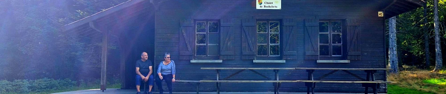
Parking au chalet rochelotte (bussang) c'est de la que l'on démarre la boucle.
Passage par le monument du souvenir devant le chalet du petit-haut, la fontaine des grognards, le point de vue du haut des revolles, la croix de fresse, la station de ski Larcenaire et retour au chalet rochelotte.
Positioning
Country:
France
Region :
Grand Est
Department/Province :
Vosges
Municipality :
Bussang
Location:
Unknown
Start:(Dec)
Start:(UTM)
339654 ; 5308101 (32T) N.
Comments
Trails nearby
![Trail Walking Bussang - Col de Bussang - Rouge Gazon - Séchenat - Photo](https://media.geolcdn.com/t/375/260/ext.jpg?maxdim=2&url=https%3A%2F%2Fservices.sitytrail.com%2FGeolivesWS%2FDownloadMedia.ashx%3FTrailID%3D450013%26Media%3Dfix__20150715145430.jpg)
![Walking Walking](https://static1.geolcdn.com/sitytour/trail-icons/101.png)
Col de Bussang - Rouge Gazon - Séchenat
Walking
Difficult
(1)
Bussang,
Grand Est,
Vosges,
France
![](/images/other/stat-length.png)
15 km | 24 km-effort
6h 0min
![](https://static1.geolcdn.com/siteimages/upload/files/16400158638029165_repeat_loop_refresh_sync_direction_icon.png)
No
![Trail Snowshoes Bussang - Circuit de raquette de Bussang - Photo](https://media.geolcdn.com/t/375/260/ext.jpg?maxdim=2&url=https%3A%2F%2Fservices.sitytrail.com%2FGeolivesWS%2FDownloadMedia.ashx%3FTrailID%3D111638%26Media%3D7873_6.jpg)
![Snowshoes Snowshoes](https://static1.geolcdn.com/sitytour/trail-icons/504.png)
Circuit de raquette de Bussang
Snowshoes
Difficult
(1)
Bussang,
Grand Est,
Vosges,
France
![](/images/other/stat-length.png)
7.7 km | 11.2 km-effort
3h 0min
![](https://static1.geolcdn.com/siteimages/upload/files/16400158638029165_repeat_loop_refresh_sync_direction_icon.png)
Yes
![Trail Walking Ventron - L'Ermitage du Frère Joseph depuis Ventron - Photo](https://media.geolcdn.com/t/375/260/ext.jpg?maxdim=2&url=https%3A%2F%2Fservices.sitytrail.com%2FGeolivesWS%2FDownloadMedia.ashx%3FTrailID%3D665161%26Media%3Dfix__20161126152747.jpg)
![Walking Walking](https://static1.geolcdn.com/sitytour/trail-icons/101.png)
L'Ermitage du Frère Joseph depuis Ventron
Walking
Easy
(1)
Ventron,
Grand Est,
Vosges,
France
![](/images/other/stat-length.png)
10.2 km | 15.4 km-effort
2h 49min
![](https://static1.geolcdn.com/siteimages/upload/files/16400158638029165_repeat_loop_refresh_sync_direction_icon.png)
Yes
![Mountain bike Mountain bike](https://static1.geolcdn.com/sitytour/trail-icons/202.png)
activity_9407679223
Mountain bike
Medium
Bussang,
Grand Est,
Vosges,
France
![](/images/other/stat-length.png)
21 km | 30 km-effort
2h 2min
![](https://static1.geolcdn.com/siteimages/upload/files/16400158638029165_repeat_loop_refresh_sync_direction_icon.png)
Yes
![Trail Walking Ventron - 2022-02-19 Marche Ventron Tête des Champs - Photo](https://media.geolcdn.com/t/375/260/06aadd17-f4b2-4026-a19b-5cf0f11fcd92.jpg&format=jpg&maxdim=2)
![Walking Walking](https://static1.geolcdn.com/sitytour/trail-icons/101.png)
2022-02-19 Marche Ventron Tête des Champs
Walking
Very difficult
Ventron,
Grand Est,
Vosges,
France
![](/images/other/stat-length.png)
22 km | 34 km-effort
5h 52min
![](https://static1.geolcdn.com/siteimages/upload/files/16400158638029165_repeat_loop_refresh_sync_direction_icon.png)
Yes
![Trail On foot Ventron - Circuit de la Croix de l’Hermite par Forgoutte - Photo](https://media.geolcdn.com/t/375/260/d9c2017f-89af-4e26-9799-43d15f74a50f.jpeg&format=jpg&maxdim=2)
![On foot On foot](https://static1.geolcdn.com/sitytour/trail-icons/100.png)
Circuit de la Croix de l’Hermite par Forgoutte
On foot
Easy
Ventron,
Grand Est,
Vosges,
France
![](/images/other/stat-length.png)
4.3 km | 6.6 km-effort
1h 29min
![](https://static1.geolcdn.com/siteimages/upload/files/16400158638029165_repeat_loop_refresh_sync_direction_icon.png)
No
![Trail On foot Fresse-sur-Moselle - Les ballons à l’horizon - Photo](https://media.geolcdn.com/t/375/260/30df9189-1183-47e3-a585-be073639a450.jpeg&format=jpg&maxdim=2)
![On foot On foot](https://static1.geolcdn.com/sitytour/trail-icons/100.png)
Les ballons à l’horizon
On foot
Easy
Fresse-sur-Moselle,
Grand Est,
Vosges,
France
![](/images/other/stat-length.png)
7.7 km | 12.6 km-effort
2h 51min
![](https://static1.geolcdn.com/siteimages/upload/files/16400158638029165_repeat_loop_refresh_sync_direction_icon.png)
Yes
![Trail On foot Ventron - Circuit panoramique de la Futaie - Photo](https://media.geolcdn.com/t/375/260/eb0c45ef-a3eb-4f0d-8469-bf703ef6a7a4.jpeg&format=jpg&maxdim=2)
![On foot On foot](https://static1.geolcdn.com/sitytour/trail-icons/100.png)
Circuit panoramique de la Futaie
On foot
Easy
Ventron,
Grand Est,
Vosges,
France
![](/images/other/stat-length.png)
8.8 km | 12.6 km-effort
2h 52min
![](https://static1.geolcdn.com/siteimages/upload/files/16400158638029165_repeat_loop_refresh_sync_direction_icon.png)
Yes
![Mountain bike Mountain bike](https://static1.geolcdn.com/sitytour/trail-icons/202.png)
Bussang_20210918_101006
Mountain bike
Very easy
Bussang,
Grand Est,
Vosges,
France
![](/images/other/stat-length.png)
30 km | 43 km-effort
Unknown
![](https://static1.geolcdn.com/siteimages/upload/files/16400158638029165_repeat_loop_refresh_sync_direction_icon.png)
No