


Randonnées Goynut canyon

3190csi
User
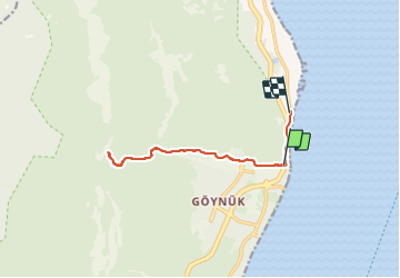

Length
13.7 km

Max alt
179 m

Uphill gradient
318 m
Km-Effort
18 km

Min alt
6 m

Downhill gradient
329 m
Boucle
No
Creation date :
2023-09-11 11:31:25.459
Updated on :
2023-09-11 14:36:19.511
3h04
Difficulty : Difficult

FREE GPS app for hiking
 SityTrail
IGN / Geographical institutes
SityTrail World
The world is yours!
About
Trail Walking of 13.7 km to be discovered at Antalya, Konyaaltı. This trail is proposed by 3190csi.
Positioning
Country:
Turkey
Region :
Antalya
Department/Province :
Konyaaltı
Municipality :
Unknown
Location:
Unknown
Start:(Dec)
Start:(UTM)
282734 ; 4062044 (36S) N.
Comments
Trails nearby