


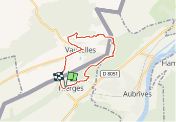

14.8 km | 21 km-effort


User


FREE GPS app for hiking
 SityTrail
IGN / Geographical institutes
SityTrail World
The world is yours!
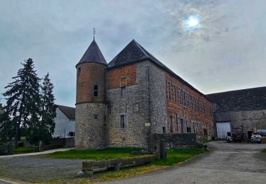
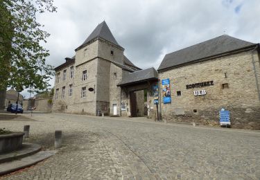
Trail Walking of 6.1 km to be discovered at Grand Est, Ardennes, Hierges. This trail is proposed by ELISECRO.
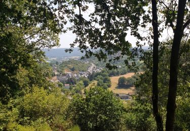
randonnée par les bois , les campagnes, le village classé de Hierges (France) et le chemin des crêtes avec son magnifique point de vue et cabane ..... difficulté pour la descente car le sentier passe dans des petits rochers (possibilité de contournement)


Walking
Walking

Walking

Walking

Walking
Walking

Walking
On foot