![](/images/other/stat-length.png)
![Trail Walking Pleumeur-Bodou - Pleumeur-Bodou - GR34 Chapelle Saint-Samson - 7.7km 60m 1h55 - 2023 09 06 - Photo](https://media.geolcdn.com/t/1900/400/5d74374c-67e8-400e-845c-98d92708147a.jpg&format=pjpeg&maxdim=2)
Pleumeur-Bodou - GR34 Chapelle Saint-Samson - 7.7km 60m 1h55 - 2023 09 06
Orcal37
User GUIDE
![Length](/images/other/stat-length.png)
Length
7.7 km
![Max alt](https://static1.geolcdn.com/siteimages/upload/files/1508320355ic_sort_altitude_max_24dp.png)
Max alt
63 m
![Uphill gradient](https://static1.geolcdn.com/siteimages/upload/files/1508320355ic_sort_den_pos_24dp.png)
Uphill gradient
62 m
![Km-Effort](/images/other/stat-length.png)
Km-Effort
8.5 km
![Min alt](https://static1.geolcdn.com/siteimages/upload/files/1508320355ic_sort_altitude_min_24dp.png)
Min alt
21 m
![Downhill gradient](https://static1.geolcdn.com/siteimages/upload/files/1508320355ic_sort_den_neg_24dp.png)
Downhill gradient
65 m
![Boucle](https://static1.geolcdn.com/siteimages/upload/files/16400158638029165_repeat_loop_refresh_sync_direction_icon.png)
Boucle
Yes
Creation date :
2023-09-06 12:26:21.049
Updated on :
2023-09-23 13:54:32.801
![Walking](https://static1.geolcdn.com/sitytour/trail-icons/101.png)
1h55
Difficulty : Medium
![Scan this QR Code to open this trail in the SityTrail application](https://capi.geolives.com/qq0zvz2zws4bq2lad0pu/sitytour/trails/3797514/qr.png?size=200)
FREE GPS app for hiking
About
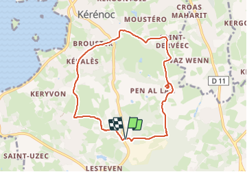
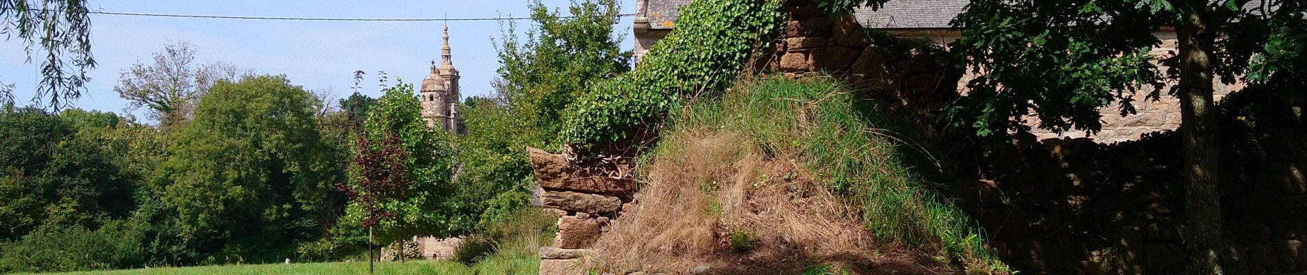
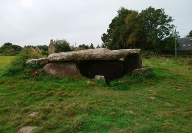
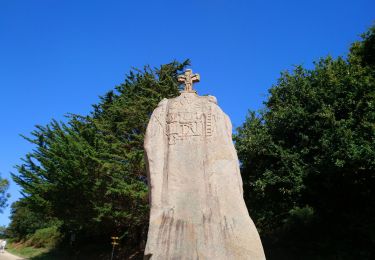
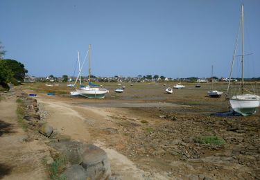
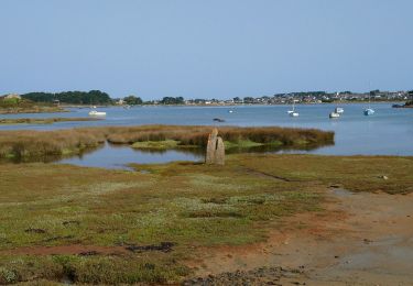
Trail Walking of 7.7 km to be discovered at Brittany, Côtes-d'Armor, Pleumeur-Bodou. This trail is proposed by Orcal37.
Description
Pleumeur-Bodou - départ du parking Parcours Aventure (départ possible du parking de la chapelle) - GR34 - Chapelle Saint-Samson - 7.7km 60m 1h55 - 2023 09 06
Positioning
Country:
France
Region :
Brittany
Department/Province :
Côtes-d'Armor
Municipality :
Pleumeur-Bodou
Location:
Unknown
Start:(Dec)
Start:(UTM)
461844 ; 5403901 (30U) N.
Comments
Trails nearby
![Trail Walking Perros-Guirec - Perros-Guirec - GR34 - 11.1km 185m 2h50 - 2023 09 08 - Photo](https://media.geolcdn.com/t/375/260/d1728063-b6c3-4241-bba7-0eab61cebb20.jpg&format=jpg&maxdim=2)
![Walking Walking](https://static1.geolcdn.com/sitytour/trail-icons/101.png)
Perros-Guirec - GR34 - 11.1km 185m 2h50 - 2023 09 08
Walking
Medium
(1)
Perros-Guirec,
Brittany,
Côtes-d'Armor,
France
![](/images/other/stat-length.png)
11.1 km | 13.6 km-effort
2h 50min
![](https://static1.geolcdn.com/siteimages/upload/files/16400158638029165_repeat_loop_refresh_sync_direction_icon.png)
Yes
![Trail Walking Trégastel - Trégastel - GR34 Île Renote Moulin à marée Chapelle de Gorgon - 13.8km 100m 3h35 - 2023 09 07 - Photo](https://media.geolcdn.com/t/375/260/f7b585bc-cd92-4f03-b6f8-635e10f5e6be.jpg&format=jpg&maxdim=2)
![Walking Walking](https://static1.geolcdn.com/sitytour/trail-icons/101.png)
Trégastel - GR34 Île Renote Moulin à marée Chapelle de Gorgon - 13.8km 100m 3...
Walking
Difficult
(2)
Trégastel,
Brittany,
Côtes-d'Armor,
France
![](/images/other/stat-length.png)
13.8 km | 15.1 km-effort
3h 35min
![](https://static1.geolcdn.com/siteimages/upload/files/16400158638029165_repeat_loop_refresh_sync_direction_icon.png)
Yes
![Trail Walking Perros-Guirec - la côte de granit rose à Ploumanach - Photo](https://media.geolcdn.com/t/375/260/64deb34e-d59c-4f9a-95ec-bcb98ff541ad.jpg&format=jpg&maxdim=2)
![Walking Walking](https://static1.geolcdn.com/sitytour/trail-icons/101.png)
la côte de granit rose à Ploumanach
Walking
Very easy
(2)
Perros-Guirec,
Brittany,
Côtes-d'Armor,
France
![](/images/other/stat-length.png)
6 km | 6.9 km-effort
2h 38min
![](https://static1.geolcdn.com/siteimages/upload/files/16400158638029165_repeat_loop_refresh_sync_direction_icon.png)
Yes
![Trail Walking Perros-Guirec - Les sentiers de Ploumanac'h - Photo](https://media.geolcdn.com/t/375/260/ext.jpg?maxdim=2&url=https%3A%2F%2Fservices.sitytrail.com%2FGeolivesWS%2FDownloadMedia.ashx%3FTrailID%3D317019%26Media%3D16161_1.jpg)
![Walking Walking](https://static1.geolcdn.com/sitytour/trail-icons/101.png)
Les sentiers de Ploumanac'h
Walking
Medium
(2)
Perros-Guirec,
Brittany,
Côtes-d'Armor,
France
![](/images/other/stat-length.png)
10.3 km | 12 km-effort
3h 0min
![](https://static1.geolcdn.com/siteimages/upload/files/16400158638029165_repeat_loop_refresh_sync_direction_icon.png)
Yes
![Trail Walking Trégastel - Trégastel - GR34 Ploumanac'h Kasino de Perros-Guirec - 11.7km 200m 2h55 (50mn) - 2023 09 08 - Photo](https://media.geolcdn.com/t/375/260/3132b43e-4920-4682-bf35-15b1d429cbae.jpg&format=jpg&maxdim=2)
![Walking Walking](https://static1.geolcdn.com/sitytour/trail-icons/101.png)
Trégastel - GR34 Ploumanac'h Kasino de Perros-Guirec - 11.7km 200m 2h55 (50mn...
Walking
Medium
Trégastel,
Brittany,
Côtes-d'Armor,
France
![](/images/other/stat-length.png)
11.7 km | 14.4 km-effort
2h 55min
![](https://static1.geolcdn.com/siteimages/upload/files/16400158638029165_repeat_loop_refresh_sync_direction_icon.png)
Yes
![Trail Walking Pleumeur-Bodou - Pleumeur-Bodou - GR34 Presqu'île de Landrellec - 11km 90m 2h40 (55mn) - 2023 09 07 - Photo](https://media.geolcdn.com/t/375/260/8535d7bc-c32f-4d63-8654-21c356641e89.jpg&format=jpg&maxdim=2)
![Walking Walking](https://static1.geolcdn.com/sitytour/trail-icons/101.png)
Pleumeur-Bodou - GR34 Presqu'île de Landrellec - 11km 90m 2h40 (55mn) - 2023 ...
Walking
Medium
Pleumeur-Bodou,
Brittany,
Côtes-d'Armor,
France
![](/images/other/stat-length.png)
11 km | 12.2 km-effort
2h 40min
![](https://static1.geolcdn.com/siteimages/upload/files/16400158638029165_repeat_loop_refresh_sync_direction_icon.png)
Yes
![Trail Walking Pleumeur-Bodou - Pleumeur-Bodou - GR34 Menhir de Saint-Uzec Chapelle de Penvern - 5.6km 60m 1h20 (40mn) - 2023 09 06 - Photo](https://media.geolcdn.com/t/375/260/acb169dc-b395-42f6-b477-bf2c7a0dcada.jpg&format=jpg&maxdim=2)
![Walking Walking](https://static1.geolcdn.com/sitytour/trail-icons/101.png)
Pleumeur-Bodou - GR34 Menhir de Saint-Uzec Chapelle de Penvern - 5.6km 60m 1h...
Walking
Easy
Pleumeur-Bodou,
Brittany,
Côtes-d'Armor,
France
![](/images/other/stat-length.png)
5.6 km | 6.4 km-effort
1h 20min
![](https://static1.geolcdn.com/siteimages/upload/files/16400158638029165_repeat_loop_refresh_sync_direction_icon.png)
Yes
![Trail Walking Trébeurden - Trébeurden - Penvern GR34 Île Grande - 11.3km 60m 2h50 - 2023 09 05 - Photo](https://media.geolcdn.com/t/375/260/275c9a9a-e5ac-4c80-ab61-1fa1f790fcfe.jpg&format=jpg&maxdim=2)
![Walking Walking](https://static1.geolcdn.com/sitytour/trail-icons/101.png)
Trébeurden - Penvern GR34 Île Grande - 11.3km 60m 2h50 - 2023 09 05
Walking
Medium
Trébeurden,
Brittany,
Côtes-d'Armor,
France
![](/images/other/stat-length.png)
11.3 km | 12.1 km-effort
2h 50min
![](https://static1.geolcdn.com/siteimages/upload/files/16400158638029165_repeat_loop_refresh_sync_direction_icon.png)
Yes
![Trail Walking Trébeurden - Trébeurden - Kerhellen GR34 Menhirs - 5.8km 105m 1h25 (40mn) - 2023 09 05 - Photo](https://media.geolcdn.com/t/375/260/df40cffd-f864-4855-ad1d-ec7495de5a51.jpg&format=jpg&maxdim=2)
![Walking Walking](https://static1.geolcdn.com/sitytour/trail-icons/101.png)
Trébeurden - Kerhellen GR34 Menhirs - 5.8km 105m 1h25 (40mn) - 2023 09 05
Walking
Medium
Trébeurden,
Brittany,
Côtes-d'Armor,
France
![](/images/other/stat-length.png)
5.8 km | 7.3 km-effort
1h 25min
![](https://static1.geolcdn.com/siteimages/upload/files/16400158638029165_repeat_loop_refresh_sync_direction_icon.png)
Yes