13.2 km | 15.1 km-effort
Courpiac -Mas d'Agenais
ilur56
User
Length
64 km
Max alt
102 m
Uphill gradient
759 m
Km-Effort
74 km
Min alt
10 m
Downhill gradient
755 m
Boucle
No
Creation date :
2023-09-06 07:28:58.306
Updated on :
2023-09-19 09:37:58.302
--
Difficulty : Very difficult
FREE GPS app for hiking
About
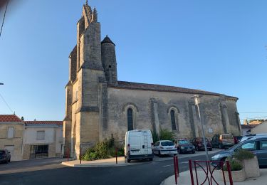
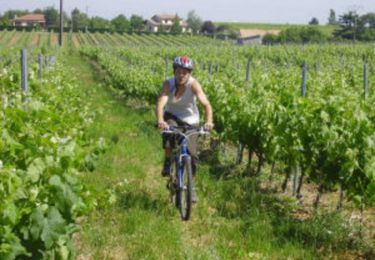
Trail Bicycle tourism of 64 km to be discovered at New Aquitaine, Gironde, Courpiac. This trail is proposed by ilur56.
Description
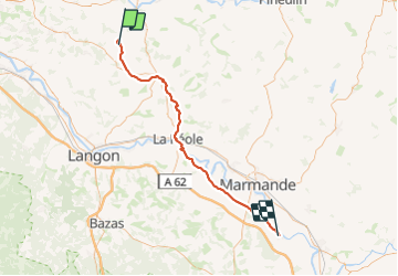
Etape 2 sur le canal de la Garonne
Positioning
Country:
France
Region :
New Aquitaine
Department/Province :
Gironde
Municipality :
Courpiac
Location:
Unknown
Start:(Dec)
Start:(UTM)
723107 ; 4959221 (30T) N.
Comments
Trails nearby
Frontenac monté/attelé
Coupling
Medium
Frontenac,
New Aquitaine,
Gironde,
France
13.3 km | 15.3 km-effort
2h 19min
Yes
Ballade de sainte presentine
Walking
Very easy
Frontenac,
New Aquitaine,
Gironde,
France
14.8 km | 16.6 km-effort
3h 54min
Yes
Frontenac - ruisseaux et carrières
Mountain bike
Easy
Frontenac,
New Aquitaine,
Gironde,
France
10.5 km | 12.2 km-effort
1h 30min
Yes
Frontenac - ruisseaux et carrières
Walking
Easy
Frontenac,
New Aquitaine,
Gironde,
France
10.5 km | 12.2 km-effort
3h 0min
Yes
G27_Naujan_et_Postiac
Walking
Difficult
(1)
Naujan-et-Postiac,
New Aquitaine,
Gironde,
France
12.2 km | 14 km-effort
3h 11min
Yes
montignac
Walking
Difficult
Montignac,
New Aquitaine,
Gironde,
France
11.4 km | 13.3 km-effort
3h 20min
Yes