![](/images/other/stat-length.png)
![Trail Walking Trébeurden - Trébeurden - Trozoul GR34 Chapelles Église - 11.1km 200m 3h15 - 2023 09 04 - Photo](https://media.geolcdn.com/t/1900/400/92fcd3d2-b378-46b0-9471-502f8724784a.jpg&format=pjpeg&maxdim=2)
Trébeurden - Trozoul GR34 Chapelles Église - 11.1km 200m 3h15 - 2023 09 04
Orcal37
User GUIDE
![Length](/images/other/stat-length.png)
Length
11.2 km
![Max alt](https://static1.geolcdn.com/siteimages/upload/files/1508320355ic_sort_altitude_max_24dp.png)
Max alt
78 m
![Uphill gradient](https://static1.geolcdn.com/siteimages/upload/files/1508320355ic_sort_den_pos_24dp.png)
Uphill gradient
206 m
![Km-Effort](/images/other/stat-length.png)
Km-Effort
13.9 km
![Min alt](https://static1.geolcdn.com/siteimages/upload/files/1508320355ic_sort_altitude_min_24dp.png)
Min alt
0 m
![Downhill gradient](https://static1.geolcdn.com/siteimages/upload/files/1508320355ic_sort_den_neg_24dp.png)
Downhill gradient
207 m
![Boucle](https://static1.geolcdn.com/siteimages/upload/files/16400158638029165_repeat_loop_refresh_sync_direction_icon.png)
Boucle
Yes
Creation date :
2023-09-04 12:49:34.043
Updated on :
2023-09-23 13:42:00.842
![Walking](https://static1.geolcdn.com/sitytour/trail-icons/101.png)
3h15
Difficulty : Difficult
![Scan this QR Code to open this trail in the SityTrail application](https://capi.geolives.com/qq0zvz2zws4bq2lad0pu/sitytour/trails/3795416/qr.png?size=200)
FREE GPS app for hiking
About
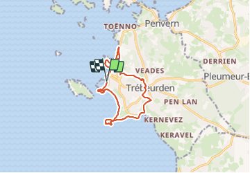
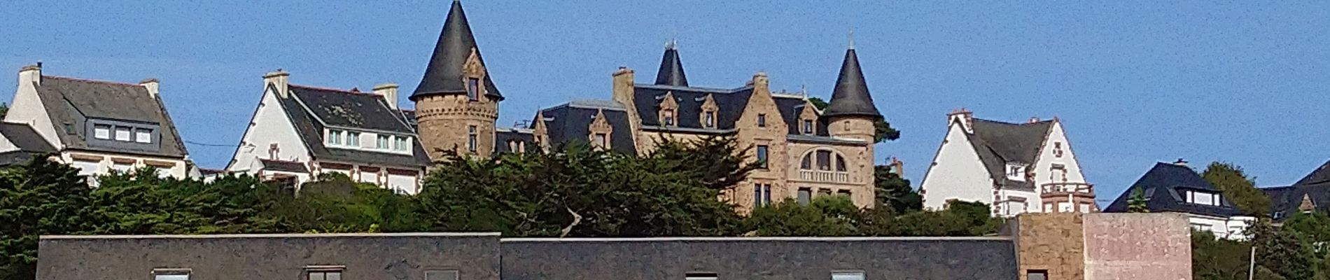
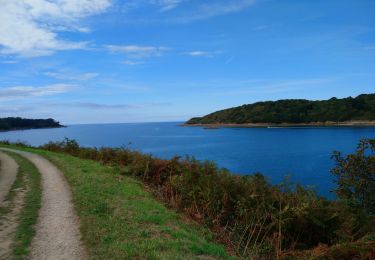
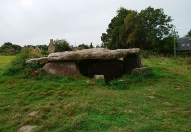
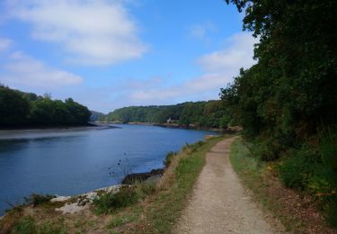
Trail Walking of 11.2 km to be discovered at Brittany, Côtes-d'Armor, Trébeurden. This trail is proposed by Orcal37.
Description
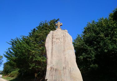
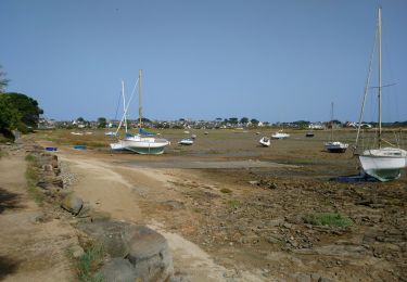
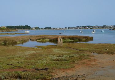
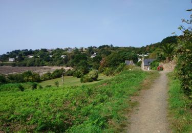
Trébeurden - Trozoul - GR34 - Marais du Quellen - Chapelles - Église - Porz Mabo - GR34 - Pointe de Bihit - le Castel - 11.1km 200m 3h15 - 2023 09 04
Positioning
Country:
France
Region :
Brittany
Department/Province :
Côtes-d'Armor
Municipality :
Trébeurden
Location:
Unknown
Start:(Dec)
Start:(UTM)
457102 ; 5402233 (30U) N.
Comments
Trails nearby
![Trail Walking Ploulec'h - le Yaudet - GR34 Locquémeau - 9.4km 220m 2h30 - 2023 09 11 - Photo](https://media.geolcdn.com/t/375/260/2eeb17d1-bab0-475d-9575-f8db3e07c699.jpg&format=jpg&maxdim=2)
![Walking Walking](https://static1.geolcdn.com/sitytour/trail-icons/101.png)
le Yaudet - GR34 Locquémeau - 9.4km 220m 2h30 - 2023 09 11
Walking
Difficult
(1)
Ploulec'h,
Brittany,
Côtes-d'Armor,
France
![](/images/other/stat-length.png)
9.4 km | 12.3 km-effort
2h 30min
![](https://static1.geolcdn.com/siteimages/upload/files/16400158638029165_repeat_loop_refresh_sync_direction_icon.png)
Yes
![Trail Walking Pleumeur-Bodou - Pleumeur-Bodou - GR34 Presqu'île de Landrellec - 11km 90m 2h40 (55mn) - 2023 09 07 - Photo](https://media.geolcdn.com/t/375/260/8535d7bc-c32f-4d63-8654-21c356641e89.jpg&format=jpg&maxdim=2)
![Walking Walking](https://static1.geolcdn.com/sitytour/trail-icons/101.png)
Pleumeur-Bodou - GR34 Presqu'île de Landrellec - 11km 90m 2h40 (55mn) - 2023 ...
Walking
Medium
Pleumeur-Bodou,
Brittany,
Côtes-d'Armor,
France
![](/images/other/stat-length.png)
11 km | 12.2 km-effort
2h 40min
![](https://static1.geolcdn.com/siteimages/upload/files/16400158638029165_repeat_loop_refresh_sync_direction_icon.png)
Yes
![Trail Walking Pleumeur-Bodou - Pleumeur-Bodou - GR34 Chapelle Saint-Samson - 7.7km 60m 1h55 - 2023 09 06 - Photo](https://media.geolcdn.com/t/375/260/5d74374c-67e8-400e-845c-98d92708147a.jpg&format=jpg&maxdim=2)
![Walking Walking](https://static1.geolcdn.com/sitytour/trail-icons/101.png)
Pleumeur-Bodou - GR34 Chapelle Saint-Samson - 7.7km 60m 1h55 - 2023 09 06
Walking
Medium
Pleumeur-Bodou,
Brittany,
Côtes-d'Armor,
France
![](/images/other/stat-length.png)
7.7 km | 8.5 km-effort
1h 55min
![](https://static1.geolcdn.com/siteimages/upload/files/16400158638029165_repeat_loop_refresh_sync_direction_icon.png)
Yes
![Trail Walking Pleumeur-Bodou - Pleumeur-Bodou - GR34 Menhir de Saint-Uzec Chapelle de Penvern - 5.6km 60m 1h20 (40mn) - 2023 09 06 - Photo](https://media.geolcdn.com/t/375/260/acb169dc-b395-42f6-b477-bf2c7a0dcada.jpg&format=jpg&maxdim=2)
![Walking Walking](https://static1.geolcdn.com/sitytour/trail-icons/101.png)
Pleumeur-Bodou - GR34 Menhir de Saint-Uzec Chapelle de Penvern - 5.6km 60m 1h...
Walking
Easy
Pleumeur-Bodou,
Brittany,
Côtes-d'Armor,
France
![](/images/other/stat-length.png)
5.6 km | 6.4 km-effort
1h 20min
![](https://static1.geolcdn.com/siteimages/upload/files/16400158638029165_repeat_loop_refresh_sync_direction_icon.png)
Yes
![Trail Walking Trébeurden - Trébeurden - Penvern GR34 Île Grande - 11.3km 60m 2h50 - 2023 09 05 - Photo](https://media.geolcdn.com/t/375/260/275c9a9a-e5ac-4c80-ab61-1fa1f790fcfe.jpg&format=jpg&maxdim=2)
![Walking Walking](https://static1.geolcdn.com/sitytour/trail-icons/101.png)
Trébeurden - Penvern GR34 Île Grande - 11.3km 60m 2h50 - 2023 09 05
Walking
Medium
Trébeurden,
Brittany,
Côtes-d'Armor,
France
![](/images/other/stat-length.png)
11.3 km | 12.1 km-effort
2h 50min
![](https://static1.geolcdn.com/siteimages/upload/files/16400158638029165_repeat_loop_refresh_sync_direction_icon.png)
Yes
![Trail Walking Trébeurden - Trébeurden - Kerhellen GR34 Menhirs - 5.8km 105m 1h25 (40mn) - 2023 09 05 - Photo](https://media.geolcdn.com/t/375/260/df40cffd-f864-4855-ad1d-ec7495de5a51.jpg&format=jpg&maxdim=2)
![Walking Walking](https://static1.geolcdn.com/sitytour/trail-icons/101.png)
Trébeurden - Kerhellen GR34 Menhirs - 5.8km 105m 1h25 (40mn) - 2023 09 05
Walking
Medium
Trébeurden,
Brittany,
Côtes-d'Armor,
France
![](/images/other/stat-length.png)
5.8 km | 7.3 km-effort
1h 25min
![](https://static1.geolcdn.com/siteimages/upload/files/16400158638029165_repeat_loop_refresh_sync_direction_icon.png)
Yes
![Trail Walking Trébeurden - Trébeurden - Porz Mabo GR34 - 6.6km 165m 1h50 (40mn) - 2023 09 04 - Photo](https://media.geolcdn.com/t/375/260/4f4a5121-d670-4014-a780-e42da8e62161.jpg&format=jpg&maxdim=2)
![Walking Walking](https://static1.geolcdn.com/sitytour/trail-icons/101.png)
Trébeurden - Porz Mabo GR34 - 6.6km 165m 1h50 (40mn) - 2023 09 04
Walking
Medium
Trébeurden,
Brittany,
Côtes-d'Armor,
France
![](/images/other/stat-length.png)
6.6 km | 8.9 km-effort
1h 50min
![](https://static1.geolcdn.com/siteimages/upload/files/16400158638029165_repeat_loop_refresh_sync_direction_icon.png)
Yes
![Trail Walking Trébeurden - Trébeurden - Croaz Golo GR34A GR34 - 15.1km 320m 4h15 (50mn) - 2023 09 03 - Photo](https://media.geolcdn.com/t/375/260/1a08cc2b-a6d7-4306-885a-2253f395737e.jpg&format=jpg&maxdim=2)
![Walking Walking](https://static1.geolcdn.com/sitytour/trail-icons/101.png)
Trébeurden - Croaz Golo GR34A GR34 - 15.1km 320m 4h15 (50mn) - 2023 09 03
Walking
Medium
Trébeurden,
Brittany,
Côtes-d'Armor,
France
![](/images/other/stat-length.png)
15.1 km | 19.4 km-effort
4h 15min
![](https://static1.geolcdn.com/siteimages/upload/files/16400158638029165_repeat_loop_refresh_sync_direction_icon.png)
Yes
![Trail Walking Trébeurden - Ile grande - Photo](https://media.geolcdn.com/t/375/260/ext.jpg?maxdim=2&url=https%3A%2F%2Fstatic1.geolcdn.com%2Fsiteimages%2Fupload%2Ffiles%2F1553511878bg_sport_marche.png)
![Walking Walking](https://static1.geolcdn.com/sitytour/trail-icons/101.png)
Ile grande
Walking
Easy
(1)
Trébeurden,
Brittany,
Côtes-d'Armor,
France
![](/images/other/stat-length.png)
10.6 km | 11.4 km-effort
3h 7min
![](https://static1.geolcdn.com/siteimages/upload/files/16400158638029165_repeat_loop_refresh_sync_direction_icon.png)
Yes