9.2 km | 14.6 km-effort
glendalough outer circuit
isurgeon
User
Length
21 km
Max alt
702 m
Uphill gradient
900 m
Km-Effort
33 km
Min alt
135 m
Downhill gradient
945 m
Boucle
Yes
Creation date :
2014-12-10 00:00:00.0
Updated on :
2014-12-10 00:00:00.0
--
Difficulty : Unknown
FREE GPS app for hiking
About
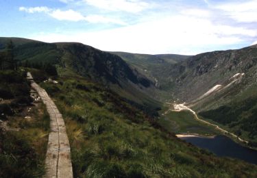
Trail Walking of 21 km to be discovered at Unknown, County Wicklow, The Municipal District of Wicklow. This trail is proposed by isurgeon.
Positioning
Country:
Ireland
Region :
Unknown
Department/Province :
County Wicklow
Municipality :
The Municipal District of Wicklow
Location:
Brockagh
Start:(Dec)
Start:(UTM)
678126 ; 5876482 (29U) N.
Comments
Trails nearby
Spinc and Glenealo Valley
On foot
Easy
The Municipal District of Wicklow,
Unknown,
County Wicklow,
Ireland
3h 19min
Yes
Saint Kevin's Way
On foot
Easy
The Municipal District of Wicklow,
Unknown,
County Wicklow,
Ireland
6.6 km | 10.2 km-effort
2h 19min
No
Glendalough
Walking
Medium
The Municipal District of Wicklow,
Unknown,
County Wicklow,
Ireland
9.4 km | 13.7 km-effort
2h 21min
Yes
Glendalough
Walking
Medium
The Municipal District of Wicklow,
Unknown,
County Wicklow,
Ireland
9.6 km | 14 km-effort
2h 59min
Yes
Mountain Hike from Glendalough car park
Walking
Very easy
The Municipal District of Wicklow,
Unknown,
County Wicklow,
Ireland
17.2 km | 26 km-effort
6h 1min
Yes
The Brockaghs and St Kevins Road
Walking
Very easy
The Municipal District of Wicklow,
Unknown,
County Wicklow,
Ireland
16.7 km | 25 km-effort
Unknown
Yes
Arts Lough and Lugnaquilla
Walking
Very easy
The Municipal District of Arklow,
Unknown,
County Wicklow,
Ireland
12.4 km | 23 km-effort
Unknown
Yes
Camaderry
Other activity
Very easy
The Municipal District of Wicklow,
Unknown,
County Wicklow,
Ireland
8.8 km | 15.8 km-effort
Unknown
Yes
Camaderry
Other activity
Very easy
The Municipal District of Wicklow,
Unknown,
County Wicklow,
Ireland
12.6 km | 20 km-effort
Unknown
Yes