


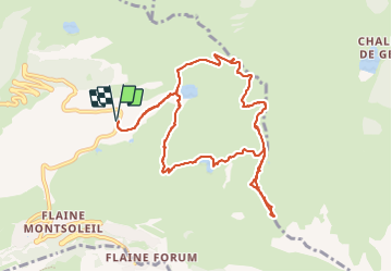

6.7 km | 11.7 km-effort


User


FREE GPS app for hiking
 SityTrail
IGN / Geographical institutes
SityTrail World
The world is yours!
Trail Walking of 11 km to be discovered at Auvergne-Rhône-Alpes, Upper Savoy, Arâches-la-Frasse. This trail is proposed by le jurassien.39.
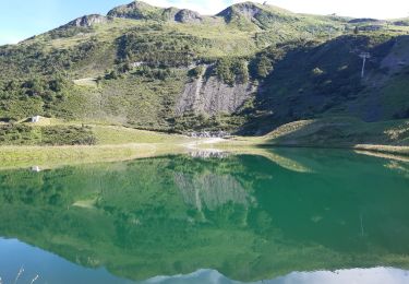
Depuis le parking de Verant monter par la combe Enverse pour le lac de Verant puis les grands vans pour finir la montée au col du Veret.

Walking

Walking

Walking
Walking

Walking

Walking

Walking

Walking
Walking