![](/images/other/stat-length.png)
![Trail Walking Valkenburg aan de Geul - 2023-08-29_11h45m24_route-des-vins-berg-en-terblijt--houthem-st-gerlach-vi6 - Photo](https://media.geolcdn.com/t/1900/400/852c106e-818c-4548-acc4-e956e65bf915.jpg&format=pjpeg&maxdim=2)
2023-08-29_11h45m24_route-des-vins-berg-en-terblijt--houthem-st-gerlach-vi6
mumu.larandonneuse
User GUIDE
![Length](/images/other/stat-length.png)
![Max alt](https://static1.geolcdn.com/siteimages/upload/files/1508320355ic_sort_altitude_max_24dp.png)
![Uphill gradient](https://static1.geolcdn.com/siteimages/upload/files/1508320355ic_sort_den_pos_24dp.png)
![Km-Effort](/images/other/stat-length.png)
![Min alt](https://static1.geolcdn.com/siteimages/upload/files/1508320355ic_sort_altitude_min_24dp.png)
![Downhill gradient](https://static1.geolcdn.com/siteimages/upload/files/1508320355ic_sort_den_neg_24dp.png)
![Boucle](https://static1.geolcdn.com/siteimages/upload/files/16400158638029165_repeat_loop_refresh_sync_direction_icon.png)
![Walking](https://static1.geolcdn.com/sitytour/trail-icons/101.png)
3h11
Difficulty : Easy
![Scan this QR Code to open this trail in the SityTrail application](https://capi.geolives.com/qq0zvz2zws4bq2lad0pu/sitytour/trails/3787975/qr.png?size=200)
FREE GPS app for hiking
About
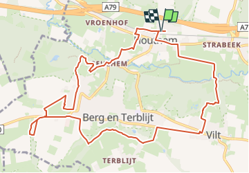
Trail Walking of 11.8 km to be discovered at Limburg, Unknown, Valkenburg aan de Geul. This trail is proposed by mumu.larandonneuse.
Description
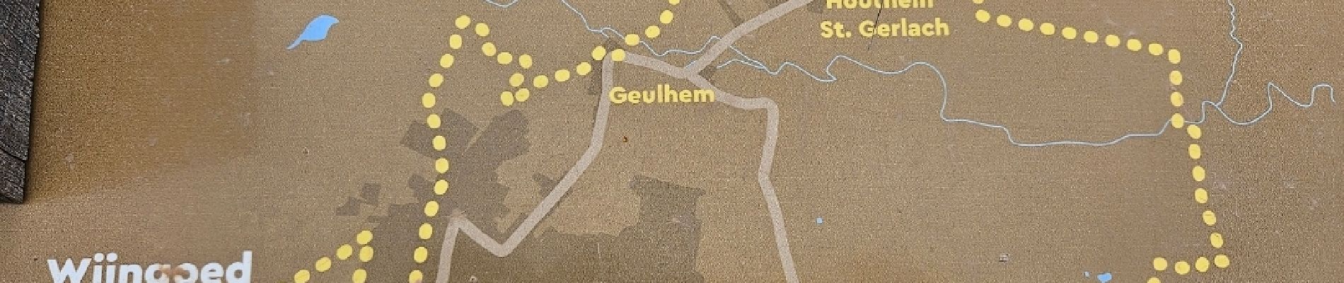
● Route des Vins Berg en Terblijt – Houthem St. Gerlach Vi6 ●
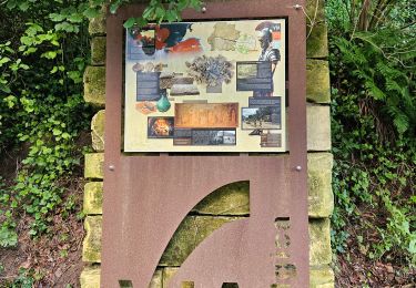
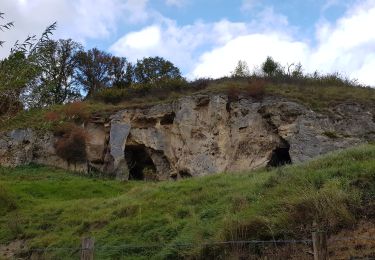
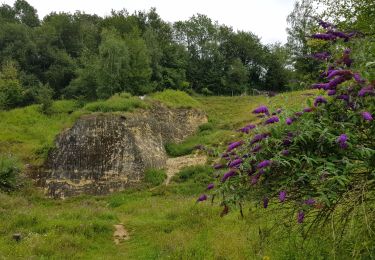
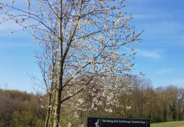
Sur la Route des Vins Berg et Terblijt - Houthem st. Gerlach, vous passez devant plusieurs vignobles et un verger fruitier et vous en apprenez davantage sur Wijngoed Lenoire , Dorpswijngaard Halte St. Gerlach , Fruitbedrijf Huids, Leerwijngaard Entre Les Collines et Wijndomein St. Martinus . Des vues surprenantes, des forêts à flanc de colline et l'Ingendael font partie de cet itinéraire de 12 kilomètres. Suivez le symbole du raisin tout au long du chemin et prenez la route !
ℹ️ www visitzuidlimburg.nl
➡️ Point de départ et d'arrivée :
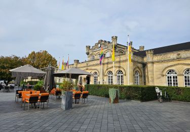
Gare de Houthem St. Gerlach, Caldenborghsweg 4.
Positioning
Comments
Trails nearby
![Trail Walking Valkenburg aan de Geul - 🚂 Valkenburg à 🚂 Maastricht par Via Belgica - Photo](https://media.geolcdn.com/t/375/260/cdced05f-f774-4cf2-bb15-fe4c48e907c6.jpg&format=jpg&maxdim=2)
![Walking Walking](https://static1.geolcdn.com/sitytour/trail-icons/101.png)
Walking
![](/images/other/stat-length.png)
![](https://static1.geolcdn.com/siteimages/upload/files/16400158638029165_repeat_loop_refresh_sync_direction_icon.png)
![Trail Walking Valkenburg aan de Geul - 🎅🎄 Valkenburg - Photo](https://media.geolcdn.com/t/375/260/c3fac4ca-18c6-41ea-bd7c-d2a8e36eb914.jpg&format=jpg&maxdim=2)
![Walking Walking](https://static1.geolcdn.com/sitytour/trail-icons/101.png)
Walking
![](/images/other/stat-length.png)
![](https://static1.geolcdn.com/siteimages/upload/files/16400158638029165_repeat_loop_refresh_sync_direction_icon.png)
![Trail Walking Valkenburg aan de Geul - 2023-11-10_18h36m23_1730.gpx.xml - Photo](https://media.geolcdn.com/t/375/260/0c5632d6-fa7c-4b28-afdd-a11c00242503.jpg&format=jpg&maxdim=2)
![Walking Walking](https://static1.geolcdn.com/sitytour/trail-icons/101.png)
Walking
![](/images/other/stat-length.png)
![](https://static1.geolcdn.com/siteimages/upload/files/16400158638029165_repeat_loop_refresh_sync_direction_icon.png)
![Trail Walking Valkenburg aan de Geul - Sibbe - Valkenburg 🎄🎅 - Photo](https://media.geolcdn.com/t/375/260/635f6fea-be0e-416f-bbe0-3fc5facaae54.jpg&format=jpg&maxdim=2)
![Walking Walking](https://static1.geolcdn.com/sitytour/trail-icons/101.png)
Walking
![](/images/other/stat-length.png)
![](https://static1.geolcdn.com/siteimages/upload/files/16400158638029165_repeat_loop_refresh_sync_direction_icon.png)
![Trail Walking Valkenburg aan de Geul - 2022-11-11_17h59m47_hoogtewandeling-valkenburg-aan-de-geul - Photo](https://media.geolcdn.com/t/375/260/17d77ae4-7009-4034-91af-70d2fca6ac04.jpg&format=jpg&maxdim=2)
![Walking Walking](https://static1.geolcdn.com/sitytour/trail-icons/101.png)
Walking
![](/images/other/stat-length.png)
![](https://static1.geolcdn.com/siteimages/upload/files/16400158638029165_repeat_loop_refresh_sync_direction_icon.png)
![Trail Walking Maastricht - 2021-10-27_21h23m34_1087 - Photo](https://media.geolcdn.com/t/375/260/23f3cb69-ec7d-4156-85e2-e9b9420f412b.jpg&format=jpg&maxdim=2)
![Walking Walking](https://static1.geolcdn.com/sitytour/trail-icons/101.png)
Walking
![](/images/other/stat-length.png)
![](https://static1.geolcdn.com/siteimages/upload/files/16400158638029165_repeat_loop_refresh_sync_direction_icon.png)
![Trail Walking Valkenburg aan de Geul - 2021-07-31_16h24m37_668 (1) - Photo](https://media.geolcdn.com/t/375/260/068441ca-100f-4e0b-aeb5-ac0dbbad0b2b.jpg&format=jpg&maxdim=2)
![Walking Walking](https://static1.geolcdn.com/sitytour/trail-icons/101.png)
Walking
![](/images/other/stat-length.png)
![](https://static1.geolcdn.com/siteimages/upload/files/16400158638029165_repeat_loop_refresh_sync_direction_icon.png)
![Trail Walking Valkenburg aan de Geul - geulpark-en-kasteel-oost-va2-valkenburg-aan-de-geul - Photo](https://media.geolcdn.com/t/375/260/826a5cdc-cfc5-40c0-aa94-21dd8ba3e11f.jpeg&format=jpg&maxdim=2)
![Walking Walking](https://static1.geolcdn.com/sitytour/trail-icons/101.png)
Walking
![](/images/other/stat-length.png)
![](https://static1.geolcdn.com/siteimages/upload/files/16400158638029165_repeat_loop_refresh_sync_direction_icon.png)
![Trail Walking Eijsden-Margraten - Bemelen - Photo](https://media.geolcdn.com/t/375/260/80eebd30-fb74-4ca3-902d-6de0a7861089.jpg&format=jpg&maxdim=2)
![Walking Walking](https://static1.geolcdn.com/sitytour/trail-icons/101.png)
Walking
![](/images/other/stat-length.png)
![](https://static1.geolcdn.com/siteimages/upload/files/16400158638029165_repeat_loop_refresh_sync_direction_icon.png)
Très beau parcours.