![](/images/other/stat-length.png)
![Trail Walking La Courneuve - GRP CV-IDF 2023 - Photo](https://media.geolcdn.com/t/1900/400/7a4519de-23cf-421c-99a8-e8d2c57d2756.jpg&format=pjpeg&maxdim=2)
GRP CV-IDF 2023
clalaur
User
![Length](/images/other/stat-length.png)
Length
16 km
![Max alt](https://static1.geolcdn.com/siteimages/upload/files/1508320355ic_sort_altitude_max_24dp.png)
Max alt
76 m
![Uphill gradient](https://static1.geolcdn.com/siteimages/upload/files/1508320355ic_sort_den_pos_24dp.png)
Uphill gradient
137 m
![Km-Effort](/images/other/stat-length.png)
Km-Effort
17.7 km
![Min alt](https://static1.geolcdn.com/siteimages/upload/files/1508320355ic_sort_altitude_min_24dp.png)
Min alt
34 m
![Downhill gradient](https://static1.geolcdn.com/siteimages/upload/files/1508320355ic_sort_den_neg_24dp.png)
Downhill gradient
114 m
![Boucle](https://static1.geolcdn.com/siteimages/upload/files/16400158638029165_repeat_loop_refresh_sync_direction_icon.png)
Boucle
No
Creation date :
2023-08-26 16:42:25.776
Updated on :
2023-12-30 12:45:31.679
![Walking](https://static1.geolcdn.com/sitytour/trail-icons/101.png)
4h01
Difficulty : Difficult
![Scan this QR Code to open this trail in the SityTrail application](https://capi.geolives.com/qq0zvz2zws4bq2lad0pu/sitytour/trails/3785323/qr.png?size=200)
FREE GPS app for hiking
About
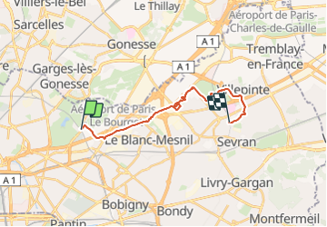
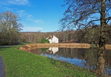
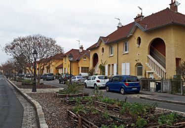
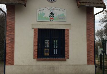
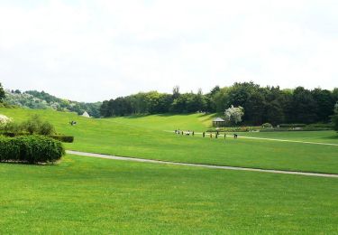
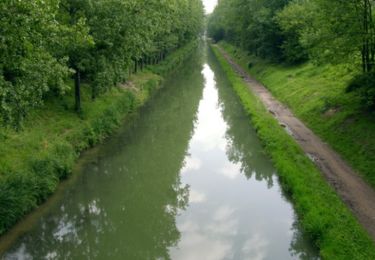
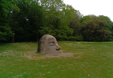
Trail Walking of 16 km to be discovered at Ile-de-France, Seine-Saint-Denis, La Courneuve. This trail is proposed by clalaur.
Description
Radonnée faite le 28 décembre 2023.
Départ : Gare Dugny-La-Courneuve (Tram T11) La Courneuve ; Arrivée : Gare Sevran-Beaudottes (RER B) Sevran
Positioning
Country:
France
Region :
Ile-de-France
Department/Province :
Seine-Saint-Denis
Municipality :
La Courneuve
Location:
Unknown
Start:(Dec)
Start:(UTM)
456918 ; 5421388 (31U) N.
Comments
Trails nearby
![Trail Walking Groslay - SityTrail - GRP CV-IDF - Photo](https://media.geolcdn.com/t/375/260/a37735ed-52ba-45d2-bc83-78ca281ae5cd.jpg&format=jpg&maxdim=2)
![Walking Walking](https://static1.geolcdn.com/sitytour/trail-icons/101.png)
SityTrail - GRP CV-IDF
Walking
Medium
Groslay,
Ile-de-France,
Val-d'Oise,
France
![](/images/other/stat-length.png)
19.7 km | 24 km-effort
5h 17min
![](https://static1.geolcdn.com/siteimages/upload/files/16400158638029165_repeat_loop_refresh_sync_direction_icon.png)
No
![Trail Walking Le Bourget - SityTrail - GRP CV-IDF - Photo](https://media.geolcdn.com/t/375/260/f7f2951a-d2ee-4427-833a-5110e7dc433d.jpg&format=jpg&maxdim=2)
![Walking Walking](https://static1.geolcdn.com/sitytour/trail-icons/101.png)
SityTrail - GRP CV-IDF
Walking
Easy
Le Bourget,
Ile-de-France,
Seine-Saint-Denis,
France
![](/images/other/stat-length.png)
14.6 km | 16.5 km-effort
4h 15min
![](https://static1.geolcdn.com/siteimages/upload/files/16400158638029165_repeat_loop_refresh_sync_direction_icon.png)
No
![Trail Other activity Saint-Denis - Saint Denis Basilique - Photo](https://media.geolcdn.com/t/375/260/ext.jpg?maxdim=2&url=https%3A%2F%2Fservices.sitytrail.com%2FGeolivesWS%2FDownloadMedia.ashx%3FTrailID%3D692581%26Media%3D20170202143231.jpg)
![Other activity Other activity](https://static1.geolcdn.com/sitytour/trail-icons/900.png)
Saint Denis Basilique
Other activity
Easy
Saint-Denis,
Ile-de-France,
Seine-Saint-Denis,
France
![](/images/other/stat-length.png)
14.9 km | 16.5 km-effort
4h 29min
![](https://static1.geolcdn.com/siteimages/upload/files/16400158638029165_repeat_loop_refresh_sync_direction_icon.png)
No
![Trail Walking Groslay - La Ceinture Verte de Groslay à Chelles - Photo](https://media.geolcdn.com/t/375/260/ext.jpg?maxdim=2&url=https%3A%2F%2Fservices.sitytrail.com%2FGeolivesWS%2FDownloadMedia.ashx%3FTrailID%3D316687%26Media%3D3832_1.jpg)
![Walking Walking](https://static1.geolcdn.com/sitytour/trail-icons/101.png)
La Ceinture Verte de Groslay à Chelles
Walking
Difficult
Groslay,
Ile-de-France,
Val-d'Oise,
France
![](/images/other/stat-length.png)
45 km | 51 km-effort
10h 45min
![](https://static1.geolcdn.com/siteimages/upload/files/16400158638029165_repeat_loop_refresh_sync_direction_icon.png)
No
![Trail Mountain bike Saint-Denis - De Paris à Meaux via l'Ourq - Photo](https://media.geolcdn.com/t/375/260/ext.jpg?maxdim=2&url=https%3A%2F%2Fservices.sitytrail.com%2FGeolivesWS%2FDownloadMedia.ashx%3FTrailID%3D106512%26Media%3D11065_2.jpg)
![Mountain bike Mountain bike](https://static1.geolcdn.com/sitytour/trail-icons/202.png)
De Paris à Meaux via l'Ourq
Mountain bike
Medium
Saint-Denis,
Ile-de-France,
Seine-Saint-Denis,
France
![](/images/other/stat-length.png)
52 km | 57 km-effort
6h 0min
![](https://static1.geolcdn.com/siteimages/upload/files/16400158638029165_repeat_loop_refresh_sync_direction_icon.png)
No
![Trail Walking Drancy - Drancy , Chemin des résistances - Photo](https://media.geolcdn.com/t/375/260/ext.jpg?maxdim=2&url=https%3A%2F%2Fstatic1.geolcdn.com%2Fsiteimages%2Fupload%2Ffiles%2F1553511878bg_sport_marche.png)
![Walking Walking](https://static1.geolcdn.com/sitytour/trail-icons/101.png)
Drancy , Chemin des résistances
Walking
Medium
Drancy,
Ile-de-France,
Seine-Saint-Denis,
France
![](/images/other/stat-length.png)
9 km | 9.6 km-effort
2h 10min
![](https://static1.geolcdn.com/siteimages/upload/files/16400158638029165_repeat_loop_refresh_sync_direction_icon.png)
Yes
![Trail Walking Saint-Denis - Le parc des chanteraines - Photo](https://media.geolcdn.com/t/375/260/ext.jpg?maxdim=2&url=https%3A%2F%2Fstatic1.geolcdn.com%2Fsiteimages%2Fupload%2Ffiles%2F1553511878bg_sport_marche.png)
![Walking Walking](https://static1.geolcdn.com/sitytour/trail-icons/101.png)
Le parc des chanteraines
Walking
Difficult
Saint-Denis,
Ile-de-France,
Seine-Saint-Denis,
France
![](/images/other/stat-length.png)
14 km | 15.6 km-effort
3h 33min
![](https://static1.geolcdn.com/siteimages/upload/files/16400158638029165_repeat_loop_refresh_sync_direction_icon.png)
Yes
![Trail On foot Saint-Denis - parc de chanteraine - Photo](https://media.geolcdn.com/t/375/260/ext.jpg?maxdim=2&url=https%3A%2F%2Fstatic1.geolcdn.com%2Fsiteimages%2Fupload%2Ffiles%2F1545311037marcheuse_200dpi.jpg)
![On foot On foot](https://static1.geolcdn.com/sitytour/trail-icons/100.png)
parc de chanteraine
On foot
Medium
Saint-Denis,
Ile-de-France,
Seine-Saint-Denis,
France
![](/images/other/stat-length.png)
18.2 km | 19.9 km-effort
4h 37min
![](https://static1.geolcdn.com/siteimages/upload/files/16400158638029165_repeat_loop_refresh_sync_direction_icon.png)
Yes
![Trail Walking La Courneuve - la Courneuve - Photo](https://media.geolcdn.com/t/375/260/bea8aa6a-e079-4cb5-873c-9f112197d7ab.jpg&format=jpg&maxdim=2)
![Walking Walking](https://static1.geolcdn.com/sitytour/trail-icons/101.png)
la Courneuve
Walking
Difficult
La Courneuve,
Ile-de-France,
Seine-Saint-Denis,
France
![](/images/other/stat-length.png)
13.3 km | 15.3 km-effort
4h 25min
![](https://static1.geolcdn.com/siteimages/upload/files/16400158638029165_repeat_loop_refresh_sync_direction_icon.png)
Yes