Trail Walking Braine - mont notre dame  - Photo

mont notre dame

© OpenStreetMap contributors
Length
Length
31 km
Max alt
Max alt
179 m
Uphill gradient
Uphill gradient
486 m
Km-Effort
Km-Effort  
37 km
Min alt
Min alt
51 m
Downhill gradient
Downhill gradient
468 m
Boucle
Boucle
No
Creation date :
2015-01-18 00:00:00.0
Updated on :
2015-01-18 00:00:00.0

(0 Reviews)

Walking
Walking
6h40
Difficulty : Difficult

Scan this QR Code to open this trail in the SityTrail application

FREE GPS app for hiking

Logo SityTrail SityTrail

IGN / Geographical institutes

Download SityTrail from the App Store Download SityTrail from Google Play

Logo SityTrail SityTrail World

The world is yours!

Download SityTrail from the App Store Download SityTrail from Google Play Download SityTrail on Huawei AppGallery

About

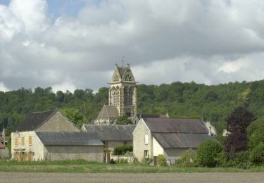
Trail Walking of 31 km to be discovered at Hauts-de-France, Aisne, Braine. This trail is proposed by 0674628622.

Description

difficile

Elevation profile

Points of interest

Point of interest Mont-Notre-Dame - Point 1 - Photo
0674628622
MONT-NOTRE-DAME 

Positioning

Country:
France
Region :
Hauts-de-France
Department/Province :
Aisne
Municipality :
Braine
Location:
Unknown
Start:(UTM)
538469 ; 5465526 (31U) N.

Trails nearby

Trail Walking Chassemy - Chassemy - Le temps perdu - Photo
Walking
tracegps

Walking

Medium
Chassemy, Hauts-de-France, Aisne, France
14.3 km | 17.5 km-effort
3h 45min
Yes
Trail Walking Braine - La Folie - Photo
Walking
tracegps

Walking

Very difficult
(1)
Braine, Hauts-de-France, Aisne, France
8.4 km | 10.6 km-effort
3h 0min
Yes
Trail Walking Couvrelles - Les échauguettes - Photo
Walking
tracegps

Walking

Very difficult
Couvrelles, Hauts-de-France, Aisne, France
9.4 km | 12 km-effort
3h 0min
Yes
Trail Walking Couvrelles - Les échauguettes - variante 2 - Photo
Walking
tracegps

Walking

Medium
(2)
Couvrelles, Hauts-de-France, Aisne, France
15 km | 19.1 km-effort
1h 30min
Yes
Trail Walking Couvrelles - Les échauguettes - variante 1 - Photo
Walking
tracegps

Walking

Very difficult
Couvrelles, Hauts-de-France, Aisne, France
5.2 km | 7 km-effort
4h 30min
Yes
Trail Walking Braine - Variante de la Randonnée la Folie . Braine 02 - Photo
Walking
José800

Walking

Difficult
Braine, Hauts-de-France, Aisne, France
12.3 km | 15.3 km-effort
3h 28min
Yes
Trail Walking Braine - chemin de  onne dame - Photo
Walking
Michel02220

Walking

Easy
Braine, Hauts-de-France, Aisne, France
3.5 km | 3.7 km-effort
54min
Yes
Trail Walking Chassemy - rando dodo mai 21 4 - Photo
Walking
avallee

Walking

Medium
Chassemy, Hauts-de-France, Aisne, France
8 km | 9.1 km-effort
1h 41min
Yes


Close
My subscriptions