


10.6 km | 13.5 km-effort
![Trail Walking La Chapelle-Montligeon - [Itinéraire] La chute de Beillard - Départ de La Chapelle - Photo](https://media.geolcdn.com/t/1900/400/ext.pjpeg?maxdim=2&url=https%3A%2F%2Fstatic1.geolcdn.com%2Fsiteimages%2Fupload%2Ffiles%2F1553511878bg_sport_marche.png)

User


FREE GPS app for hiking
 SityTrail
IGN / Geographical institutes
SityTrail World
The world is yours!
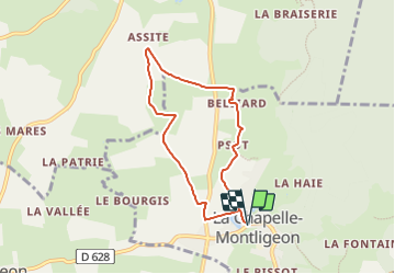
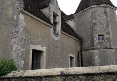
Trail Walking of 6.3 km to be discovered at Normandy, Orne, La Chapelle-Montligeon. This trail is proposed by ODDAD78.
Départ : La Chapelle-Montligeon Arrivée : La Chapelle-Montligeon Balisage : PR
Communes : 1. La Chapelle-Montligeon 2. Saint-Mard-de-Réno
Départ de La Chapelle-Montligeon
Quitter la Place de l’église par la Rue de la Poste.
1. Au lotissement du Plan d’eau, traverser la rue goudronnée et continuer en face par un chemin creux qui, devenant herbeux, suit la vallée de la Villette.
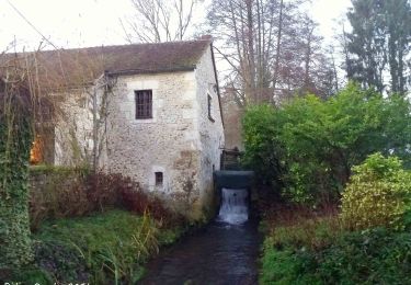
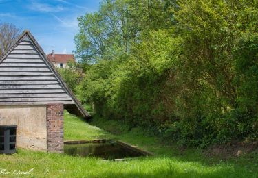
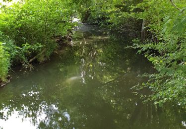
2. En bout de ligne droite, prendre le chemin à gauche, franchir une 1ère passerelle en béton sur la rivière, puis une 2ème sur un bief, pour arriver au hameau de Psot. Suivre à droite en traversant la cour commune entre deux maisons. Longer ensuite le bief jusqu’à l’Hôtel Chauvin.
3. Tourner à gauche derrière la maison et, par un chemin pierré, rejoindre Beillard. Suivre le chemin goudronné qui contourne une propriété entourée de murs et, juste après, prendre à droite puis à gauche. Longer le cours de l’ancien bief du moulin jusqu’au barrage (attention : barrage effondré en janvier 2023, travaux en attente).
4. Tourner à gauche et remonter par un chemin caillouteux pour gagner la D5. La traverser et continuer tout droit par un chemin parfois humide jusqu’à une petite route goudronnée. La suivre à droite sur 300m.
5. Au premier carrefour, au point 5 sur la carte, on peut choisir de rejoindre le bourg de Saint-Mard- de-Réno en continuant tout droit. Sinon, pour poursuivre le circuit, prendre à gauche, emprunter un chemin d’abord goudronné jusqu’aux dernières maisons, puis en herbe jusqu’au hameau du Chêne (ATTENTION, passage parfois humide). Prendre alors à gauche le chemin goudronné, puis tout droit derrière les bâtiments,par le chemin de terre.
6. Ce chemin tourne à droite à angle droit, et emprunte d’abord une partie ombragée (et humide). Remonter en face le chemin de terre débouchant sur la VC2. La traverser et continuer tout droit sur 400m.
7. A la rencontre d’un autre chemin de terre, tourner à gauche et rejoindre la D5. Prendre ensuite à droite sur 150m puis à gauche. Vous passerez devant le poney-club, la salle omnisports et le plan d’eau : on est alors sur le tracé de l'ancienne « Ligne du tram ». Puis retour en centre-bourg.
(Pas à pas : Rando-Perche)

Walking

On foot
![Trail Walking La Chapelle-Montligeon - [Itinéraire] Le Mont Ligeon - Photo](https://media.geolcdn.com/t/375/260/ce92da88-fb92-411f-965d-5e4e270d0f79.jpeg&format=jpg&maxdim=2)
Walking
Walking
Walking
Walking
Walking
Walking
Walking