


12 km | 14.1 km-effort
![Trail Walking Val-au-Perche - [Itinéraire] La forêt de Trahant - Photo](https://media.geolcdn.com/t/1900/400/ext.pjpeg?maxdim=2&url=https%3A%2F%2Fstatic1.geolcdn.com%2Fsiteimages%2Fupload%2Ffiles%2F1553511878bg_sport_marche.png)

User


FREE GPS app for hiking
 SityTrail
IGN / Geographical institutes
SityTrail World
The world is yours!
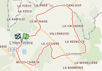
Trail Walking of 10.9 km to be discovered at Normandy, Orne, Val-au-Perche. This trail is proposed by ODDAD78.
Départ : L'Hermitière, place de l'église Arrivée : L'Hermitière, place de l'église Balisage : PR
Communes : 1. L'Hermitière
2. Le Theil
3. La Rouge
4. Préaux-du-Perche
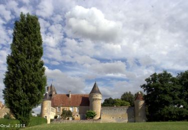
1. Contourner l’église et descendre la D 211. Jolie vue à droite sur le château de L’Hermitière. Passer devant le Logis Neuf et le Champ Meunier. Arrivé à une croix de granit, abandonner la D211 en prenant à gauche direction Le Theil. Passer devant la Petite Rigotière. Au carrefour du Chêne Vert, prendre à gauche la D107 sur 5 m puis emprunter à gauche le chemin goudronné descendant à Montcorbin.
2. 100 m avant le lieu-dit le Bois le Roy, bifurquer à gauche et pénétrer en sous-bois par un chemin de terre. Suivre ce chemin toujours tout droit, en ignorant les sentiers qui le coupent. Sortir du bois et gagner le hameau de la Coudre.
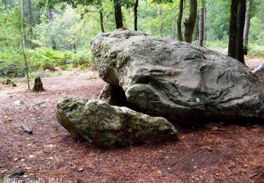
3. Monter à droite un raidillon. Continuer par un beau chemin creux s’enfonçant en sous-bois. À hauteur du lieu-dit la Sergotière, virer à droite et continuer en montant. À gauche, échappée de vue sur le bourg du Theil. Peu après le Bois Gonsard, redescendre, toujours à travers bois.
4. À une intersection en Y, virer à gauche. Descendre un chemin rural très encaissé qui aboutit au hameau du Petit Sablon. Continuer par un chemin goudronné débouchant sur la D636 au lieu-dit la Joussinière.
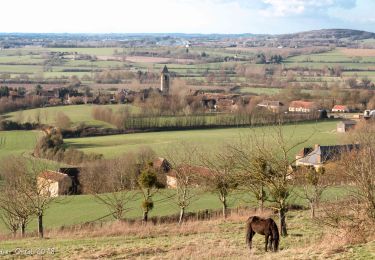
5. Traverser la Départementale : PRUDENCE ! Tout droit par le chemin de la Vigne. Continuer par un chemin de terre, humide par endroits et en pente forte, qui grimpe sur la butte pour aboutir à Bellevue.
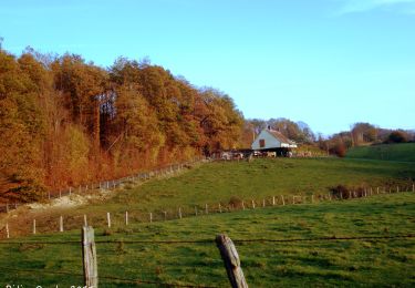
6. Tourner à gauche et emprunter sur 50 m une large allée empierrée que prolonge un chemin de terre à travers bois. À une intersection en Y, prendre la branche de gauche. Le chemin, humide par endroits, descend progressivement. Sortir du bois à l’Hôtel Reno (belle échappée de vue sur la campagne). Continuer par un chemin non revêtu. Passer la Crônerie. Au hameau de la Gennetière, tourner à droite, puis à gauche. Longer un bois.
7. À la rencontre d’un chemin creux, virer à gauche pour déboucher sur la D 211. Suivre la D 211. Passer devant la Péculière et le Champ Vert.
8. Quitter la départementale pour prendre, à droite, le chemin du Chêne, qui vire à angle droit. Ignorer à droite le chemin de la Page et prendre à gauche un chemin creux, en lisière de bois. Déboucher sur le chemin empierré des Maison Neuves. ATTENTION : Sur ce chemin empierre, bien prendre à gauche : ça monte (ne pas suivre le balisage sur droite qui concerne un autre circuit). Passer devant la Grisonnière (un poteau y sera implanté en juin 2022). Continuer tout droit pour rejoindre la VC 1 que l’on descend à gauche.
9. À l’intersection avec la D 211, tourner à droite pour retourner dans le bourg par la Coulongerie et les Feugeries.
(Pas à pas : Rando-Perche

Walking

Walking
Walking
Walking
Walking
Walking
Walking
Walking
Walking