![](/images/other/stat-length.png)
![Trail Walking Pléneuf-Val-André - GR_34_CA_14_Pleneuf-Val-Andre_Lamballe_20230820 - Photo](https://media.geolcdn.com/t/1900/400/dc9169ae-5d20-486b-b60a-ec7c033f0c7b.jpg&format=pjpeg&maxdim=2)
GR_34_CA_14_Pleneuf-Val-Andre_Lamballe_20230820
patrickdanilo
User
![Length](/images/other/stat-length.png)
Length
14 km
![Max alt](https://static1.geolcdn.com/siteimages/upload/files/1508320355ic_sort_altitude_max_24dp.png)
Max alt
53 m
![Uphill gradient](https://static1.geolcdn.com/siteimages/upload/files/1508320355ic_sort_den_pos_24dp.png)
Uphill gradient
295 m
![Km-Effort](/images/other/stat-length.png)
Km-Effort
17.9 km
![Min alt](https://static1.geolcdn.com/siteimages/upload/files/1508320355ic_sort_altitude_min_24dp.png)
Min alt
0 m
![Downhill gradient](https://static1.geolcdn.com/siteimages/upload/files/1508320355ic_sort_den_neg_24dp.png)
Downhill gradient
291 m
![Boucle](https://static1.geolcdn.com/siteimages/upload/files/16400158638029165_repeat_loop_refresh_sync_direction_icon.png)
Boucle
No
Creation date :
2023-08-20 08:00:28.818
Updated on :
2023-09-20 18:00:52.0
![Walking](https://static1.geolcdn.com/sitytour/trail-icons/101.png)
3h33
Difficulty : Medium
![Scan this QR Code to open this trail in the SityTrail application](https://capi.geolives.com/qq0zvz2zws4bq2lad0pu/sitytour/trails/3778496/qr.png?size=200)
FREE GPS app for hiking
About
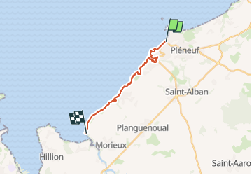
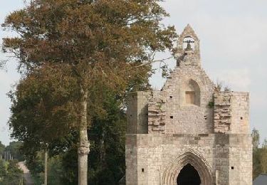
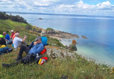
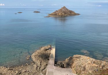
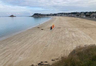
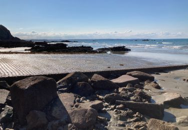
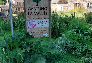
Trail Walking of 14 km to be discovered at Brittany, Côtes-d'Armor, Pléneuf-Val-André. This trail is proposed by patrickdanilo.
Description
Randonnée Marche de 14 km à découvrir à Bretagne, Côtes-d'Armor, Pléneuf-Val-André. Cette randonnée est proposée par patrickdanilo.
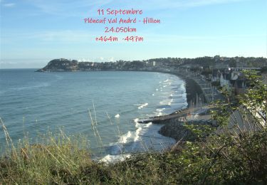
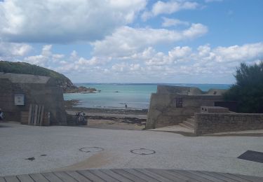
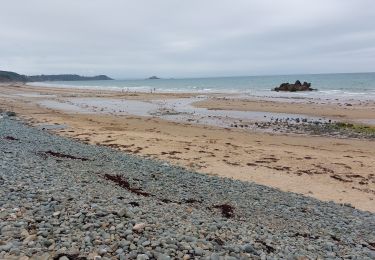
Positioning
Country:
France
Region :
Brittany
Department/Province :
Côtes-d'Armor
Municipality :
Pléneuf-Val-André
Location:
Unknown
Start:(Dec)
Start:(UTM)
532819 ; 5381925 (30U) N.
Comments
Trails nearby
![Trail Walking Pléneuf-Val-André - SityTrail - GR 34 Pléneuf Val andré -- Hillion - Photo](https://media.geolcdn.com/t/375/260/a7664a50-bf36-435d-8dd9-5d811f168a14.jpg&format=jpg&maxdim=2)
![Walking Walking](https://static1.geolcdn.com/sitytour/trail-icons/101.png)
SityTrail - GR 34 Pléneuf Val andré -- Hillion
Walking
Very difficult
Pléneuf-Val-André,
Brittany,
Côtes-d'Armor,
France
![](/images/other/stat-length.png)
24 km | 30 km-effort
6h 54min
![](https://static1.geolcdn.com/siteimages/upload/files/16400158638029165_repeat_loop_refresh_sync_direction_icon.png)
No
![Trail Walking Lamballe-Armor - La Côte du Port Morvan 6.7.23 - Photo](https://media.geolcdn.com/t/375/260/8311d318-82e2-44fd-9871-c2f1c72b6002.jpg&format=jpg&maxdim=2)
![Walking Walking](https://static1.geolcdn.com/sitytour/trail-icons/101.png)
La Côte du Port Morvan 6.7.23
Walking
Easy
Lamballe-Armor,
Brittany,
Côtes-d'Armor,
France
![](/images/other/stat-length.png)
7.9 km | 10.2 km-effort
2h 15min
![](https://static1.geolcdn.com/siteimages/upload/files/16400158638029165_repeat_loop_refresh_sync_direction_icon.png)
Yes
![Trail Walking Erquy - LE CAP D'ERQUY DEPUIS LE CAMPING LA VALLEE - Photo](https://media.geolcdn.com/t/375/260/844bcf38-4939-4501-9740-44824bba3a6f.jpg&format=jpg&maxdim=2)
![Walking Walking](https://static1.geolcdn.com/sitytour/trail-icons/101.png)
LE CAP D'ERQUY DEPUIS LE CAMPING LA VALLEE
Walking
Very difficult
Erquy,
Brittany,
Côtes-d'Armor,
France
![](/images/other/stat-length.png)
15.8 km | 19.9 km-effort
3h 43min
![](https://static1.geolcdn.com/siteimages/upload/files/16400158638029165_repeat_loop_refresh_sync_direction_icon.png)
Yes
![Trail Walking Saint-Alban - A la rencontre de la Flora - Saint Alban - Photo](https://media.geolcdn.com/t/375/260/ext.jpg?maxdim=2&url=https%3A%2F%2Fservices.sitytrail.com%2FGeolivesWS%2FDownloadMedia.ashx%3FTrailID%3D112673%26Media%3D11455_5.jpg)
![Walking Walking](https://static1.geolcdn.com/sitytour/trail-icons/101.png)
A la rencontre de la Flora - Saint Alban
Walking
Medium
Saint-Alban,
Brittany,
Côtes-d'Armor,
France
![](/images/other/stat-length.png)
10 km | 12 km-effort
2h 30min
![](https://static1.geolcdn.com/siteimages/upload/files/16400158638029165_repeat_loop_refresh_sync_direction_icon.png)
Yes
![Trail Walking Pléneuf-Val-André - dahouet - Photo](https://media.geolcdn.com/t/375/260/15fe32ae-cb04-4ac1-8080-bb10a1b960da.jpg&format=jpg&maxdim=2)
![Walking Walking](https://static1.geolcdn.com/sitytour/trail-icons/101.png)
dahouet
Walking
Difficult
Pléneuf-Val-André,
Brittany,
Côtes-d'Armor,
France
![](/images/other/stat-length.png)
9.1 km | 12 km-effort
2h 42min
![](https://static1.geolcdn.com/siteimages/upload/files/16400158638029165_repeat_loop_refresh_sync_direction_icon.png)
No
![Trail Walking Pléneuf-Val-André - Pleneuf Val André - Photo](https://media.geolcdn.com/t/375/260/845eb97f-436b-4324-bb70-14b51579c59e.jpg&format=jpg&maxdim=2)
![Walking Walking](https://static1.geolcdn.com/sitytour/trail-icons/101.png)
Pleneuf Val André
Walking
Medium
Pléneuf-Val-André,
Brittany,
Côtes-d'Armor,
France
![](/images/other/stat-length.png)
13 km | 16.3 km-effort
3h 30min
![](https://static1.geolcdn.com/siteimages/upload/files/16400158638029165_repeat_loop_refresh_sync_direction_icon.png)
Yes
![Trail Walking Pléneuf-Val-André - Dahouet - Photo](https://media.geolcdn.com/t/375/260/0f240a74-0928-471b-9079-268af701de39.jpg&format=jpg&maxdim=2)
![Walking Walking](https://static1.geolcdn.com/sitytour/trail-icons/101.png)
Dahouet
Walking
Very easy
Pléneuf-Val-André,
Brittany,
Côtes-d'Armor,
France
![](/images/other/stat-length.png)
5.4 km | 6.7 km-effort
1h 36min
![](https://static1.geolcdn.com/siteimages/upload/files/16400158638029165_repeat_loop_refresh_sync_direction_icon.png)
Yes
![Trail Walking Lamballe-Armor - Planguenouan - Photo](https://media.geolcdn.com/t/375/260/c8ac0864-9c49-43bb-8972-2ec0fd1097e5.jpg&format=jpg&maxdim=2)
![Walking Walking](https://static1.geolcdn.com/sitytour/trail-icons/101.png)
Planguenouan
Walking
Medium
Lamballe-Armor,
Brittany,
Côtes-d'Armor,
France
![](/images/other/stat-length.png)
14.2 km | 18.2 km-effort
4h 16min
![](https://static1.geolcdn.com/siteimages/upload/files/16400158638029165_repeat_loop_refresh_sync_direction_icon.png)
Yes
![Trail Walking Erquy - POINTE DE PLENEUF DEPUIS LE CAMPING LA VALLÉE - Photo](https://media.geolcdn.com/t/375/260/fd761a9b-b86a-459a-a3f7-a71dadda1ffb.jpg&format=jpg&maxdim=2)
![Walking Walking](https://static1.geolcdn.com/sitytour/trail-icons/101.png)
POINTE DE PLENEUF DEPUIS LE CAMPING LA VALLÉE
Walking
Difficult
Erquy,
Brittany,
Côtes-d'Armor,
France
![](/images/other/stat-length.png)
13.2 km | 16.9 km-effort
2h 55min
![](https://static1.geolcdn.com/siteimages/upload/files/16400158638029165_repeat_loop_refresh_sync_direction_icon.png)
Yes