


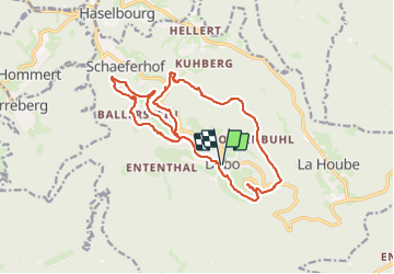

14.5 km | 22 km-effort


User


FREE GPS app for hiking
 SityTrail
IGN / Geographical institutes
SityTrail World
The world is yours!
Trail Walking of 18 km to be discovered at Grand Est, Moselle, Dabo. This trail is proposed by cravattep.
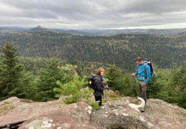
Boucle de 18 km au départ de l'église de Dabo et passage au Rocher du Dabo... avec pause à la brasserie du Rocher ... avant de rejoindre le village de Dabo

Walking

Walking

Walking

Walking

Mountain bike

Walking

Horseback riding
Walking
Walking