7.6 km | 9.5 km-effort
rando sarcey
Nicole SIMONNET
User
Length
10.9 km
Max alt
450 m
Uphill gradient
273 m
Km-Effort
14.6 km
Min alt
338 m
Downhill gradient
273 m
Boucle
Yes
Creation date :
2023-08-16 06:57:41.853
Updated on :
2023-08-16 09:56:19.871
2h56
Difficulty : Medium
FREE GPS app for hiking
About
Trail Walking of 10.9 km to be discovered at Grand Est, Haute-Marne, Sarcey. This trail is proposed by Nicole SIMONNET.
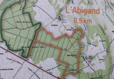
Positioning
Country:
France
Region :
Grand Est
Department/Province :
Haute-Marne
Municipality :
Sarcey
Location:
Unknown
Start:(Dec)
Start:(UTM)
671740 ; 5325023 (31U) N.
Comments
Trails nearby
52 LOUVIERES JC NOV 2024
sport
Very easy
Louvières,
Grand Est,
Haute-Marne,
France
14 km | 18 km-effort
Unknown
Yes
Forêt domaniale d'Ageville
On foot
Easy
Biesles,
Grand Est,
Haute-Marne,
France
13.4 km | 15.4 km-effort
Unknown
Yes
Louvières
Walking
Easy
Louvières,
Grand Est,
Haute-Marne,
France
13.3 km | 16.1 km-effort
3h 28min
Yes
Lanques sur rognon-52
Walking
Very easy
Lanques-sur-Rognon,
Grand Est,
Haute-Marne,
France
14.4 km | 17.4 km-effort
3h 16min
Yes