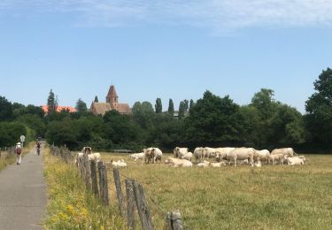
Trail Horseback riding Walbourg - Walbourg Boucle 10km - Photo

Walbourg Boucle 10km

© OpenStreetMap contributors
Length
Length
11.7 km
Max alt
Max alt
186 m
Uphill gradient
Uphill gradient
133 m
Km-Effort
Km-Effort  
13.5 km
Min alt
Min alt
148 m
Downhill gradient
Downhill gradient
133 m
Boucle
Boucle
Yes
Creation date :
2023-08-14 16:57:57.967
Updated on :
2023-08-14 17:01:28.386

(0 Reviews)

Horseback riding
Horseback riding
1h46
Difficulty : Easy

Scan this QR Code to open this trail in the SityTrail application

FREE GPS app for hiking

Logo SityTrail SityTrail

IGN / Geographical institutes

Download SityTrail from the App Store Download SityTrail from Google Play

Logo SityTrail SityTrail World

The world is yours!

Download SityTrail from the App Store Download SityTrail from Google Play Download SityTrail on Huawei AppGallery

About

Trail Horseback riding of 11.7 km to be discovered at Grand Est, Bas-Rhin, Walbourg. This trail is proposed by Thérèse GASSER.

Elevation profile

Positioning

Country:
France
Region :
Grand Est
Department/Province :
Bas-Rhin
Municipality :
Walbourg
Location:
Unknown
Start:(UTM)
411440 ; 5415839 (32U) N.

Trails nearby

Trail Walking Walbourg - 2023-06-18-Abbatiale de Walbourg - Photo
Walking
milou1941

Walking

Walbourg, Grand Est, Bas-Rhin, France
6.7 km | 7.6 km-effort
2h 56min
Yes
Trail Horseback riding Merkwiller-Pechelbronn - Circuit VDN MerkwillerPechelbronn Obersteinbach Long - Photo
Horseback riding
GUIDE+

Horseback riding

Very difficult
Merkwiller-Pechelbronn, Grand Est, Bas-Rhin, France
43 km | 59 km-effort
7h 13min
No
Trail Horseback riding Merkwiller-Pechelbronn - Circuit VDN MerkwillerPechelbronn Obersteinbach Court - Photo
Horseback riding
GUIDE+

Horseback riding

Medium
Merkwiller-Pechelbronn, Grand Est, Bas-Rhin, France
24 km | 31 km-effort
3h 56min
No
Trail Walking Gunstett - Gunstett G3 - Photo
Walking
Dominique Baudelocque

Walking

Difficult
Gunstett, Grand Est, Bas-Rhin, France
15.2 km | 18.2 km-effort
2h 58min
No
Trail Bicycle tourism Walbourg - sortie 26/06 - Photo
Bicycle tourism
Philippe caspar

Bicycle tourism

Medium
Walbourg, Grand Est, Bas-Rhin, France
22 km | 25 km-effort
1h 36min
Yes
Trail Cycle Surbourg - Covid radius 2 - Photo
Cycle
remyj

Cycle

Difficult
Surbourg, Grand Est, Bas-Rhin, France
97 km | 115 km-effort
3h 20min
Yes
Trail Walking Surbourg - randonnée de nuit surbourg 2013 - Photo
Walking
reymuben

Walking

Very easy
Surbourg, Grand Est, Bas-Rhin, France
11.5 km | 13.6 km-effort
2h 58min
Yes
Trail Cycle Frœschwiller - Woerth - Bitche - Photo
Cycle
tracegps

Cycle

Difficult
Frœschwiller, Grand Est, Bas-Rhin, France
94 km | 115 km-effort
4h 10min
Yes
Trail Mountain bike Frœschwiller - En passant par Disteldorf - Photo
Mountain bike
tracegps

Mountain bike

Difficult
Frœschwiller, Grand Est, Bas-Rhin, France
46 km | 60 km-effort
3h 0min
Yes


Close
My subscriptions