![](/images/other/stat-length.png)
![Trail Walking Arcisses - [Itinéraire] Vers le bout du Bois - Photo](https://media.geolcdn.com/t/1900/400/ext.pjpeg?maxdim=2&url=https%3A%2F%2Fstatic1.geolcdn.com%2Fsiteimages%2Fupload%2Ffiles%2F1553511878bg_sport_marche.png)
[Itinéraire] Vers le bout du Bois
ODDAD78
User
![Length](/images/other/stat-length.png)
![Max alt](https://static1.geolcdn.com/siteimages/upload/files/1508320355ic_sort_altitude_max_24dp.png)
![Uphill gradient](https://static1.geolcdn.com/siteimages/upload/files/1508320355ic_sort_den_pos_24dp.png)
![Km-Effort](/images/other/stat-length.png)
![Min alt](https://static1.geolcdn.com/siteimages/upload/files/1508320355ic_sort_altitude_min_24dp.png)
![Downhill gradient](https://static1.geolcdn.com/siteimages/upload/files/1508320355ic_sort_den_neg_24dp.png)
![Boucle](https://static1.geolcdn.com/siteimages/upload/files/16400158638029165_repeat_loop_refresh_sync_direction_icon.png)
![Walking](https://static1.geolcdn.com/sitytour/trail-icons/101.png)
5h16
Difficulty : Very difficult
![Mountain bike](https://static1.geolcdn.com/sitytour/trail-icons/202.png)
1h36
Difficulty : Medium
![Hybrid bike](https://static1.geolcdn.com/sitytour/trail-icons/203.png)
--
Difficulty : Medium
![Scan this QR Code to open this trail in the SityTrail application](https://capi.geolives.com/qq0zvz2zws4bq2lad0pu/sitytour/trails/3765902/qr.png?size=200)
FREE GPS app for hiking
About
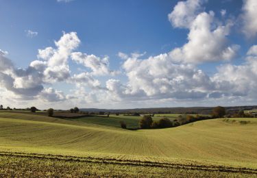
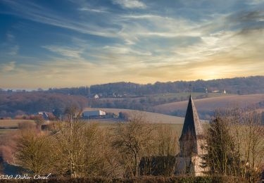
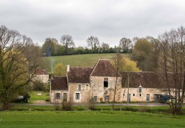
Trail Walking of 20 km to be discovered at Centre-Loire Valley, Eure-et-Loir, Arcisses. This trail is proposed by ODDAD78.
Description
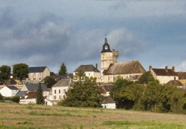
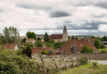
Départ : Brunelles, commune d'Arcisses Arrivée : Brunelles, commune d'Arcisses Communes : 1. Brunelles
2. Margon
3. Champrond-en-Perchet
4. Nogent-le-Rotrou
5. Trizay-Coutretot-Saint-Serge
Depuis le parking, prendre la rue de le Mairie puis tourner à droite sur la rue de la Vallée.
1. Tourner à gauche sur la rue des Moulins puis descendre vers le Moulin Neuf.
2. A l’intersection avec la D351-10, tourner à gauche vers la Cour aux Prêtres, puis tourner à droite
vers l’Artoire. Marcher sur 250 mètres puis prendre le chemin à gauche, traverser les Cottières.
3. Tourner à droite sur la D110, marcher sur 400 mètres puis tourner à droite vers le Moulin à
Papier. En bas de la côte, tourner à gauche
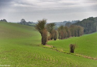
4. A l’intersection prendre en face dans les bois et marcher sur 1 Km.
5. A la sortie du bois, prendre direction l’Argenterie sur 700 mètres
6. Prendre le chemin pour rentrer dans le Bois de Perchet. A environ 650 mètres, bifurquer sur la
droite jusqu’au Bout du Bois et tourner à gauche vers les Petites Salles.
7. Tourner à gauche sur la D922 - PRUDENCE PENDANT LA TRAVERSEE – Puis à 150 mètres
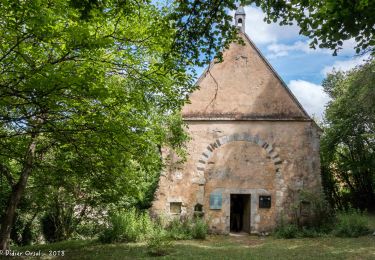
tourner à droite vers Gaumert. A la ferme Gaumert, tourner à droite dans le chemin. Marcher sur 450 mètres puis tourner à gauche sur la D112-1. PUIS PRUDENCE : Emprunter la D112-1 sur 900 mètres. A la chapelle monter à gauche sur 800 mètres.
8. A l’intersection, prendre en face vers Fauchet. A Roucherais, prendre le chemin en face jusqu’à la D110-7 puis monter sur votre gauche.
9. Prendre à droite vers la Grande Mairie et la Petite Mairie. Continuer pour rejoindre la D368 puis tourner à droite vers la Vove. A 650 mètres tourner à gauche dans le chemin creux. Marcher sur 750 mètres puis à l’intersection prendre à gauche direction la Bouillère.
10. Arriver à la Bouillère, tourner à droite jusqu’à la D922 - PRUDENCE PENDANT LA TRAVERSEE : Prendre en face sur 700 mètres pour rejoindre la Jubeaudière puis tourner à gauche. Marcher sur 600 mètres pour arriver à la Grande Maison en tournant à gauche puis aussitôt à droite pour passer devant RL Menuiserie. A RL Menuiserie, tourner à droite direction BRUNELLES en arrivant par la rue St Martin.
11. Au croisement, prendre la rue des Moulins, puis aussitôt la rue de l’Eglise.
Positioning
Comments
Trails nearby
![Trail Walking Trizay-Coutretot-Saint-Serge - Trizay 100-B - Photo](https://media.geolcdn.com/t/375/260/ext.jpg?maxdim=2&url=https%3A%2F%2Fstatic1.geolcdn.com%2Fsiteimages%2Fupload%2Ffiles%2F1553511878bg_sport_marche.png)
![Walking Walking](https://static1.geolcdn.com/sitytour/trail-icons/101.png)
Walking
![](/images/other/stat-length.png)
![](https://static1.geolcdn.com/siteimages/upload/files/16400158638029165_repeat_loop_refresh_sync_direction_icon.png)
![Trail Walking Arcisses - Coudreceau, les panoramas du Perche Eurélien 9,4 km - Photo](https://media.geolcdn.com/t/375/260/93185f9c-ce34-4e92-883e-ab49829b2889.jpeg&format=jpg&maxdim=2)
![Walking Walking](https://static1.geolcdn.com/sitytour/trail-icons/101.png)
Walking
![](/images/other/stat-length.png)
![](https://static1.geolcdn.com/siteimages/upload/files/16400158638029165_repeat_loop_refresh_sync_direction_icon.png)
![Trail Walking Arcisses - Brunelles - Autour du Promontoire 10 km - Photo](https://media.geolcdn.com/t/375/260/d22874c5-839f-4011-a0f9-00e8c44e1208.jpeg&format=jpg&maxdim=2)
![Walking Walking](https://static1.geolcdn.com/sitytour/trail-icons/101.png)
Walking
![](/images/other/stat-length.png)
![](https://static1.geolcdn.com/siteimages/upload/files/16400158638029165_repeat_loop_refresh_sync_direction_icon.png)
![Trail Walking Arcisses - 2023-04-24_20h15m45_Ozée 9,1 km - Photo](https://media.geolcdn.com/t/375/260/ext.jpg?maxdim=2&url=https%3A%2F%2Fstatic1.geolcdn.com%2Fsiteimages%2Fupload%2Ffiles%2F1553511878bg_sport_marche.png)
![Walking Walking](https://static1.geolcdn.com/sitytour/trail-icons/101.png)
Walking
![](/images/other/stat-length.png)
![](https://static1.geolcdn.com/siteimages/upload/files/16400158638029165_repeat_loop_refresh_sync_direction_icon.png)
![Trail Walking La Gaudaine - La Gaudaine - les panoramas 12 km - Photo](https://media.geolcdn.com/t/375/260/7d44d83e-0c4d-469b-b2b8-1846d9ca6509.jpeg&format=jpg&maxdim=2)
![Walking Walking](https://static1.geolcdn.com/sitytour/trail-icons/101.png)
Walking
![](/images/other/stat-length.png)
![](https://static1.geolcdn.com/siteimages/upload/files/16400158638029165_repeat_loop_refresh_sync_direction_icon.png)
![Trail Walking Marolles-les-Buis - SityTrail - Le hameau de la Cloche 7,4 km - Photo](https://media.geolcdn.com/t/375/260/be06a1ec-da26-4982-bec0-14d197dfa4b5.jpg&format=jpg&maxdim=2)
![Walking Walking](https://static1.geolcdn.com/sitytour/trail-icons/101.png)
Walking
![](/images/other/stat-length.png)
![](https://static1.geolcdn.com/siteimages/upload/files/16400158638029165_repeat_loop_refresh_sync_direction_icon.png)
![Trail Walking Arcisses - Coudreceau - Saint-Victor-de-Buthon 11 km - Photo](https://media.geolcdn.com/t/375/260/0e7de4a4-08a4-4fcb-97dc-5370116ce0be.jpg&format=jpg&maxdim=2)
![Walking Walking](https://static1.geolcdn.com/sitytour/trail-icons/101.png)
Walking
![](/images/other/stat-length.png)
![](https://static1.geolcdn.com/siteimages/upload/files/16400158638029165_repeat_loop_refresh_sync_direction_icon.png)
![Trail Walking Arcisses - Coudreceau - Nogent-le-Rotrou 11 km - Photo](https://media.geolcdn.com/t/375/260/b9a44e85-5a21-4b01-b59f-00bbfdd7e9b5.jpg&format=jpg&maxdim=2)
![Walking Walking](https://static1.geolcdn.com/sitytour/trail-icons/101.png)
Walking
![](/images/other/stat-length.png)
![](https://static1.geolcdn.com/siteimages/upload/files/16400158638029165_repeat_loop_refresh_sync_direction_icon.png)
![Trail Walking Arcisses - Coudreceau - Thiron-Gardais 9,2 km - Photo](https://media.geolcdn.com/t/375/260/18fddcac-d0bd-464b-8f75-cea37d64eb13.jpg&format=jpg&maxdim=2)
![Walking Walking](https://static1.geolcdn.com/sitytour/trail-icons/101.png)
Walking
![](/images/other/stat-length.png)
![](https://static1.geolcdn.com/siteimages/upload/files/16400158638029165_repeat_loop_refresh_sync_direction_icon.png)