


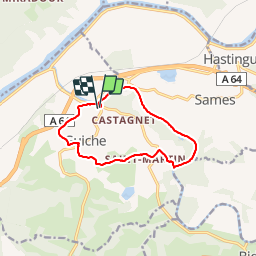

11.2 km | 12.9 km-effort


User


FREE GPS app for hiking
 SityTrail
IGN / Geographical institutes
SityTrail World
The world is yours!
Trail Walking of 11 km to be discovered at New Aquitaine, Pyrénées-Atlantiques, Guiche. This trail is proposed by DECHAMPD.
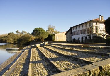
Ce circuit fera découvrir le patrimoine historique du village de Guiche, au travers de son port empierré, son château et de ces chemins de halage.

Walking
Walking

On foot

Walking

Equestrian
Mountain bike

Walking

Hybrid bike

Walking