Trail Walking Arbent - ballade en forêt de Marchon et Viry.  - Photo

ballade en forêt de Marchon et Viry.

© OpenStreetMap contributors
Length
Length
18.1 km
Max alt
Max alt
1092 m
Uphill gradient
Uphill gradient
737 m
Km-Effort
Km-Effort  
28 km
Min alt
Min alt
532 m
Downhill gradient
Downhill gradient
733 m
Boucle
Boucle
Yes
Creation date :
2023-07-31 11:42:15.587
Updated on :
2023-07-31 18:29:49.748

(0 Reviews)

Walking
Walking
3h45
Difficulty : Medium

Scan this QR Code to open this trail in the SityTrail application

FREE GPS app for hiking

Logo SityTrail SityTrail

IGN / Geographical institutes

Download SityTrail from the App Store Download SityTrail from Google Play

Logo SityTrail SityTrail World

The world is yours!

Download SityTrail from the App Store Download SityTrail from Google Play Download SityTrail on Huawei AppGallery

About

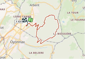
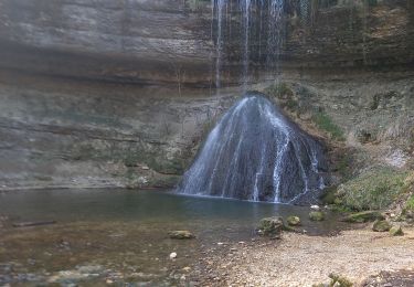
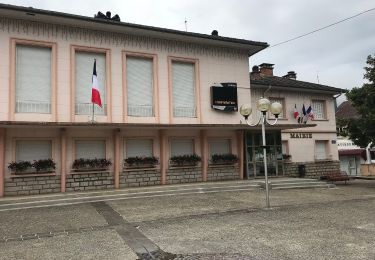
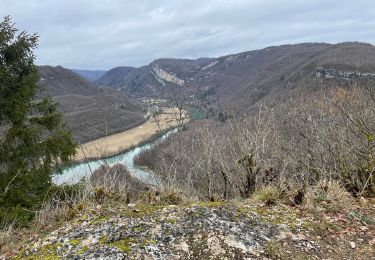
Trail Walking of 18.1 km to be discovered at Auvergne-Rhône-Alpes, Ain, Arbent. This trail is proposed by le jurassien.39.

Description

Départ du stade de Marchon pour la RF du Macretet jusqu'au poteau Mulevin et virer à gauche pour la RF de Longecombe jusqu'au cul de Larry et monter les monts de la Chaux et récupérer le belvédère du Molard Rond et descendre sur la Poinye de Biez et retour maison.
Ballafe de 18.1kms pour 3h45 et dénivelé positif de 737m.

Elevation profile

Positioning

Country:
France
Region :
Auvergne-Rhône-Alpes
Department/Province :
Ain
Municipality :
Arbent
Location:
Unknown
Start:(UTM)
705711 ; 5127994 (31T) N.

Trails nearby

Trail Walking Viry - Haut Jura - Giron - Viry - Photo
Walking
tracegps

Walking

Difficult
(1)
Viry, Bourgogne-Franche-Comté, Jura, France
25 km | 37 km-effort
6h 0min
No
Trail On foot Oyonnax - Les Grottes de Lordon - Photo
On foot
GUIDE+

On foot

Easy
Oyonnax, Auvergne-Rhône-Alpes, Ain, France
5.9 km | 10.8 km-effort
2h 27min
No
Trail Walking Dortan - col de la Tendue pierre qui vire  - Photo
Walking
Jackoyo

Walking

Difficult
Dortan, Auvergne-Rhône-Alpes, Ain, France
9.2 km | 15.5 km-effort
2h 51min
Yes
Trail Walking Dortan - vouais. la pierre qui vire.la cascade de la combe. - Photo
Walking
colomb24

Walking

Easy
Dortan, Auvergne-Rhône-Alpes, Ain, France
10 km | 14.7 km-effort
2h 51min
Yes
Trail On foot Dortan - La Pierre qui vire - Photo
On foot
GUIDE+

On foot

Easy
Dortan, Auvergne-Rhône-Alpes, Ain, France
3.1 km | 6.1 km-effort
1h 23min
No
Trail Walking Dortan - Boucle sur les hauteurs de Dortan  - Photo
Walking
zefreefly

Walking

Medium
Dortan, Auvergne-Rhône-Alpes, Ain, France
18.1 km | 28 km-effort
4h 35min
Yes
Trail Walking Viry - Siege - Photo
Walking
Jackoyo

Walking

Medium
Viry, Bourgogne-Franche-Comté, Jura, France
7.6 km | 11.5 km-effort
2h 28min
Yes
Trail Walking Oyonnax - oyonnax apremont et lac genin - Photo
Walking
colomb24

Walking

Very difficult
Oyonnax, Auvergne-Rhône-Alpes, Ain, France
19.3 km | 28 km-effort
9h 48min
No
Trail Walking Dortan - vouais - Photo
Walking
colomb24

Walking

Difficult
Dortan, Auvergne-Rhône-Alpes, Ain, France
14.3 km | 22 km-effort
7h 11min
Yes


Close
My subscriptions