![](/images/other/stat-length.png)
![Trail Walking La Ferrière - la Ferrière - le Moulin à Vent à Saint-Laurent-en-Gâtines - 14.9km 115m 3h20 (30mn) - 2023 07 30 - Photo](https://media.geolcdn.com/t/1900/400/d3c77c4c-8983-42fc-ab09-ce988903c800.jpg&format=pjpeg&maxdim=2)
la Ferrière - le Moulin à Vent à Saint-Laurent-en-Gâtines - 14.9km 115m 3h20 (30mn) - 2023 07 30
Orcal37
User GUIDE
![Length](/images/other/stat-length.png)
Length
14.9 km
![Max alt](https://static1.geolcdn.com/siteimages/upload/files/1508320355ic_sort_altitude_max_24dp.png)
Max alt
172 m
![Uphill gradient](https://static1.geolcdn.com/siteimages/upload/files/1508320355ic_sort_den_pos_24dp.png)
Uphill gradient
119 m
![Km-Effort](/images/other/stat-length.png)
Km-Effort
16.5 km
![Min alt](https://static1.geolcdn.com/siteimages/upload/files/1508320355ic_sort_altitude_min_24dp.png)
Min alt
130 m
![Downhill gradient](https://static1.geolcdn.com/siteimages/upload/files/1508320355ic_sort_den_neg_24dp.png)
Downhill gradient
117 m
![Boucle](https://static1.geolcdn.com/siteimages/upload/files/16400158638029165_repeat_loop_refresh_sync_direction_icon.png)
Boucle
Yes
Creation date :
2023-07-30 08:50:38.892
Updated on :
2023-08-02 08:44:12.715
![Walking](https://static1.geolcdn.com/sitytour/trail-icons/101.png)
3h20
Difficulty : Easy
![Scan this QR Code to open this trail in the SityTrail application](https://capi.geolives.com/qq0zvz2zws4bq2lad0pu/sitytour/trails/3752820/qr.png?size=200)
FREE GPS app for hiking
About
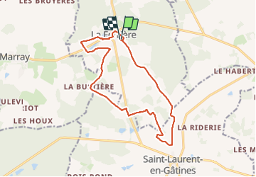
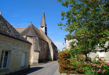
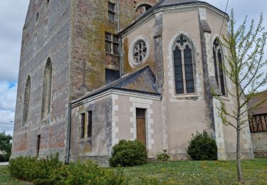
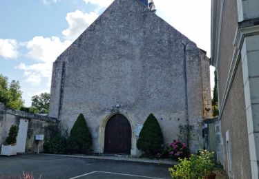
Trail Walking of 14.9 km to be discovered at Centre-Loire Valley, Indre-et-Loire, La Ferrière. This trail is proposed by Orcal37.
Description
la Ferrière - PRs jusqu'au lieu nommé le Moulin à Vent à Saint-Laurent-en-Gâtines puis retour par une petite route - 14.9km 115m 3h20 (30mn) - 2023 07 30
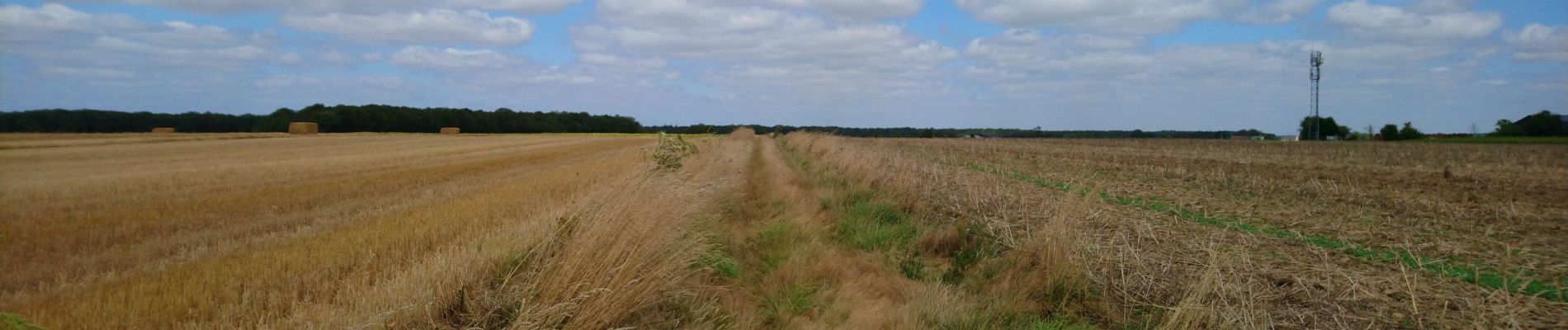
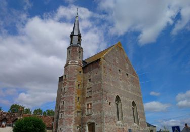
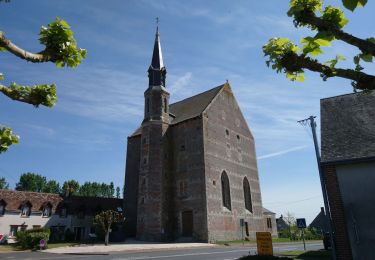
Positioning
Country:
France
Region :
Centre-Loire Valley
Department/Province :
Indre-et-Loire
Municipality :
La Ferrière
Location:
Unknown
Start:(Dec)
Start:(UTM)
331011 ; 5277266 (31T) N.
Comments
Trails nearby
![Trail Walking Saint-Laurent-en-Gâtines - Saint-Laurent-en-Gâtines - variante du PR Chemin de Chenusson - 10.2km 90m 2h25 - 2023 07 30 - Photo](https://media.geolcdn.com/t/375/260/9480277e-5582-454b-ba7d-ba1780556f7f.jpg&format=jpg&maxdim=2)
![Walking Walking](https://static1.geolcdn.com/sitytour/trail-icons/101.png)
Saint-Laurent-en-Gâtines - variante du PR Chemin de Chenusson - 10.2km 90m 2h...
Walking
Easy
Saint-Laurent-en-Gâtines,
Centre-Loire Valley,
Indre-et-Loire,
France
![](/images/other/stat-length.png)
10.3 km | 11.5 km-effort
2h 25min
![](https://static1.geolcdn.com/siteimages/upload/files/16400158638029165_repeat_loop_refresh_sync_direction_icon.png)
Yes
![Trail Walking Saint-Laurent-en-Gâtines - Saint-Laurent-en-Gâtines - Circuit jaune avec variante le Sentier - 18.7km 120m 4h30 - 2022 05 01 - Photo](https://media.geolcdn.com/t/375/260/8fa477e2-239d-46b3-938e-82d894cde1c1.jpg&format=jpg&maxdim=2)
![Walking Walking](https://static1.geolcdn.com/sitytour/trail-icons/101.png)
Saint-Laurent-en-Gâtines - Circuit jaune avec variante le Sentier - 18.7km 12...
Walking
Easy
Saint-Laurent-en-Gâtines,
Centre-Loire Valley,
Indre-et-Loire,
France
![](/images/other/stat-length.png)
18.7 km | 20 km-effort
4h 30min
![](https://static1.geolcdn.com/siteimages/upload/files/16400158638029165_repeat_loop_refresh_sync_direction_icon.png)
Yes
![Trail Walking Marray - Marray - 2 boucles - 19.2km 245m 5h05 (30mn) - 2021 06 09 - Photo](https://media.geolcdn.com/t/375/260/45a2bb2e-f724-44bd-9abd-5e3ed1735943.jpg&format=jpg&maxdim=2)
![Walking Walking](https://static1.geolcdn.com/sitytour/trail-icons/101.png)
Marray - 2 boucles - 19.2km 245m 5h05 (30mn) - 2021 06 09
Walking
Medium
Marray,
Centre-Loire Valley,
Indre-et-Loire,
France
![](/images/other/stat-length.png)
19.2 km | 22 km-effort
5h 5min
![](https://static1.geolcdn.com/siteimages/upload/files/16400158638029165_repeat_loop_refresh_sync_direction_icon.png)
Yes
![Trail Walking Saint-Laurent-en-Gâtines - Saint-Laurent-en-Gatines - Photo](https://media.geolcdn.com/t/375/260/3bcc51bc-dce3-484e-8c68-f9b9dd3f130d.jpg&format=jpg&maxdim=2)
![Walking Walking](https://static1.geolcdn.com/sitytour/trail-icons/101.png)
Saint-Laurent-en-Gatines
Walking
Difficult
Saint-Laurent-en-Gâtines,
Centre-Loire Valley,
Indre-et-Loire,
France
![](/images/other/stat-length.png)
13.1 km | 14.9 km-effort
3h 23min
![](https://static1.geolcdn.com/siteimages/upload/files/16400158638029165_repeat_loop_refresh_sync_direction_icon.png)
Yes
![Trail Walking Marray - Marray - Les versants de la Dême - Photo](https://media.geolcdn.com/t/375/260/a9d7133a-9eea-405b-99f5-2661c5c29f57.jpg&format=jpg&maxdim=2)
![Walking Walking](https://static1.geolcdn.com/sitytour/trail-icons/101.png)
Marray - Les versants de la Dême
Walking
Medium
Marray,
Centre-Loire Valley,
Indre-et-Loire,
France
![](/images/other/stat-length.png)
12.8 km | 15.2 km-effort
3h 27min
![](https://static1.geolcdn.com/siteimages/upload/files/16400158638029165_repeat_loop_refresh_sync_direction_icon.png)
Yes
![Trail Walking La Ferrière - La Ferrière - Photo](https://media.geolcdn.com/t/375/260/2b9da9c8-3be2-44f6-92a4-c42159cd8b74.jpg&format=jpg&maxdim=2)
![Walking Walking](https://static1.geolcdn.com/sitytour/trail-icons/101.png)
La Ferrière
Walking
Easy
La Ferrière,
Centre-Loire Valley,
Indre-et-Loire,
France
![](/images/other/stat-length.png)
10.6 km | 11.9 km-effort
2h 42min
![](https://static1.geolcdn.com/siteimages/upload/files/16400158638029165_repeat_loop_refresh_sync_direction_icon.png)
Yes
![Trail Walking Les Hermites - sentier de l'ermite - Photo](https://media.geolcdn.com/t/375/260/ext.jpg?maxdim=2&url=https%3A%2F%2Fservices.sitytrail.com%2FGeolivesWS%2FDownloadMedia.ashx%3FTrailID%3D315383%26Media%3Dfix__20140622121912.jpg)
![Walking Walking](https://static1.geolcdn.com/sitytour/trail-icons/101.png)
sentier de l'ermite
Walking
Very easy
Les Hermites,
Centre-Loire Valley,
Indre-et-Loire,
France
![](/images/other/stat-length.png)
25 km | 28 km-effort
5h 29min
![](https://static1.geolcdn.com/siteimages/upload/files/16400158638029165_repeat_loop_refresh_sync_direction_icon.png)
Yes
![Trail Walking Saint-Laurent-en-Gâtines - saint laurent en gatine - Photo](https://media.geolcdn.com/t/375/260/ext.jpg?maxdim=2&url=https%3A%2F%2Fservices.sitytrail.com%2FGeolivesWS%2FDownloadMedia.ashx%3FTrailID%3D265906%26Media%3Dfix__20140412112239.jpg)
![Walking Walking](https://static1.geolcdn.com/sitytour/trail-icons/101.png)
saint laurent en gatine
Walking
Easy
Saint-Laurent-en-Gâtines,
Centre-Loire Valley,
Indre-et-Loire,
France
![](/images/other/stat-length.png)
13.9 km | 14.9 km-effort
2h 59min
![](https://static1.geolcdn.com/siteimages/upload/files/16400158638029165_repeat_loop_refresh_sync_direction_icon.png)
Yes
![Trail Walking La Ferrière - marray - la ferrière - Photo](https://media.geolcdn.com/t/375/260/ext.jpg?maxdim=2&url=https%3A%2F%2Fstatic1.geolcdn.com%2Fsiteimages%2Fupload%2Ffiles%2F1553511878bg_sport_marche.png)
![Walking Walking](https://static1.geolcdn.com/sitytour/trail-icons/101.png)
marray - la ferrière
Walking
Easy
La Ferrière,
Centre-Loire Valley,
Indre-et-Loire,
France
![](/images/other/stat-length.png)
16.7 km | 19.6 km-effort
3h 27min
![](https://static1.geolcdn.com/siteimages/upload/files/16400158638029165_repeat_loop_refresh_sync_direction_icon.png)
Yes