![](/images/other/stat-length.png)
![Trail Walking Arrens-Marsous - col de soulor, lac de soum, col de bazes, col de soulor - Photo](https://media.geolcdn.com/t/1900/400/9c3094c8-45a9-4b5a-9dd6-274e8c565d12.jpg&format=pjpeg&maxdim=2)
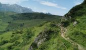
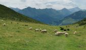
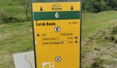
col de soulor, lac de soum, col de bazes, col de soulor
fbienmuller
User
![Length](/images/other/stat-length.png)
Length
16.4 km
![Max alt](https://static1.geolcdn.com/siteimages/upload/files/1508320355ic_sort_altitude_max_24dp.png)
Max alt
1602 m
![Uphill gradient](https://static1.geolcdn.com/siteimages/upload/files/1508320355ic_sort_den_pos_24dp.png)
Uphill gradient
524 m
![Km-Effort](/images/other/stat-length.png)
Km-Effort
23 km
![Min alt](https://static1.geolcdn.com/siteimages/upload/files/1508320355ic_sort_altitude_min_24dp.png)
Min alt
1429 m
![Downhill gradient](https://static1.geolcdn.com/siteimages/upload/files/1508320355ic_sort_den_neg_24dp.png)
Downhill gradient
523 m
![Boucle](https://static1.geolcdn.com/siteimages/upload/files/16400158638029165_repeat_loop_refresh_sync_direction_icon.png)
Boucle
Yes
Creation date :
2023-07-28 07:59:43.395
Updated on :
2023-07-28 14:06:55.507
![Walking](https://static1.geolcdn.com/sitytour/trail-icons/101.png)
5h20
Difficulty : Medium
![Scan this QR Code to open this trail in the SityTrail application](https://capi.geolives.com/qq0zvz2zws4bq2lad0pu/sitytour/trails/3750262/qr.png?size=200)
FREE GPS app for hiking
About
Trail Walking of 16.4 km to be discovered at Occitania, Hautespyrenees, Arrens-Marsous. This trail is proposed by fbienmuller.
Description
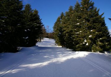
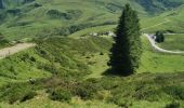
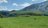
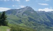
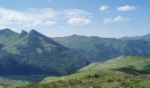
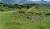
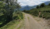
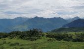
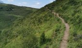
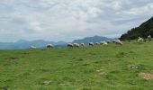
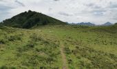
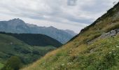
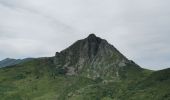
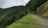
Beaux paysages mais pas d'ombres (sauf début de balade)
Positioning
Country:
France
Region :
Occitania
Department/Province :
Hautespyrenees
Municipality :
Arrens-Marsous
Location:
Unknown
Start:(Dec)
Start:(UTM)
723806 ; 4760123 (30T) N.
Comments
Trails nearby
![Trail On foot Arbéost - SityTrail - Arbeost le tour des quartiers d'Arbeost fait - Photo](https://media.geolcdn.com/t/375/260/ext.jpg?maxdim=2&url=https%3A%2F%2Fstatic1.geolcdn.com%2Fsiteimages%2Fupload%2Ffiles%2F1545311037marcheuse_200dpi.jpg)
![On foot On foot](https://static1.geolcdn.com/sitytour/trail-icons/100.png)
SityTrail - Arbeost le tour des quartiers d'Arbeost fait
On foot
Easy
(1)
Arbéost,
Occitania,
Hautespyrenees,
France
![](/images/other/stat-length.png)
6.7 km | 12.3 km-effort
Unknown
![](https://static1.geolcdn.com/siteimages/upload/files/16400158638029165_repeat_loop_refresh_sync_direction_icon.png)
Yes
![Trail Snowshoes Aucun - Le Soum de Berducou - Photo](https://media.geolcdn.com/t/375/260/ext.jpg?maxdim=2&url=https%3A%2F%2Fservices.sitytrail.com%2FGeolivesWS%2FDownloadMedia.ashx%3FTrailID%3D110337%26Media%3D5784_1.jpg)
![Snowshoes Snowshoes](https://static1.geolcdn.com/sitytour/trail-icons/504.png)
Le Soum de Berducou
Snowshoes
Medium
(1)
Aucun,
Occitania,
Hautespyrenees,
France
![](/images/other/stat-length.png)
5.3 km | 9.6 km-effort
3h 15min
![](https://static1.geolcdn.com/siteimages/upload/files/16400158638029165_repeat_loop_refresh_sync_direction_icon.png)
Yes
![Trail Walking Arrens-Marsous - ARRENS MARSOUS Le Turon des aulhes 2906361 - Photo](https://media.geolcdn.com/t/375/260/11ee13f3-f703-440e-9be7-4acb8ea55d91.jpg&format=jpg&maxdim=2)
![Walking Walking](https://static1.geolcdn.com/sitytour/trail-icons/101.png)
ARRENS MARSOUS Le Turon des aulhes 2906361
Walking
Medium
(1)
Arrens-Marsous,
Occitania,
Hautespyrenees,
France
![](/images/other/stat-length.png)
9.5 km | 16.4 km-effort
5h 55min
![](https://static1.geolcdn.com/siteimages/upload/files/16400158638029165_repeat_loop_refresh_sync_direction_icon.png)
Yes
![Trail Winter sports Aucun - couraduc soulor - Photo](https://media.geolcdn.com/t/375/260/ext.jpg?maxdim=2&url=https%3A%2F%2Fstatic1.geolcdn.com%2Fsiteimages%2Fupload%2Ffiles%2F1524743153ski.jpg)
![Winter sports Winter sports](https://static1.geolcdn.com/sitytour/trail-icons/500.png)
couraduc soulor
Winter sports
Difficult
(1)
Aucun,
Occitania,
Hautespyrenees,
France
![](/images/other/stat-length.png)
34 km | 45 km-effort
2h 31min
![](https://static1.geolcdn.com/siteimages/upload/files/16400158638029165_repeat_loop_refresh_sync_direction_icon.png)
Yes
![Trail Winter sports Aucun - Bazes soulor - Photo](https://media.geolcdn.com/t/375/260/ext.jpg?maxdim=2&url=https%3A%2F%2Fstatic1.geolcdn.com%2Fsiteimages%2Fupload%2Ffiles%2F1524743153ski.jpg)
![Winter sports Winter sports](https://static1.geolcdn.com/sitytour/trail-icons/500.png)
Bazes soulor
Winter sports
Medium
(1)
Aucun,
Occitania,
Hautespyrenees,
France
![](/images/other/stat-length.png)
25 km | 34 km-effort
2h 4min
![](https://static1.geolcdn.com/siteimages/upload/files/16400158638029165_repeat_loop_refresh_sync_direction_icon.png)
Yes
![Trail Walking Aucun - Lac de Soum depuis Col de Couraduque en boucle - Photo](https://media.geolcdn.com/t/375/260/796fccc8-4f12-43e4-93ad-e83b0e4ee94e.jpg&format=jpg&maxdim=2)
![Walking Walking](https://static1.geolcdn.com/sitytour/trail-icons/101.png)
Lac de Soum depuis Col de Couraduque en boucle
Walking
Easy
Aucun,
Occitania,
Hautespyrenees,
France
![](/images/other/stat-length.png)
11.9 km | 18.2 km-effort
4h 36min
![](https://static1.geolcdn.com/siteimages/upload/files/16400158638029165_repeat_loop_refresh_sync_direction_icon.png)
Yes
![Trail Walking Arbéost - G3arbeost le tour fait 2022 - Photo](https://media.geolcdn.com/t/375/260/48356084-36bc-465f-b160-a49039e9ce27.jpg&format=jpg&maxdim=2)
![Walking Walking](https://static1.geolcdn.com/sitytour/trail-icons/101.png)
G3arbeost le tour fait 2022
Walking
Very difficult
Arbéost,
Occitania,
Hautespyrenees,
France
![](/images/other/stat-length.png)
7.1 km | 12.5 km-effort
4h 48min
![](https://static1.geolcdn.com/siteimages/upload/files/16400158638029165_repeat_loop_refresh_sync_direction_icon.png)
Yes
![Trail Walking Arrens-Marsous - ARRENS-MARSOUS le chemin de la mine G4 3059377 - Photo](https://media.geolcdn.com/t/375/260/518ded4d-66a4-45f9-be9c-992637e83008.jpg&format=jpg&maxdim=2)
![Walking Walking](https://static1.geolcdn.com/sitytour/trail-icons/101.png)
ARRENS-MARSOUS le chemin de la mine G4 3059377
Walking
Medium
Arrens-Marsous,
Occitania,
Hautespyrenees,
France
![](/images/other/stat-length.png)
11.2 km | 14.6 km-effort
3h 23min
![](https://static1.geolcdn.com/siteimages/upload/files/16400158638029165_repeat_loop_refresh_sync_direction_icon.png)
Yes
![Trail Walking Aucun - AUCUN VERO rando couraduque hivernale - Photo](https://media.geolcdn.com/t/375/260/47a60887-15e8-40c7-8028-76adc719c740.jpg&format=jpg&maxdim=2)
![Walking Walking](https://static1.geolcdn.com/sitytour/trail-icons/101.png)
AUCUN VERO rando couraduque hivernale
Walking
Medium
Aucun,
Occitania,
Hautespyrenees,
France
![](/images/other/stat-length.png)
5.9 km | 8.7 km-effort
4h 6min
![](https://static1.geolcdn.com/siteimages/upload/files/16400158638029165_repeat_loop_refresh_sync_direction_icon.png)
No