![](/images/other/stat-length.png)
![Trail On foot Saint-Marcel - Octobre rose à St Marcel - Photo](https://media.geolcdn.com/t/1900/400/ext.pjpeg?maxdim=2&url=https%3A%2F%2Fstatic1.geolcdn.com%2Fsiteimages%2Fupload%2Ffiles%2F1545311037marcheuse_200dpi.jpg)
Octobre rose à St Marcel
jeanpaulcheyssac
User
![Length](/images/other/stat-length.png)
Length
2.8 km
![Max alt](https://static1.geolcdn.com/siteimages/upload/files/1508320355ic_sort_altitude_max_24dp.png)
Max alt
183 m
![Uphill gradient](https://static1.geolcdn.com/siteimages/upload/files/1508320355ic_sort_den_pos_24dp.png)
Uphill gradient
20 m
![Km-Effort](/images/other/stat-length.png)
Km-Effort
3.1 km
![Min alt](https://static1.geolcdn.com/siteimages/upload/files/1508320355ic_sort_altitude_min_24dp.png)
Min alt
168 m
![Downhill gradient](https://static1.geolcdn.com/siteimages/upload/files/1508320355ic_sort_den_neg_24dp.png)
Downhill gradient
21 m
![Boucle](https://static1.geolcdn.com/siteimages/upload/files/16400158638029165_repeat_loop_refresh_sync_direction_icon.png)
Boucle
Yes
Creation date :
2023-07-26 17:25:13.269
Updated on :
2023-07-26 17:28:42.34
![On foot](https://static1.geolcdn.com/sitytour/trail-icons/100.png)
41m
Difficulty : Easy
![Scan this QR Code to open this trail in the SityTrail application](https://capi.geolives.com/qq0zvz2zws4bq2lad0pu/sitytour/trails/3748308/qr.png?size=200)
FREE GPS app for hiking
About
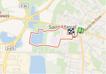
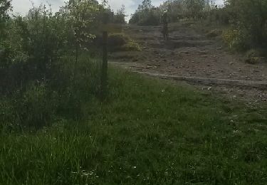
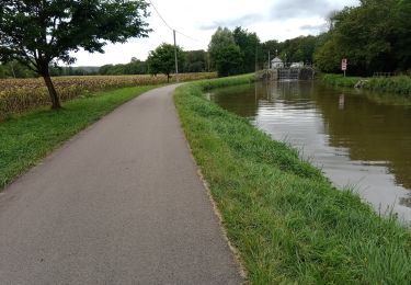
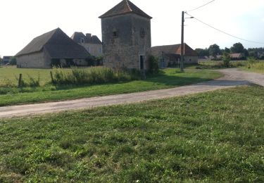
Trail On foot of 2.8 km to be discovered at Bourgogne-Franche-Comté, Saône-et-Loire, Saint-Marcel. This trail is proposed by jeanpaulcheyssac.
Description
Départ de la salle JARREAU , place de ROMENTINO , Mairie , sentier JOSEFINE , tour du lac , gymnase et retour salle JARREAU .
Positioning
Country:
France
Region :
Bourgogne-Franche-Comté
Department/Province :
Saône-et-Loire
Municipality :
Saint-Marcel
Location:
Unknown
Start:(Dec)
Start:(UTM)
644414 ; 5181777 (31T) N.
Comments
Trails nearby
![Trail Nordic walking Sevrey - sevrey - Photo](https://media.geolcdn.com/t/375/260/ext.jpg?maxdim=2&url=https%3A%2F%2Fstatic1.geolcdn.com%2Fsiteimages%2Fupload%2Ffiles%2F1545311037marcheuse_200dpi.jpg)
![Nordic walking Nordic walking](https://static1.geolcdn.com/sitytour/trail-icons/102.png)
sevrey
Nordic walking
Very easy
(1)
Sevrey,
Bourgogne-Franche-Comté,
Saône-et-Loire,
France
![](/images/other/stat-length.png)
9.7 km | 10.2 km-effort
1h 37min
![](https://static1.geolcdn.com/siteimages/upload/files/16400158638029165_repeat_loop_refresh_sync_direction_icon.png)
Yes
![Trail Walking Chalon-sur-Saône - Balade en bord de Saône à Chalon - Photo](https://media.geolcdn.com/t/375/260/8e4d7cac-cf9f-46b7-a64e-342de3a9e9d5.jpg&format=jpg&maxdim=2)
![Walking Walking](https://static1.geolcdn.com/sitytour/trail-icons/101.png)
Balade en bord de Saône à Chalon
Walking
Easy
Chalon-sur-Saône,
Bourgogne-Franche-Comté,
Saône-et-Loire,
France
![](/images/other/stat-length.png)
5.6 km | 6.4 km-effort
1h 15min
![](https://static1.geolcdn.com/siteimages/upload/files/16400158638029165_repeat_loop_refresh_sync_direction_icon.png)
Yes
![Trail Walking Chalon-sur-Saône - Chalon embouchure de la Thalie et retour - Photo](https://media.geolcdn.com/t/375/260/abde2e03-69c5-4324-8dc4-e3b5352ebee9.jpg&format=jpg&maxdim=2)
![Walking Walking](https://static1.geolcdn.com/sitytour/trail-icons/101.png)
Chalon embouchure de la Thalie et retour
Walking
Easy
Chalon-sur-Saône,
Bourgogne-Franche-Comté,
Saône-et-Loire,
France
![](/images/other/stat-length.png)
7.3 km | 7.8 km-effort
1h 31min
![](https://static1.geolcdn.com/siteimages/upload/files/16400158638029165_repeat_loop_refresh_sync_direction_icon.png)
Yes
![Trail Walking Chalon-sur-Saône - Chalon Port Guillot Lux sentier de la Thalie Chalon - Photo](https://media.geolcdn.com/t/375/260/afd7d2e3-221b-46d6-a2d7-5a57ba1a946c.jpg&format=jpg&maxdim=2)
![Walking Walking](https://static1.geolcdn.com/sitytour/trail-icons/101.png)
Chalon Port Guillot Lux sentier de la Thalie Chalon
Walking
Easy
Chalon-sur-Saône,
Bourgogne-Franche-Comté,
Saône-et-Loire,
France
![](/images/other/stat-length.png)
9.7 km | 10.7 km-effort
1h 57min
![](https://static1.geolcdn.com/siteimages/upload/files/16400158638029165_repeat_loop_refresh_sync_direction_icon.png)
Yes
![Trail Mountain bike Chalon-sur-Saône - rando chaumes de givry av christppher - Photo](https://media.geolcdn.com/t/375/260/ext.jpg?maxdim=2&url=https%3A%2F%2Fservices.sitytrail.com%2FGeolivesWS%2FDownloadMedia.ashx%3FTrailID%3D411059%26Media%3Dfix__20150422163330.jpg)
![Mountain bike Mountain bike](https://static1.geolcdn.com/sitytour/trail-icons/202.png)
rando chaumes de givry av christppher
Mountain bike
Medium
(1)
Chalon-sur-Saône,
Bourgogne-Franche-Comté,
Saône-et-Loire,
France
![](/images/other/stat-length.png)
31 km | 38 km-effort
2h 59min
![](https://static1.geolcdn.com/siteimages/upload/files/16400158638029165_repeat_loop_refresh_sync_direction_icon.png)
Yes
![Trail Walking Châtenoy-en-Bresse - Golf - Photo](https://media.geolcdn.com/t/375/260/f985e983-4aef-42ee-97c2-69036080e552.jpg&format=jpg&maxdim=2)
![Walking Walking](https://static1.geolcdn.com/sitytour/trail-icons/101.png)
Golf
Walking
Very difficult
Châtenoy-en-Bresse,
Bourgogne-Franche-Comté,
Saône-et-Loire,
France
![](/images/other/stat-length.png)
19.4 km | 21 km-effort
5h 1min
![](https://static1.geolcdn.com/siteimages/upload/files/16400158638029165_repeat_loop_refresh_sync_direction_icon.png)
No
![Trail Road bike Saint-Marcel - mn06 - Photo](https://media.geolcdn.com/t/375/260/fa82a4c7-abc9-457c-8d2a-f07b6220f52b.jpg&format=jpg&maxdim=2)
![Road bike Road bike](https://static1.geolcdn.com/sitytour/trail-icons/201.png)
mn06
Road bike
Medium
Saint-Marcel,
Bourgogne-Franche-Comté,
Saône-et-Loire,
France
![](/images/other/stat-length.png)
24 km | 26 km-effort
2h 21min
![](https://static1.geolcdn.com/siteimages/upload/files/16400158638029165_repeat_loop_refresh_sync_direction_icon.png)
No
![Trail Walking Châtenoy-en-Bresse - 20190524 Parcours 9 trous Roseraie - Photo](https://media.geolcdn.com/t/375/260/099e47d3-74ed-4590-803c-7ceac8722efa.jpg&format=jpg&maxdim=2)
![Walking Walking](https://static1.geolcdn.com/sitytour/trail-icons/101.png)
20190524 Parcours 9 trous Roseraie
Walking
Very easy
Châtenoy-en-Bresse,
Bourgogne-Franche-Comté,
Saône-et-Loire,
France
![](/images/other/stat-length.png)
5 km | 5.4 km-effort
2h 47min
![](https://static1.geolcdn.com/siteimages/upload/files/16400158638029165_repeat_loop_refresh_sync_direction_icon.png)
Yes
![Trail Cycle Lux - LUX LA SAÔNE - Photo](https://media.geolcdn.com/t/375/260/ext.jpg?maxdim=2&url=https%3A%2F%2Fservices.sitytrail.com%2FGeolivesWS%2FDownloadMedia.ashx%3FTrailID%3D1016166%26Media%3D20180804181051.jpg)
![Cycle Cycle](https://static1.geolcdn.com/sitytour/trail-icons/200.png)
LUX LA SAÔNE
Cycle
Very easy
Lux,
Bourgogne-Franche-Comté,
Saône-et-Loire,
France
![](/images/other/stat-length.png)
7.7 km | 8.4 km-effort
1h 52min
![](https://static1.geolcdn.com/siteimages/upload/files/16400158638029165_repeat_loop_refresh_sync_direction_icon.png)
Yes