


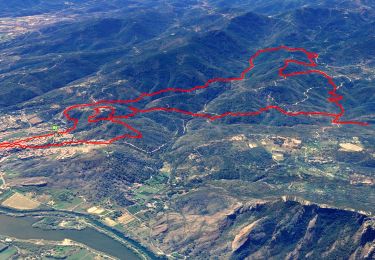
14.4 km | 20 km-effort


User


FREE GPS app for hiking
 SityTrail
IGN / Geographical institutes
SityTrail World
The world is yours!
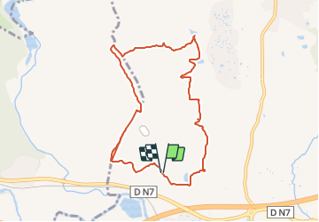
Trail Walking of 9.9 km to be discovered at Provence-Alpes-Côte d'Azur, Var, Roquebrune-sur-Argens. This trail is proposed by Martînati.
Parking piste de Palayson Prendre N7 vers le Muy de suite après passage sur le pont au dessus de l’autouroute,tourner à droite,faire 200-300m et se garer 50-60 m après le local de l’office des forêts sur la droite de la piste
GPS: 43.4688 , 6.6193
Walking

Walking

Walking

Walking

Walking
Walking
Walking

On foot
Walking