Trail Walking Embrun - CC - Embrun  col des Cordellias en circuit - Photo

CC - Embrun col des Cordellias en circuit

© OpenStreetMap contributors
Length
Length
15.2 km
Max alt
Max alt
2595 m
Uphill gradient
Uphill gradient
1263 m
Km-Effort
Km-Effort  
32 km
Min alt
Min alt
1603 m
Downhill gradient
Downhill gradient
1263 m
Boucle
Boucle
Yes
Creation date :
2023-07-24 17:08:33.297
Updated on :
2023-07-24 17:58:31.338

(0 Reviews)

Walking
Walking
7h17
Difficulty : Very difficult

Scan this QR Code to open this trail in the SityTrail application

FREE GPS app for hiking

Logo SityTrail SityTrail

IGN / Geographical institutes

Download SityTrail from the App Store Download SityTrail from Google Play

Logo SityTrail SityTrail World

The world is yours!

Download SityTrail from the App Store Download SityTrail from Google Play Download SityTrail on Huawei AppGallery

About

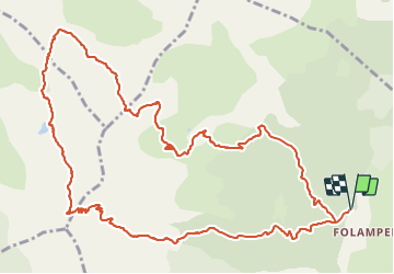
Trail Walking of 15.2 km to be discovered at Provence-Alpes-Côte d'Azur, Hautes-Alpes, Embrun. This trail is proposed by Chocard-contemplatif.

Description

Rando en grande partie très sauvage, entre le col deTrempa-Latz et le lac de l'Hivernet c'est hors sentier, quelques drailles et cairns, mais terrain sans problème.
Le parcours proposé est juste indicatif, de nombreuses options sont possibles, mais à entreprendre par temps clair, ça pourrait devenir laborieux dans le brouillard ou sous la pluie.
Et pourquoi pas en sens inverse, personnellement j'ai hésité
Sans doute faisable en ski de rando ou raquettes

Elevation profile

Positioning

Country:
France
Region :
Provence-Alpes-Côte d'Azur
Department/Province :
Hautes-Alpes
Municipality :
Embrun
Location:
Unknown
Start:(Dec)
Start:(UTM)
299611 ; 4940901 (32T) N.

Trails nearby

Trail Walking Embrun - Lac de l'Hivernet - Photo
Walking
gildascb

Walking

Easy
(1)
Embrun, Provence-Alpes-Côte d'Azur, Hautes-Alpes, France
10.6 km | 21 km-effort
3h 55min
Yes
Trail Walking Embrun - Mont Guillaume-Col de Chanté Perdrix-Lac de l'Hivernet(07-09-16) - Photo
Walking
Dervalmarc

Walking

Difficult
(2)
Embrun, Provence-Alpes-Côte d'Azur, Hautes-Alpes, France
15.4 km | 31 km-effort
7h 4min
Yes
Trail Walking Châteauroux-les-Alpes - boucle cascade de la pisse - Photo
Walking
gildascb

Walking

Very easy
(1)
Châteauroux-les-Alpes, Provence-Alpes-Côte d'Azur, Hautes-Alpes, France
8.8 km | 12.4 km-effort
2h 17min
Yes
Trail Walking Puy-Saint-Eusèbe - canal de reyssas jusqu'aux Touisses / retour par le GR Serre-Ponçon via ravin de la pisse  - Photo
Walking
GUIDE
stef789

Walking

Medium
Puy-Saint-Eusèbe, Provence-Alpes-Côte d'Azur, Hautes-Alpes, France
9.7 km | 15.4 km-effort
4h 51min
Yes
Trail Walking Embrun - Mont Guillaume - Col de Trempa-Latz - 2671 - 10/09/23 - Photo
Walking
GUIDE
R@ph

Walking

Very difficult
Embrun, Provence-Alpes-Côte d'Azur, Hautes-Alpes, France
13.6 km | 28 km-effort
6h 20min
Yes
Trail Walking Embrun - Mont Guillaume - Photo
Walking
GUIDE
Marco05

Walking

Difficult
Embrun, Provence-Alpes-Côte d'Azur, Hautes-Alpes, France
12.6 km | 26 km-effort
5h 55min
Yes
Trail Walking Embrun - Mt Guillaume - Lac de l'Hivernet - Photo
Walking
GUIDE
David25400

Walking

Difficult
Embrun, Provence-Alpes-Côte d'Azur, Hautes-Alpes, France
12.7 km | 28 km-effort
4h 8min
Yes
Trail Walking Embrun - lac de l hivernet - Photo
Walking
gibello

Walking

Easy
(1)
Embrun, Provence-Alpes-Côte d'Azur, Hautes-Alpes, France
9.4 km | 19.5 km-effort
4h 1min
Yes
Trail Walking Embrun - Embrun - 3.4km 90m 1h00 - 2018 06 26 - privé - Photo
Walking
GUIDE
Orcal37

Walking

Very easy
Embrun, Provence-Alpes-Côte d'Azur, Hautes-Alpes, France
3.1 km | 4.1 km-effort
1h 15min
Yes


Close
My subscriptions