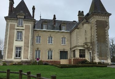
Trail Other activity Candé - Angers-Candé - Photo
 st141230
st141230

User

© OpenStreetMap contributors
Length
Length
43 km
Max alt
Max alt
86 m
Uphill gradient
Uphill gradient
269 m
Km-Effort
Km-Effort  
46 km
Min alt
Min alt
9 m
Downhill gradient
Downhill gradient
271 m
Boucle
Boucle
No
Creation date :
2014-12-30 00:00:00.0
Updated on :
2014-12-30 00:00:00.0

(0 Reviews)

Other activity
Other activity
--
Difficulty : Unknown

Scan this QR Code to open this trail in the SityTrail application

FREE GPS app for hiking

Logo SityTrail SityTrail

IGN / Geographical institutes

Download SityTrail from the App Store Download SityTrail from Google Play

Logo SityTrail SityTrail World

The world is yours!

Download SityTrail from the App Store Download SityTrail from Google Play Download SityTrail on Huawei AppGallery

About

Trail Other activity of 43 km to be discovered at Pays de la Loire, Maine-et-Loire, Candé. This trail is proposed by st141230.

Description

Tracé de l'ancienne ligne de chemin de fer à voie métrique du Petit Anjou (OV)

Elevation profile

Points of interest

Point of interest Angrie - Angrie (Halte) - Photo
st141230
Point of interest Val-d'Erdre-Auxence - La Cornuaille (Gare) - Photo
st141230
VAL-D'ERDRE-AUXENCE 
Point of interest Val-d'Erdre-Auxence - La Mornaie (Halte) - Photo
st141230
VAL-D'ERDRE-AUXENCE 
Point of interest Val-d'Erdre-Auxence - Le Louroux Béconnais (Gare) - Photo
st141230
VAL-D'ERDRE-AUXENCE 
Point of interest Bécon-les-Granits - Bécon les Granits (Gare) - Photo
st141230
BÉCON-LES-GRANITS 
Point of interest Bécon-les-Granits - Carrières de granit - Photo
st141230
BÉCON-LES-GRANITS 
Point of interest Bécon-les-Granits - Gourmaillon - St Clément (Halte) - Photo
st141230
Point of interest Bécon-les-Granits - St Augustin des Bois (Halte) - Photo
st141230
BÉCON-LES-GRANITS 
Point of interest Saint-Léger-de-Linières - St Léger - St Lambert (Gare) - Photo
st141230
SAINT-LÉGER-DE-LINIÈRES 
Point of interest Saint-Léger-de-Linières - St Jean de Lignères (Gare) - Photo
st141230
SAINT-LÉGER-DE-LINIÈRES 
Point of interest Bouchemaine - Pruniers (Gare) - Photo
st141230
BOUCHEMAINE 
Point of interest Angers - La Croix Verte (Halte) - Photo
st141230
Point of interest Angers - Angers Anjou (Gare) - Photo
st141230
Point of interest Candé - Candé Anjou (Gare) - Photo
st141230
Point of interest Candé - Candé-Etat (Gare) - Photo
st141230

Positioning

Country:
France
Region :
Pays de la Loire
Department/Province :
Maine-et-Loire
Municipality :
Candé
Location:
Unknown
Start:(UTM)
647567 ; 5269611 (30T) N.

Trails nearby

Trail Other activity Angrie - Candé et la chocolaterie  - Photo
Other activity
bellicaud

Other activity

Very easy
(1)
Angrie, Pays de la Loire, Maine-et-Loire, France
7.4 km | 8.3 km-effort
1h 33min
Yes
Trail Horseback riding Vallons-de-l'Erdre - étape 4 - Photo
Horseback riding
quitou

Horseback riding

Medium
Vallons-de-l'Erdre, Pays de la Loire, Loire-Atlantique, France
25 km | 27 km-effort
4h 41min
No
Trail Horseback riding Candé - etape 4 vritz La Poueze - Photo
Horseback riding
quitou

Horseback riding

Easy
Candé, Pays de la Loire, Maine-et-Loire, France
25 km | 27 km-effort
1h 25min
No
Trail Walking Candé - Candé freigne - Photo
Walking
MarcBoscher

Walking

Difficult
Candé, Pays de la Loire, Maine-et-Loire, France
12.5 km | 14 km-effort
5h 36min
Yes
Trail Horseback riding Candé - equirando    vive éve  -Candé - Photo
Horseback riding
quitou

Horseback riding

Easy
Candé, Pays de la Loire, Maine-et-Loire, France
66 km | 72 km-effort
1h 33min
No
Trail Walking Angrie - track - Photo
Walking
bubuserge

Walking

Difficult
Angrie, Pays de la Loire, Maine-et-Loire, France
13.5 km | 14.9 km-effort
3h 18min
Yes
Trail Walking Angrie - Angrie - Photo
Walking
chasle

Walking

Easy
Angrie, Pays de la Loire, Maine-et-Loire, France
12.4 km | 13.5 km-effort
3h 0min
Yes
Trail Walking Angrie - Candé - Photo
Walking
chasle

Walking

Easy
Angrie, Pays de la Loire, Maine-et-Loire, France
14 km | 15.6 km-effort
3h 25min
No


Close
My subscriptions