Trail Walking Saint-Symphorien-de-Lay - Tour du clos de château : passage au viaduc et village de Lay - Photo

Tour du clos de château : passage au viaduc et village de Lay

© OpenStreetMap contributors
Length
Length
8.4 km
Max alt
Max alt
462 m
Uphill gradient
Uphill gradient
225 m
Km-Effort
Km-Effort  
11.4 km
Min alt
Min alt
349 m
Downhill gradient
Downhill gradient
225 m
Boucle
Boucle
Yes
Creation date :
2023-07-14 07:39:11.437
Updated on :
2023-07-14 16:34:26.952

(0 Reviews)

Walking
Walking
3h00
Difficulty : Medium
Running
Running
1h17
Difficulty : Very easy

Scan this QR Code to open this trail in the SityTrail application

FREE GPS app for hiking

Logo SityTrail SityTrail

IGN / Geographical institutes

Download SityTrail from the App Store Download SityTrail from Google Play

Logo SityTrail SityTrail World

The world is yours!

Download SityTrail from the App Store Download SityTrail from Google Play Download SityTrail on Huawei AppGallery

About

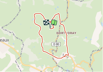
Trail Walking of 8.4 km to be discovered at Auvergne-Rhône-Alpes, Loire, Saint-Symphorien-de-Lay. This trail is proposed by Sarah92130.

Description

200 m de dénivelé en 8km .... costaud par temps tres chaud mais le tour évident, varié et assez joli pour découvrir les alentours depuis le gîte.Charmant village du lay et surprenant viaduc !

Elevation profile

Positioning

Country:
France
Region :
Auvergne-Rhône-Alpes
Department/Province :
Loire
Municipality :
Saint-Symphorien-de-Lay
Location:
Unknown
Start:(UTM)
593700 ; 5091106 (31T) N.

Trails nearby

Trail Walking Saint-Symphorien-de-Lay - etang st symphorien de lay - Photo
Walking
poterie

Walking

Difficult
(1)
Saint-Symphorien-de-Lay, Auvergne-Rhône-Alpes, Loire, France
10.6 km | 14.5 km-effort
3h 17min
Yes
Trail Walking Saint-Symphorien-de-Lay - St Symphorien de lay, agri rando - Photo
Walking
mimi69670

Walking

Easy
Saint-Symphorien-de-Lay, Auvergne-Rhône-Alpes, Loire, France
15.6 km | 21 km-effort
4h 6min
No
Trail Walking Saint-Symphorien-de-Lay - Saint Symphorien de Lay - Photo
Walking
jpc42

Walking

Medium
Saint-Symphorien-de-Lay, Auvergne-Rhône-Alpes, Loire, France
12.1 km | 16.8 km-effort
3h 20min
Yes
Trail Walking Saint-Symphorien-de-Lay - St Symphorien de Lay - Photo
Walking
jpc42

Walking

Medium
Saint-Symphorien-de-Lay, Auvergne-Rhône-Alpes, Loire, France
10.5 km | 14.4 km-effort
3h 3min
Yes
Trail Mountain bike Fourneaux - Rando VTT des Crêtes (2014-VTT-50km) - Fourneaux - Photo
Mountain bike
tracegps

Mountain bike

Very difficult
Fourneaux, Auvergne-Rhône-Alpes, Loire, France
48 km | 67 km-effort
4h 30min
Yes
Trail Mountain bike Saint-Symphorien-de-Lay - VTT au creux des Vallées du Gand de l''Ecoron et du Rhins - Saint-Symphorien-de-Lay - Photo
Mountain bike
tracegps

Mountain bike

Difficult
Saint-Symphorien-de-Lay, Auvergne-Rhône-Alpes, Loire, France
30 km | 38 km-effort
3h 0min
Yes
Trail Running Neaux - La route Napoléon et la Vallée du Gand à VTT - Neaux - Photo
Running
tracegps

Running

Medium
Neaux, Auvergne-Rhône-Alpes, Loire, France
11.7 km | 14.7 km-effort
2h 0min
Yes
Trail Mountain bike Neaux - La route Napoléon et la Vallée du Gand à VTT - Neaux - Photo
Mountain bike
tracegps

Mountain bike

Medium
Neaux, Auvergne-Rhône-Alpes, Loire, France
11.7 km | 14.7 km-effort
1h 15min
Yes
Trail Walking Neaux - La route Napoléon et la Vallée du Gand à VTT - Neaux - Photo
Walking
tracegps

Walking

Medium
Neaux, Auvergne-Rhône-Alpes, Loire, France
11.7 km | 14.7 km-effort
3h 0min
Yes


Close
My subscriptions