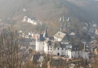
Trail Walking Wiltz - 2023-07-03_11h18m42_autopedestre-wiltz - Photo

2023-07-03_11h18m42_autopedestre-wiltz

© OpenStreetMap contributors
Length
Length
13.3 km
Max alt
Max alt
476 m
Uphill gradient
Uphill gradient
418 m
Km-Effort
Km-Effort  
18.8 km
Min alt
Min alt
288 m
Downhill gradient
Downhill gradient
417 m
Boucle
Boucle
Yes
Creation date :
2023-07-03 09:18:42.878
Updated on :
2023-07-03 09:20:26.192

(1 Reviews)

Walking
Walking
4h17
Difficulty : Medium

Scan this QR Code to open this trail in the SityTrail application

FREE GPS app for hiking

Logo SityTrail SityTrail

IGN / Geographical institutes

Download SityTrail from the App Store Download SityTrail from Google Play

Logo SityTrail SityTrail World

The world is yours!

Download SityTrail from the App Store Download SityTrail from Google Play Download SityTrail on Huawei AppGallery

About

Trail Walking of 13.3 km to be discovered at Unknown, Canton Wiltz, Wiltz. This trail is proposed by mumu.larandonneuse.

Description

L'Auto-Pédestre Wiltz passe ensuite devant les sites les plus importants de la ville sur les collines boisées à l'est du village.
L'Auto-Pédestre Wiltz démarre au château, qui abrite également le Musée national de l'Art brassicole et le Musée de la Bataille des Ardennes, ainsi qu'un office de tourisme. Ici, le chemin passe à l'est dans le Bambësch avant de traverser le Hemeschterbaach. Il va vers le sud presque jusqu'à Nocher, où le chemin fait demi-tour. Après avoir passé le Schnéibech, il continue dans la vallée de Wiltz qu'il traverse près de Merkholtz.
Le chemin ramène à Wiltz à travers des forêts denses. Sur ce dernier tronçon vous profiterez à plusieurs reprises de belles vues sur la soi-disant capitale des Ardennes luxembourgeoises.
Dans la ville, il y a bien sûr plusieurs aires de repos et divers sites, dont le jardin de la ville avec des installations artistiques, l'église gothique tardive du XVIe siècle, le mémorial national de la grève et bien plus encore.
ℹ️ visiteislek.lu

Elevation profile

Positioning

Country:
Luxembourg
Region :
Unknown
Department/Province :
Canton Wiltz
Municipality :
Wiltz
Location:
Unknown
Start:(UTM)
710657 ; 5539036 (31U) N.

Comments

Please log in to post a review or rate the element


Un beau parcours forestier.


Trails nearby

Trail Walking Wiltz - Boucle Les paysages cachés - Tronçon 2 - Wiltz - Derenbach - Photo
Walking
GUIDE+

Walking

Very easy
(1)
Wiltz, Unknown, Canton Wiltz, Luxembourg
18.9 km | 26 km-effort
Unknown
No
Trail Walking Wiltz - Eschweiler - Auto-pédestre New - Photo
Walking
GUIDE
mumu.larandonneuse

Walking

Easy
Wiltz, Unknown, Canton Wiltz, Luxembourg
7.1 km | 9.5 km-effort
1h 35min
Yes
Trail Walking Goesdorf - Autopedestres : Dahl - Photo
Walking
GUIDE+

Walking

Very easy
(1)
Goesdorf, Unknown, Canton Wiltz, Luxembourg
8.7 km | 12.6 km-effort
Unknown
Yes
Trail Walking Kiischpelt - Enscherange 8,2 km - Photo
Walking
GUIDE
rvapeldo

Walking

Easy
Kiischpelt, Unknown, Canton Wiltz, Luxembourg
8.3 km | 10.8 km-effort
2h 5min
Yes
Trail On foot Goesdorf - Fleche Bleu Dahl - Photo
On foot
GUIDE+

On foot

Easy
Goesdorf, Unknown, Canton Wiltz, Luxembourg
8.5 km | 12.3 km-effort
2h 47min
Yes
Trail Walking Wiltz - 2023-10-02_13h19m59_sentier-local-wi-4 - Photo
Walking
GUIDE
mumu.larandonneuse

Walking

Easy
(1)
Wiltz, Unknown, Canton Wiltz, Luxembourg
6.5 km | 9.1 km-effort
2h 4min
Yes
Trail Walking Wiltz - 89.401 Wiltz - Circuit Ville Haute - Photo
Walking
ADL339

Walking

Easy
(1)
Wiltz, Unknown, Canton Wiltz, Luxembourg
4.9 km | 6.5 km-effort
1h 44min
Yes
Trail Walking Wincrange - Boucle Les paysages cachés - Tronçon 3 - Derenbach - Clervaux - Photo
Walking
GUIDE+

Walking

Very easy
Wincrange, Unknown, Canton Clervaux, Luxembourg
19.7 km | 26 km-effort
Unknown
No
Trail Mountain bike Wiltz - Wiltz - Photo
Mountain bike
francois58

Mountain bike

Medium
Wiltz, Unknown, Canton Wiltz, Luxembourg
27 km | 36 km-effort
3h 54min
Yes


Close
My subscriptions