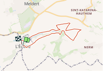
![](/images/other/stat-length.png)
![Trail Walking Beauvechain - #230630 - Superbes sentiers à l'est de l'Écluse**** - Photo](https://media.geolcdn.com/t/1900/400/ext.pjpeg?maxdim=2&url=https%3A%2F%2Fstatic1.geolcdn.com%2Fsiteimages%2Fupload%2Ffiles%2F1553511878bg_sport_marche.png)
#230630 - Superbes sentiers à l'est de l'Écluse****
Randos Ouvertes
User
![Length](/images/other/stat-length.png)
![Max alt](https://static1.geolcdn.com/siteimages/upload/files/1508320355ic_sort_altitude_max_24dp.png)
![Uphill gradient](https://static1.geolcdn.com/siteimages/upload/files/1508320355ic_sort_den_pos_24dp.png)
![Km-Effort](/images/other/stat-length.png)
![Min alt](https://static1.geolcdn.com/siteimages/upload/files/1508320355ic_sort_altitude_min_24dp.png)
![Downhill gradient](https://static1.geolcdn.com/siteimages/upload/files/1508320355ic_sort_den_neg_24dp.png)
![Boucle](https://static1.geolcdn.com/siteimages/upload/files/16400158638029165_repeat_loop_refresh_sync_direction_icon.png)
![Walking](https://static1.geolcdn.com/sitytour/trail-icons/101.png)
1h48
Difficulty : Medium
![Scan this QR Code to open this trail in the SityTrail application](https://capi.geolives.com/qq0zvz2zws4bq2lad0pu/sitytour/trails/3717855/qr.png?size=200)
FREE GPS app for hiking
About
Trail Walking of 7.1 km to be discovered at Wallonia, Walloon Brabant, Beauvechain. This trail is proposed by Randos Ouvertes.
Description
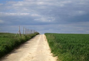
Randonnée facile d'une beauté exceptionnelle surtout au printemps et en été. Grande variété d'arbres et de flore sauvage. Superbes vues*** à longue distance. On aperçoit la majestueuse église d'Hougaerde au loin. Un must absolu !
Description
Rando découverte de 7 km très facile, seulement 50 m de dénivelé
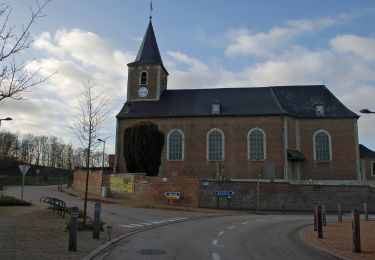
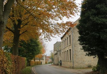
L'Ecluse est une entité à cheval sur la frontière linguistique (qui passe au milieu de l'église)
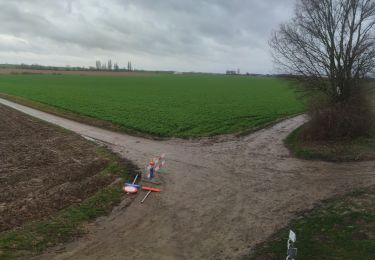
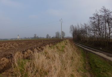
Exploration des grandes étendues à l'est du village vers Hoegaarden
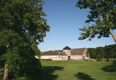
Superbes sentiers nature (dont une réserve naturelle)
Lieu du rendez-vous
Parking
GAËT (rue de) 19
1320 L'ECLUSE (Beauvechain)
Tapez ou cliquez sur l'adresse ci-dessus pour :
1. déterminer votre temps de parcours (à majorer des ralentissements matinaux éventuels)
2. naviguer avec votre smartphone jusqu'à la destination (l'app GPS du smartphone est mise à jour
en temps réel lorsqu'il y a des embouteillages, ce qui n'est pas forcément le cas du GPS intégré
de votre voiture, en outre vous ne devez pas recopier l'adresse dedans).
Ressources téléchargeables
Guide
Carte iGN
Fichier GPX
Positioning
Comments
Trails nearby
![Trail Walking Hoegaarden - Meldert - Photo](https://media.geolcdn.com/t/375/260/31b1a0a0-1852-490a-917d-83e16fb1a5a8.jpg&format=jpg&maxdim=2)
![Walking Walking](https://static1.geolcdn.com/sitytour/trail-icons/101.png)
Walking
![](/images/other/stat-length.png)
![](https://static1.geolcdn.com/siteimages/upload/files/16400158638029165_repeat_loop_refresh_sync_direction_icon.png)
![Trail Mountain bike Beauvechain - O2bikers_128_beauvechain - Photo](https://media.geolcdn.com/t/375/260/ext.jpg?maxdim=2&url=https%3A%2F%2Fstatic1.geolcdn.com%2Fsiteimages%2Fupload%2Ffiles%2F1524743154velo.jpg)
![Mountain bike Mountain bike](https://static1.geolcdn.com/sitytour/trail-icons/202.png)
Mountain bike
![](/images/other/stat-length.png)
![](https://static1.geolcdn.com/siteimages/upload/files/16400158638029165_repeat_loop_refresh_sync_direction_icon.png)
![Trail On foot Tienen - Orbeccawandeling Kort - Photo](https://media.geolcdn.com/t/375/260/e812d299-df6e-4ffd-bbb0-c17a49cbfa6d.jpeg&format=jpg&maxdim=2)
![On foot On foot](https://static1.geolcdn.com/sitytour/trail-icons/100.png)
On foot
![](/images/other/stat-length.png)
![](https://static1.geolcdn.com/siteimages/upload/files/16400158638029165_repeat_loop_refresh_sync_direction_icon.png)
![Trail On foot Jodoigne - Promenade des Hougardiers - Photo](https://media.geolcdn.com/t/375/260/1071dc8c-34bb-425f-a7cf-e1b285bff63f.jpeg&format=jpg&maxdim=2)
![On foot On foot](https://static1.geolcdn.com/sitytour/trail-icons/100.png)
On foot
![](/images/other/stat-length.png)
![](https://static1.geolcdn.com/siteimages/upload/files/16400158638029165_repeat_loop_refresh_sync_direction_icon.png)
![Trail On foot Jodoigne - Promenade de Beaulieu - Photo](https://media.geolcdn.com/t/375/260/b08f8800-3a62-4ae8-903f-50540578f53f.jpeg&format=jpg&maxdim=2)
![On foot On foot](https://static1.geolcdn.com/sitytour/trail-icons/100.png)
On foot
![](/images/other/stat-length.png)
![](https://static1.geolcdn.com/siteimages/upload/files/16400158638029165_repeat_loop_refresh_sync_direction_icon.png)
![Trail On foot Jodoigne - Promenade de Bon Secours - Photo](https://media.geolcdn.com/t/375/260/ec9ec11a-6d77-4c0b-aac1-93a6a5470637.jpeg&format=jpg&maxdim=2)
![On foot On foot](https://static1.geolcdn.com/sitytour/trail-icons/100.png)
On foot
![](/images/other/stat-length.png)
![](https://static1.geolcdn.com/siteimages/upload/files/16400158638029165_repeat_loop_refresh_sync_direction_icon.png)
![Trail On foot Jodoigne - Promenade de la Gobertange - Photo](https://media.geolcdn.com/t/375/260/127a3d39-d3fb-4baf-a281-501a8ec75f7e.jpeg&format=jpg&maxdim=2)
![On foot On foot](https://static1.geolcdn.com/sitytour/trail-icons/100.png)
On foot
![](/images/other/stat-length.png)
![](https://static1.geolcdn.com/siteimages/upload/files/16400158638029165_repeat_loop_refresh_sync_direction_icon.png)
![Trail On foot Beauvechain - Promenade de Sclûse - Photo](https://media.geolcdn.com/t/375/260/c1929032-f640-4516-9c4c-d087908ff1e2.jpeg&format=jpg&maxdim=2)
![On foot On foot](https://static1.geolcdn.com/sitytour/trail-icons/100.png)
On foot
![](/images/other/stat-length.png)
![](https://static1.geolcdn.com/siteimages/upload/files/16400158638029165_repeat_loop_refresh_sync_direction_icon.png)
![Trail On foot Beauvechain - Promenade de Bôvètché - Photo](https://media.geolcdn.com/t/375/260/624d158e-5a46-4086-9bc6-e03f5f0cc127.jpeg&format=jpg&maxdim=2)
![On foot On foot](https://static1.geolcdn.com/sitytour/trail-icons/100.png)
On foot
![](/images/other/stat-length.png)
![](https://static1.geolcdn.com/siteimages/upload/files/16400158638029165_repeat_loop_refresh_sync_direction_icon.png)