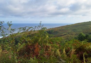
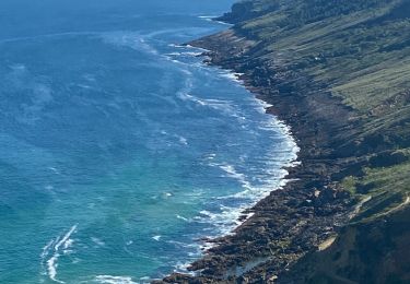
Trail Walking Pasaia - Mitxitxola Mendia litoral 2 - Photo
 DECHAMPD
DECHAMPD

User

© OpenStreetMap contributors
Length
Length
7.6 km
Max alt
Max alt
283 m
Uphill gradient
Uphill gradient
419 m
Km-Effort
Km-Effort  
13.2 km
Min alt
Min alt
50 m
Downhill gradient
Downhill gradient
419 m
Boucle
Boucle
Yes
Creation date :
2019-01-14 17:34:51.93
Updated on :
2019-01-14 17:34:52.006

(0 Reviews)

Walking
Walking
6h05
Difficulty : Difficult

Scan this QR Code to open this trail in the SityTrail application

FREE GPS app for hiking

Logo SityTrail SityTrail

IGN / Geographical institutes

Download SityTrail from the App Store Download SityTrail from Google Play

Logo SityTrail SityTrail World

The world is yours!

Download SityTrail from the App Store Download SityTrail from Google Play Download SityTrail on Huawei AppGallery

About

Trail Walking of 7.6 km to be discovered at Autonomous Community of the Basque Country, Gipuzkoa, Pasaia. This trail is proposed by DECHAMPD.

Description

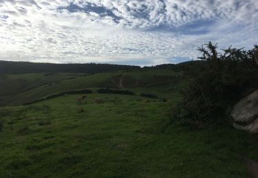
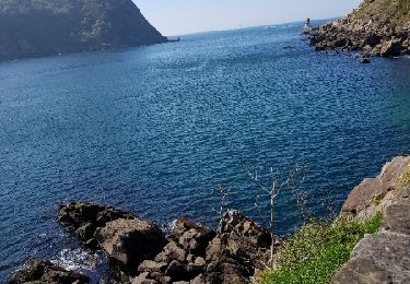
départ Parking Merendero resto, Kabite, Londres, contour de Mitxintxola Mendia par GR (rouge blanc, puis sentier à droite 260m (blanc blanc), Buenos Aires 240m, descente dans la vallée de Inalurreta, montée vers Maturreta, descente vers vallée Sagatxa, Kostaundi,remontée vers Zunbitondo 210m, descente vers Inalurreta et Merendero. La montagne Mitxitxola n'est pas plus qu'un appendice de Jaizkibel dans son versant Pasaitarra, dans ce lieu vert il y avait une série de hameaux, aujourd'hui abandonnés et semi-démolis avec des noms très pittoresques comme Londres, Buenos Aires à cotés les spectaculaires falaises de Grankanto avec caid

Elevation profile

Photos

Points of interest

Point of interest Pasaia - 00 Départ - Photo
DECHAMPD
PASAIA 
Point of interest Pasaia - 01 Londres - Photo
DECHAMPD
PASAIA 
Point of interest Pasaia - 02 - Photo
DECHAMPD
PASAIA 
Point of interest Pasaia - 01  - Photo
DECHAMPD
PASAIA 
Point of interest Pasaia - 02 - Photo
DECHAMPD
PASAIA 
Point of interest Pasaia - 05 - Photo
DECHAMPD
PASAIA 
Point of interest Pasaia - 06 - Photo
DECHAMPD
PASAIA 
Point of interest Pasaia - 07 - Photo
DECHAMPD
PASAIA 
Point of interest Pasaia - 08 - Photo
DECHAMPD
PASAIA 
Point of interest Pasaia - 09 - Photo
DECHAMPD
PASAIA 
Point of interest Pasaia - 10 - Photo
DECHAMPD
PASAIA 
Point of interest Pasaia - 11 - Photo
DECHAMPD
PASAIA 

Positioning

Country:
Spain
Region :
Autonomous Community of the Basque Country
Department/Province :
Gipuzkoa
Municipality :
Pasaia
Location:
Unknown
Start:(UTM)
589355 ; 4798509 (30T) N.

Trails nearby

Trail Walking Hondarribia/Fontarrabie - Pasaia les vallées des couleurs - Photo
Walking
ChristopheLefauconnier

Walking

Difficult
Hondarribia/Fontarrabie, Autonomous Community of the Basque Country, Gipuzkoa, Spain
11.9 km | 18 km-effort
4h 34min
Yes
Trail Walking Pasaia - Pasaia Donibane - Photo
Walking
meunier.ph.

Walking

Medium
Pasaia, Autonomous Community of the Basque Country, Gipuzkoa, Spain
7.4 km | 11.2 km-effort
2h 20min
Yes
Trail Walking Pasaia - Littoral du Jaizkibel I - Photo
Walking
DECHAMPD

Walking

Very difficult
Pasaia, Autonomous Community of the Basque Country, Gipuzkoa, Spain
10.3 km | 18.6 km-effort
3h 42min
Yes
Trail Walking Pasaia -  Piemont du Jaizkibel  Pays Basque Espagne - Photo
Walking
DECHAMPD

Walking

Very easy
Pasaia, Autonomous Community of the Basque Country, Gipuzkoa, Spain
9.8 km | 15.2 km-effort
7h 21min
Yes
Trail Walking Pasaia -  Piemont du Jaizkibel  Pays Basque Espagne - Photo
Walking
DECHAMPD

Walking

Very easy
Pasaia, Autonomous Community of the Basque Country, Gipuzkoa, Spain
9.8 km | 15.2 km-effort
7h 21min
Yes
Trail Walking Pasaia - le batier à la sauce Basque du phiphidechagny  - Photo
Walking
phiphidechagny

Walking

Difficult
Pasaia, Autonomous Community of the Basque Country, Gipuzkoa, Spain
25 km | 41 km-effort
7h 35min
Yes
Trail Walking Pasaia - le batier à la sauce Basque du phiphidechagny  - Photo
Walking
phiphidechagny

Walking

Difficult
Pasaia, Autonomous Community of the Basque Country, Gipuzkoa, Spain
25 km | 41 km-effort
7h 35min
Yes
Trail Walking Lezo - Raizkibel depuis Irun avec topo - Photo
Walking
ChristopheLefauconnier

Walking

Difficult
Lezo, Autonomous Community of the Basque Country, Gipuzkoa, Spain
16.7 km | 25 km-effort
4h 46min
No
Trail On foot San Sebastián - SL-GI 3 San Markos - Photo
On foot
GUIDE+

On foot

Easy
San Sebastián, Autonomous Community of the Basque Country, Gipuzkoa, Spain
6.6 km | 10 km-effort
2h 16min
Yes


Close
My subscriptions