![](/images/other/stat-length.png)
![Trail Walking Bredene - RCM Bredene - Photo](https://media.geolcdn.com/t/1900/400/ext.pjpeg?maxdim=2&url=https%3A%2F%2Fstatic1.geolcdn.com%2Fsiteimages%2Fupload%2Ffiles%2F1553511878bg_sport_marche.png)
RCM Bredene
Randonneur Club Marcquois
RCM ... l'esprit rando à vélo et à pied !
![Length](/images/other/stat-length.png)
Length
20 km
![Max alt](https://static1.geolcdn.com/siteimages/upload/files/1508320355ic_sort_altitude_max_24dp.png)
Max alt
29 m
![Uphill gradient](https://static1.geolcdn.com/siteimages/upload/files/1508320355ic_sort_den_pos_24dp.png)
Uphill gradient
151 m
![Km-Effort](/images/other/stat-length.png)
Km-Effort
23 km
![Min alt](https://static1.geolcdn.com/siteimages/upload/files/1508320355ic_sort_altitude_min_24dp.png)
Min alt
-1 m
![Downhill gradient](https://static1.geolcdn.com/siteimages/upload/files/1508320355ic_sort_den_neg_24dp.png)
Downhill gradient
149 m
![Boucle](https://static1.geolcdn.com/siteimages/upload/files/16400158638029165_repeat_loop_refresh_sync_direction_icon.png)
Boucle
No
Creation date :
2023-06-26 07:17:20.0
Updated on :
2023-08-02 10:15:09.842
![Walking](https://static1.geolcdn.com/sitytour/trail-icons/101.png)
5h53
Difficulty : Easy
![Scan this QR Code to open this trail in the SityTrail application](https://capi.geolives.com/qq0zvz2zws4bq2lad0pu/sitytour/trails/3713349/qr.png?size=200)
FREE GPS app for hiking
About
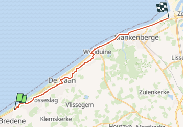
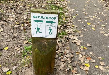
Trail Walking of 20 km to be discovered at Flanders, West Flanders, Bredene. This trail is proposed by Randonneur Club Marcquois.
Description
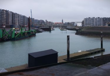
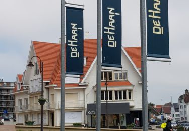
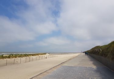
Bord de mer mais pas sur le sable ... de Bredene à Zeebrugge et retour aux véhicules par le tram côtier.
Positioning
Country:
Belgium
Region :
Flanders
Department/Province :
West Flanders
Municipality :
Bredene
Location:
Unknown
Start:(Dec)
Start:(UTM)
497813 ; 5677663 (31U) N.
Comments
Trails nearby
![Trail Walking Ostend - sgr kust (gr régional côte) day 3/4 - Photo](https://media.geolcdn.com/t/375/260/a9fa8825-a870-45dd-9963-e9584afaff4b.jpg&format=jpg&maxdim=2)
![Walking Walking](https://static1.geolcdn.com/sitytour/trail-icons/101.png)
sgr kust (gr régional côte) day 3/4
Walking
Very difficult
Ostend,
Flanders,
West Flanders,
Belgium
![](/images/other/stat-length.png)
24 km | 26 km-effort
6h 3min
![](https://static1.geolcdn.com/siteimages/upload/files/16400158638029165_repeat_loop_refresh_sync_direction_icon.png)
No
![Trail Walking De Haan - De Haan - Wenduine - Photo](https://media.geolcdn.com/t/375/260/5661005f-8914-4f0c-9e82-965d715449d9.jpg&format=jpg&maxdim=2)
![Walking Walking](https://static1.geolcdn.com/sitytour/trail-icons/101.png)
De Haan - Wenduine
Walking
Easy
(1)
De Haan,
Flanders,
West Flanders,
Belgium
![](/images/other/stat-length.png)
8.3 km | 9.1 km-effort
1h 29min
![](https://static1.geolcdn.com/siteimages/upload/files/16400158638029165_repeat_loop_refresh_sync_direction_icon.png)
No
![Trail Walking Ostend - Ostende - Bredene - Photo](https://media.geolcdn.com/t/375/260/a4e72293-e1df-4125-8578-ff77ccdb4b9d.jpg&format=jpg&maxdim=2)
![Walking Walking](https://static1.geolcdn.com/sitytour/trail-icons/101.png)
Ostende - Bredene
Walking
Easy
Ostend,
Flanders,
West Flanders,
Belgium
![](/images/other/stat-length.png)
9.4 km | 10.3 km-effort
1h 41min
![](https://static1.geolcdn.com/siteimages/upload/files/16400158638029165_repeat_loop_refresh_sync_direction_icon.png)
No
![Trail Walking De Haan - De Haan vers Wenduine et retour - Photo](https://media.geolcdn.com/t/375/260/28a6eced-b8cc-438d-8222-1c8840ced806.jpg&format=jpg&maxdim=2)
![Walking Walking](https://static1.geolcdn.com/sitytour/trail-icons/101.png)
De Haan vers Wenduine et retour
Walking
Medium
De Haan,
Flanders,
West Flanders,
Belgium
![](/images/other/stat-length.png)
11 km | 11.9 km-effort
2h 25min
![](https://static1.geolcdn.com/siteimages/upload/files/16400158638029165_repeat_loop_refresh_sync_direction_icon.png)
No
![Trail On foot Bredene - Erfgoedwandelroute Bredene - Photo](https://media.geolcdn.com/t/375/260/5c0af986-d225-41c1-8640-fd065a19c709.jpeg&format=jpg&maxdim=2)
![On foot On foot](https://static1.geolcdn.com/sitytour/trail-icons/100.png)
Erfgoedwandelroute Bredene
On foot
Easy
Bredene,
Flanders,
West Flanders,
Belgium
![](/images/other/stat-length.png)
4.4 km | 4.7 km-effort
1h 3min
![](https://static1.geolcdn.com/siteimages/upload/files/16400158638029165_repeat_loop_refresh_sync_direction_icon.png)
No
![Trail On foot Ostend - Erfgoedwandelroute Oostende - Photo](https://media.geolcdn.com/t/375/260/047b4ab6-977b-43f8-8094-d85cf0d16c1b.jpeg&format=jpg&maxdim=2)
![On foot On foot](https://static1.geolcdn.com/sitytour/trail-icons/100.png)
Erfgoedwandelroute Oostende
On foot
Easy
Ostend,
Flanders,
West Flanders,
Belgium
![](/images/other/stat-length.png)
4.5 km | 5 km-effort
1h 7min
![](https://static1.geolcdn.com/siteimages/upload/files/16400158638029165_repeat_loop_refresh_sync_direction_icon.png)
Yes
![Trail On foot De Haan - Duinbossen wandelpad - Photo](https://media.geolcdn.com/t/375/260/0867cbc5-cff5-4ddd-ad0c-5884990f3162.jpeg&format=jpg&maxdim=2)
![On foot On foot](https://static1.geolcdn.com/sitytour/trail-icons/100.png)
Duinbossen wandelpad
On foot
Easy
(1)
De Haan,
Flanders,
West Flanders,
Belgium
![](/images/other/stat-length.png)
11.1 km | 12.1 km-effort
2h 44min
![](https://static1.geolcdn.com/siteimages/upload/files/16400158638029165_repeat_loop_refresh_sync_direction_icon.png)
Yes
![Trail Walking De Haan - Duinbossenwandelroute - Photo](https://media.geolcdn.com/t/375/260/ext.jpg?maxdim=2&url=https%3A%2F%2Fstatic1.geolcdn.com%2Fsiteimages%2Fupload%2Ffiles%2F1553511878bg_sport_marche.png)
![Walking Walking](https://static1.geolcdn.com/sitytour/trail-icons/101.png)
Duinbossenwandelroute
Walking
Very easy
(4)
De Haan,
Flanders,
West Flanders,
Belgium
![](/images/other/stat-length.png)
10.3 km | 11 km-effort
Unknown
![](https://static1.geolcdn.com/siteimages/upload/files/16400158638029165_repeat_loop_refresh_sync_direction_icon.png)
Yes
![Trail Walking Ostend - Ostende Blankenberge 24 km - Photo](https://media.geolcdn.com/t/375/260/c23f2984-82f8-4fe7-9527-13e6c3285f67.jpg&format=jpg&maxdim=2)
![Walking Walking](https://static1.geolcdn.com/sitytour/trail-icons/101.png)
Ostende Blankenberge 24 km
Walking
Very difficult
Ostend,
Flanders,
West Flanders,
Belgium
![](/images/other/stat-length.png)
25 km | 27 km-effort
6h 10min
![](https://static1.geolcdn.com/siteimages/upload/files/16400158638029165_repeat_loop_refresh_sync_direction_icon.png)
No