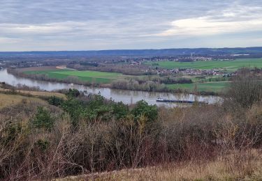
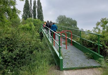
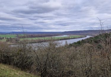
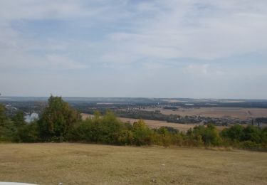
Trail Walking Muids - De la Seine au belvédère de Notre-Dame de Bellegarde - Photo

De la Seine au belvédère de Notre-Dame de Bellegarde

partout a pied et en moto

© OpenStreetMap contributors
Length
Length
15.2 km
Max alt
Max alt
143 m
Uphill gradient
Uphill gradient
256 m
Km-Effort
Km-Effort  
18.6 km
Min alt
Min alt
6 m
Downhill gradient
Downhill gradient
256 m
Boucle
Boucle
Yes
Creation date :
2023-06-20 11:18:46.221
Updated on :
2023-06-20 11:25:43.739

(0 Reviews)

Walking
Walking
4h13
Difficulty : Difficult

Scan this QR Code to open this trail in the SityTrail application

FREE GPS app for hiking

Logo SityTrail SityTrail

IGN / Geographical institutes

Download SityTrail from the App Store Download SityTrail from Google Play

Logo SityTrail SityTrail World

The world is yours!

Download SityTrail from the App Store Download SityTrail from Google Play Download SityTrail on Huawei AppGallery

About

Trail Walking of 15.2 km to be discovered at Normandy, Eure, Muids. This trail is proposed by les randos d'Olivier.

Elevation profile

Points of interest

Point of interest Muids - Église Rue Nationale - Photo
olivieraron
Point of interest Muids - Bifurcation Rue Du Moulin - Photo
olivieraron
Point of interest Muids - À droite, chemin - Photo
olivieraron
Point of interest La Roquette - Sentier du Panorama - Photo
olivieraron
LA ROQUETTE 
Point of interest La Roquette - Hameau La Roquette - Photo
olivieraron
LA ROQUETTE 
Point of interest Daubeuf-près-Vatteville - Droite - Gauche - Photo
olivieraron
DAUBEUF-PRÈS-VATTEVILLE 
Point of interest Daubeuf-près-Vatteville - À gauche, chemin - Photo
olivieraron
DAUBEUF-PRÈS-VATTEVILLE 
Point of interest Daubeuf-près-Vatteville - Carrefour Bois Gautier - Photo
olivieraron
DAUBEUF-PRÈS-VATTEVILLE 
Point of interest Daubeuf-près-Vatteville - Château des Buspins - Photo
olivieraron
DAUBEUF-PRÈS-VATTEVILLE 
Point of interest Muids - A gauche Rue Daubeuf - Photo
olivieraron
Point of interest Muids - A gauche Rue Paul Dupont - Photo
olivieraron
Point of interest Muids - Église Rue Nationale - Photo
olivieraron

Positioning

Country:
France
Region :
Normandy
Department/Province :
Eure
Municipality :
Muids
Location:
Unknown
Start:(Dec)
Start:(UTM)
375411 ; 5453433 (31U) N.

Trails nearby

Trail Walking Herqueville - Daniel - Photo
Walking
massot

Walking

Very easy
(2)
Herqueville, Normandy, Eure, France
9.8 km | 11.2 km-effort
2h 40min
Yes
Trail Walking Saint-Pierre-du-Vauvray - Saint-Pierre-du-Vauvray - Les côtes de Vauvray - Photo
Walking
marcel.F

Walking

Medium
(1)
Saint-Pierre-du-Vauvray, Normandy, Eure, France
10.7 km | 13.8 km-effort
2h 57min
Yes
Trail Walking Saint-Pierre-du-Vauvray - 20240215-St Pierre du Vauvray - Photo
Walking
doudet

Walking

Medium
Saint-Pierre-du-Vauvray, Normandy, Eure, France
12.8 km | 15.6 km-effort
3h 2min
Yes
Trail Walking Les Trois Lacs - rando venables - Photo
Walking
Dominique Petit

Walking

Medium
Les Trois Lacs, Normandy, Eure, France
10.9 km | 13.1 km-effort
3h 2min
Yes
Trail Walking Heudebouville - 20230202-Heudebouville - Photo
Walking
doudet

Walking

Medium
Heudebouville, Normandy, Eure, France
12.1 km | 15.1 km-effort
3h 55min
Yes
Trail Walking Saint-Pierre-du-Vauvray - 20220901-St Pierre du Vauvray - Photo
Walking
doudet

Walking

Medium
Saint-Pierre-du-Vauvray, Normandy, Eure, France
21 km | 25 km-effort
5h 27min
Yes
Trail Walking Saint-Pierre-du-Vauvray - 20191128-St Pierre du Vauvray - Photo
Walking
doudet

Walking

Easy
Saint-Pierre-du-Vauvray, Normandy, Eure, France
13.4 km | 14.8 km-effort
3h 14min
Yes
Trail Walking Saint-Pierre-du-Vauvray - 20150423 vironvay - Photo
Walking
doudet

Walking

Medium
Saint-Pierre-du-Vauvray, Normandy, Eure, France
13.8 km | 16.7 km-effort
3h 40min
Yes
Trail Walking Villers-sur-le-Roule - Villers-Venables_13Km - Photo
Walking
douneto

Walking

Medium
Villers-sur-le-Roule, Normandy, Eure, France
11.9 km | 14.9 km-effort
3h 10min
Yes


Close
My subscriptions