Trail Car Beaconsfield - Baie d'Urfe - Photo
 aljac
aljac

User

© OpenStreetMap contributors
Length
Length
11.8 km
Max alt
Max alt
42 m
Uphill gradient
Uphill gradient
77 m
Km-Effort
Km-Effort  
12.9 km
Min alt
Min alt
20 m
Downhill gradient
Downhill gradient
81 m
Boucle
Boucle
No
Creation date :
2023-06-19 14:49:00.697
Updated on :
2023-06-19 15:16:19.489

(0 Reviews)

Car
Car
27m
Difficulty : Very easy

Scan this QR Code to open this trail in the SityTrail application

FREE GPS app for hiking

Logo SityTrail SityTrail

IGN / Geographical institutes

Download SityTrail from the App Store Download SityTrail from Google Play

Logo SityTrail SityTrail World

The world is yours!

Download SityTrail from the App Store Download SityTrail from Google Play Download SityTrail on Huawei AppGallery

About

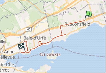
Trail Car of 11.8 km to be discovered at Quebec, Urban agglomeration of Montreal, Beaconsfield. This trail is proposed by aljac.

Elevation profile

Positioning

Country:
Canada
Region :
Quebec
Department/Province :
Urban agglomeration of Montreal
Municipality :
Beaconsfield
Location:
Unknown
Start:(UTM)
589432 ; 5031558 (18T) N.

Trails nearby

Trail Walking Montreal - Wikiloc - Montreal - Parc Nature du Cap Saint-Jacques -Sentier du Lapin - Rando-Québec - Photo
Walking
GUIDE
Alizée.pee

Walking

Medium
Montreal, Quebec, Urban agglomeration of Montreal, Canada
5.9 km | 6.6 km-effort
1h 27min
Yes
Trail Other activity Pointe-Claire - Petit parcours Pointe Claire - Photo
Other activity
aljac

Other activity

Very easy
Pointe-Claire, Quebec, Urban agglomeration of Montreal, Canada
5 km | 5.5 km-effort
36min
Yes


Close
My subscriptions