![](/images/other/stat-length.png)
![Trail Walking Chavanod - CHAVANOD ... les Gorges du Fier. - Photo](https://media.geolcdn.com/t/1900/400/ext.pjpeg?maxdim=2&url=https%3A%2F%2Fmedia.geolcdn.com%2Ff%2Fb76880dc-3a6b-4b5d-9dee-7a400ed01ca2.jpg)
CHAVANOD ... les Gorges du Fier.
GerardBouche
User
![Length](/images/other/stat-length.png)
Length
8 km
![Max alt](https://static1.geolcdn.com/siteimages/upload/files/1508320355ic_sort_altitude_max_24dp.png)
Max alt
506 m
![Uphill gradient](https://static1.geolcdn.com/siteimages/upload/files/1508320355ic_sort_den_pos_24dp.png)
Uphill gradient
210 m
![Km-Effort](/images/other/stat-length.png)
Km-Effort
10.8 km
![Min alt](https://static1.geolcdn.com/siteimages/upload/files/1508320355ic_sort_altitude_min_24dp.png)
Min alt
372 m
![Downhill gradient](https://static1.geolcdn.com/siteimages/upload/files/1508320355ic_sort_den_neg_24dp.png)
Downhill gradient
211 m
![Boucle](https://static1.geolcdn.com/siteimages/upload/files/16400158638029165_repeat_loop_refresh_sync_direction_icon.png)
Boucle
Yes
Creation date :
2023-06-12 08:34:10.015
Updated on :
2023-06-25 16:24:00.1
![Walking](https://static1.geolcdn.com/sitytour/trail-icons/101.png)
2h20
Difficulty : Medium
![Scan this QR Code to open this trail in the SityTrail application](https://capi.geolives.com/qq0zvz2zws4bq2lad0pu/sitytour/trails/3696538/qr.png?size=200)
FREE GPS app for hiking
About
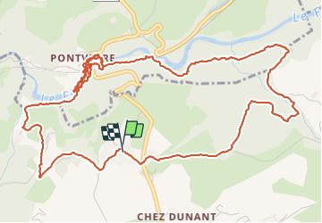
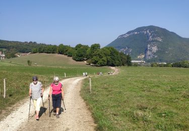
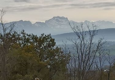
Trail Walking of 8 km to be discovered at Auvergne-Rhône-Alpes, Upper Savoy, Chavanod. This trail is proposed by GerardBouche.
Description
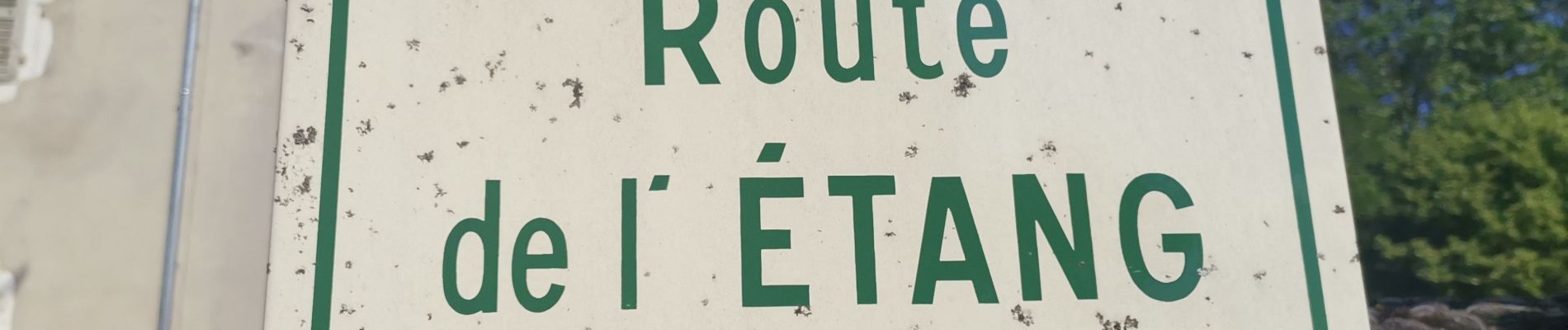
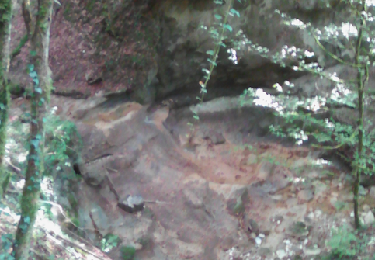
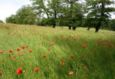
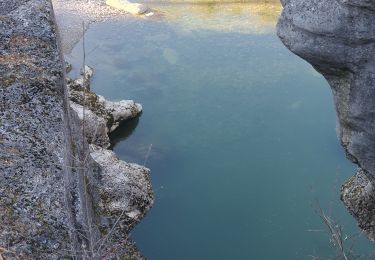
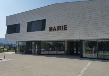
Depuis la mairie de l'Etang, un agréable parcours vers les Gorges du Fier ... une curiosité naturelle remarquable fait de gorge étroite et profonde à visiter par une passerelle à flanc de rocher.
Positioning
Country:
France
Region :
Auvergne-Rhône-Alpes
Department/Province :
Upper Savoy
Municipality :
Chavanod
Location:
Unknown
Start:(Dec)
Start:(UTM)
270338 ; 5086088 (32T) N.
Comments
Trails nearby
![Trail Walking Chavanod - CHAVANOD - Photo](https://media.geolcdn.com/t/375/260/ext.jpg?maxdim=2&url=https%3A%2F%2Fservices.sitytrail.com%2FGeolivesWS%2FDownloadMedia.ashx%3FTrailID%3D642834%26Media%3Dcf99f68d-cd6d-4093-a6f9-aa7a1c09564a.png)
![Walking Walking](https://static1.geolcdn.com/sitytour/trail-icons/101.png)
CHAVANOD
Walking
Easy
(1)
Chavanod,
Auvergne-Rhône-Alpes,
Upper Savoy,
France
![](/images/other/stat-length.png)
8.9 km | 12.8 km-effort
2h 34min
![](https://static1.geolcdn.com/siteimages/upload/files/16400158638029165_repeat_loop_refresh_sync_direction_icon.png)
Yes
![Trail Mountain bike Marcellaz-Albanais - Site VTT FFC de l'Albanais - Circuit N°4 Bois aux Loups - Marcellaz-Albanais - Photo](https://media.geolcdn.com/t/375/260/ext.jpg?maxdim=2&url=https%3A%2F%2Fservices.sitytrail.com%2FGeolivesWS%2FDownloadMedia.ashx%3FTrailID%3D191600%26Media%3D15236_1.jpg)
![Mountain bike Mountain bike](https://static1.geolcdn.com/sitytour/trail-icons/202.png)
Site VTT FFC de l'Albanais - Circuit N°4 Bois aux Loups - Marcellaz-Albanais
Mountain bike
Medium
(2)
Marcellaz-Albanais,
Auvergne-Rhône-Alpes,
Upper Savoy,
France
![](/images/other/stat-length.png)
13.4 km | 17.6 km-effort
1h 30min
![](https://static1.geolcdn.com/siteimages/upload/files/16400158638029165_repeat_loop_refresh_sync_direction_icon.png)
Yes
![Trail Walking Lovagny - 28/02/2022 - Gorges du Fier - Nonglard - Lovagny - Chavanod - Photo](https://media.geolcdn.com/t/375/260/ext.jpg?maxdim=2&url=https%3A%2F%2Fmedia.geolcdn.com%2Ff%2F03500606-e21f-4d38-a3f6-549dc5117f26.jpg)
![Walking Walking](https://static1.geolcdn.com/sitytour/trail-icons/101.png)
28/02/2022 - Gorges du Fier - Nonglard - Lovagny - Chavanod
Walking
Medium
Lovagny,
Auvergne-Rhône-Alpes,
Upper Savoy,
France
![](/images/other/stat-length.png)
20 km | 28 km-effort
5h 11min
![](https://static1.geolcdn.com/siteimages/upload/files/16400158638029165_repeat_loop_refresh_sync_direction_icon.png)
Yes
![Trail Cycle Annecy - semnoz par quintal - Photo](https://media.geolcdn.com/t/375/260/ext.jpg?maxdim=2&url=https%3A%2F%2Fstatic1.geolcdn.com%2Fsiteimages%2Fupload%2Ffiles%2F1524743154velo.jpg)
![Cycle Cycle](https://static1.geolcdn.com/sitytour/trail-icons/200.png)
semnoz par quintal
Cycle
Medium
(1)
Annecy,
Auvergne-Rhône-Alpes,
Upper Savoy,
France
![](/images/other/stat-length.png)
32 km | 52 km-effort
11min
![](https://static1.geolcdn.com/siteimages/upload/files/16400158638029165_repeat_loop_refresh_sync_direction_icon.png)
No
![Trail Walking Chavanod - CHAVANOD ... vers Montagny-les-Lanches. - Photo](https://media.geolcdn.com/t/375/260/ext.jpg?maxdim=2&url=https%3A%2F%2Fmedia.geolcdn.com%2Ff%2F9cf02be8-0d43-4c97-a143-e34f6de46c37.jpg)
![Walking Walking](https://static1.geolcdn.com/sitytour/trail-icons/101.png)
CHAVANOD ... vers Montagny-les-Lanches.
Walking
Easy
Chavanod,
Auvergne-Rhône-Alpes,
Upper Savoy,
France
![](/images/other/stat-length.png)
8.4 km | 10.7 km-effort
2h 5min
![](https://static1.geolcdn.com/siteimages/upload/files/16400158638029165_repeat_loop_refresh_sync_direction_icon.png)
Yes
![Trail sport Lovagny - 20230411 RANDONNÉE LOVAGNY - Photo](https://media.geolcdn.com/t/375/260/ext.jpg?maxdim=2&url=https%3A%2F%2Fmedia.geolcdn.com%2Ff%2Fdb936043-ccfb-4d87-a656-a3bf3f515ba1.jpg)
20230411 RANDONNÉE LOVAGNY
sport
Very easy
Lovagny,
Auvergne-Rhône-Alpes,
Upper Savoy,
France
![](/images/other/stat-length.png)
5 km | 7.5 km-effort
Unknown
![](https://static1.geolcdn.com/siteimages/upload/files/16400158638029165_repeat_loop_refresh_sync_direction_icon.png)
Yes
![Trail Walking Poisy - Marais de poisy, chemin de Poësy et vergers de Macully - Photo](https://media.geolcdn.com/t/375/260/ext.jpg?maxdim=2&url=https%3A%2F%2Fmedia.geolcdn.com%2Ff%2Fa99db235-e5a5-4581-aa0a-754977e54cbf.jpg)
![Walking Walking](https://static1.geolcdn.com/sitytour/trail-icons/101.png)
Marais de poisy, chemin de Poësy et vergers de Macully
Walking
Very easy
Poisy,
Auvergne-Rhône-Alpes,
Upper Savoy,
France
![](/images/other/stat-length.png)
5.5 km | 7 km-effort
1h 25min
![](https://static1.geolcdn.com/siteimages/upload/files/16400158638029165_repeat_loop_refresh_sync_direction_icon.png)
Yes
![Trail Walking Nonglard - Nonglard - Photo](https://media.geolcdn.com/t/375/260/ext.jpg?maxdim=2&url=https%3A%2F%2Fmedia.geolcdn.com%2Ff%2F1114e87f-940a-474b-8007-57d0b40aba43.jpg)
![Walking Walking](https://static1.geolcdn.com/sitytour/trail-icons/101.png)
Nonglard
Walking
Very easy
Nonglard,
Auvergne-Rhône-Alpes,
Upper Savoy,
France
![](/images/other/stat-length.png)
7.3 km | 10.8 km-effort
2h 37min
![](https://static1.geolcdn.com/siteimages/upload/files/16400158638029165_repeat_loop_refresh_sync_direction_icon.png)
No
![Trail Walking Vaulx - VAULX - Photo](https://media.geolcdn.com/t/375/260/ext.jpg?maxdim=2&url=https%3A%2F%2Fservices.sitytrail.com%2FGeolivesWS%2FDownloadMedia.ashx%3FTrailID%3D644952%26Media%3Dbcbae396-3b96-4dce-ac7c-01ea10635118.jpg)
![Walking Walking](https://static1.geolcdn.com/sitytour/trail-icons/101.png)
VAULX
Walking
Easy
Vaulx,
Auvergne-Rhône-Alpes,
Upper Savoy,
France
![](/images/other/stat-length.png)
8.8 km | 12.5 km-effort
2h 12min
![](https://static1.geolcdn.com/siteimages/upload/files/16400158638029165_repeat_loop_refresh_sync_direction_icon.png)
Yes