Trail Mountain bike Belfort - Belfort vers Ballon d'alsace par Col de la Rougevie. Arrêt ferme auberge Wissgrut - Photo

Belfort vers Ballon d'alsace par Col de la Rougevie. Arrêt ferme auberge Wissgrut

 Bart2015
Bart2015

User

© OpenStreetMap contributors
Length
Length
63 km
Max alt
Max alt
1172 m
Uphill gradient
Uphill gradient
1388 m
Km-Effort
Km-Effort  
82 km
Min alt
Min alt
360 m
Downhill gradient
Downhill gradient
1388 m
Boucle
Boucle
Yes
Creation date :
2023-06-11 07:03:55.674
Updated on :
2023-06-19 11:16:48.527

(0 Reviews)

Mountain bike
Mountain bike
5h39
Difficulty : Very difficult

Scan this QR Code to open this trail in the SityTrail application

FREE GPS app for hiking

Logo SityTrail SityTrail

IGN / Geographical institutes

Download SityTrail from the App Store Download SityTrail from Google Play

Logo SityTrail SityTrail World

The world is yours!

Download SityTrail from the App Store Download SityTrail from Google Play Download SityTrail on Huawei AppGallery

About

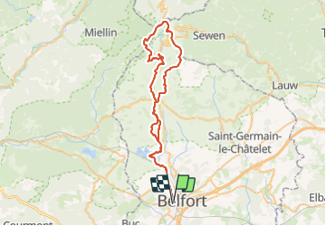
Trail Mountain bike of 63 km to be discovered at Bourgogne-Franche-Comté, Territoire-de-Belfort, Belfort. This trail is proposed by Bart2015.

Description

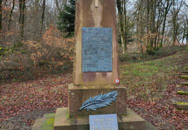
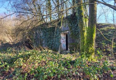
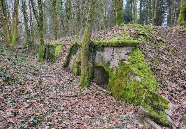
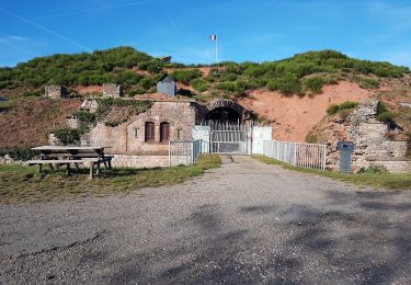
Rando VTT électrique depuis Belfort. Elle pourrait démarrer à Giromagny. Passage par le Plain des Joncs, le Col de la Rougevie avant d'atteindre le Ballon d'Alsace. Poursuite par la Gentiane et montée au Wissgrut pour une pause à la ferme auberge (ne pas oublier de réserver ...). Retour Giromagny par le Col du Chantoiseau et le château Ritter.
Bonne rando ...

Elevation profile

Positioning

Country:
France
Region :
Bourgogne-Franche-Comté
Department/Province :
Territoire-de-Belfort
Municipality :
Belfort
Location:
Unknown
Start:(UTM)
338472 ; 5277957 (32T) N.

Trails nearby

Trail Mountain bike Andelnans - Tour d'Essert - Photo
Mountain bike
qlqin

Mountain bike

Easy
(2)
Andelnans, Bourgogne-Franche-Comté, Territoire-de-Belfort, France
29 km | 36 km-effort
2h 12min
Yes
Trail Walking Belfort - Offemont - La ballade des Champs Cerisiers - Photo
Walking
bmorel@orange.fr

Walking

Easy
(1)
Belfort, Bourgogne-Franche-Comté, Territoire-de-Belfort, France
8.8 km | 10.8 km-effort
Unknown
Yes
Trail Electric bike Châlonvillars - VTT - Châlonvillars - Etobon - Ronchamp - Plancher-Bas - Malsaucy - Photo
Electric bike
Bart2015

Electric bike

Difficult
Châlonvillars, Bourgogne-Franche-Comté, Haute-Saône, France
71 km | 90 km-effort
5h 50min
Yes
Trail Walking Banvillars - Banvillars - forts du Hauts Bois et du Bois d'Oye - Photo
Walking
Bart2015

Walking

Very difficult
Banvillars, Bourgogne-Franche-Comté, Territoire-de-Belfort, France
16.3 km | 21 km-effort
4h 40min
Yes
Trail Walking Sevenans - Randonnée des forts depuis Sévenans - Photo
Walking
Bart2015

Walking

Very difficult
Sevenans, Bourgogne-Franche-Comté, Territoire-de-Belfort, France
19.9 km | 24 km-effort
5h 26min
Yes
Trail Walking Châlonvillars - Châlonvillars - Fort du Salbert - Evette-Salbert - Photo
Walking
Bart2015

Walking

Difficult
(1)
Châlonvillars, Bourgogne-Franche-Comté, Haute-Saône, France
11 km | 15.8 km-effort
3h 36min
Yes
Trail Mountain bike Châlonvillars - Châlonvillars - Fort Giromagny en passant au milieu des étangs - Photo
Mountain bike
Bart2015

Mountain bike

Very difficult
Châlonvillars, Bourgogne-Franche-Comté, Haute-Saône, France
40 km | 51 km-effort
3h 31min
Yes
Trail Mountain bike Châlonvillars - Châlonvillars - Menhir - Mandrevillars - Fort Essert et du Salbert - Photo
Mountain bike
Bart2015

Mountain bike

Very difficult
Châlonvillars, Bourgogne-Franche-Comté, Haute-Saône, France
31 km | 42 km-effort
2h 53min
Yes
Trail Walking Châlonvillars - Châlonvillars - le mehnir - Mandrevillars - Photo
Walking
Bart2015

Walking

Medium
Châlonvillars, Bourgogne-Franche-Comté, Haute-Saône, France
13.4 km | 17.1 km-effort
2h 39min
Yes


Close
My subscriptions