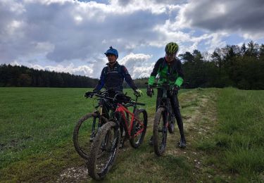

2023-06-06_23h11m14_SityTrail - 119178 - moyenxvalloisxgerbeviller

MarieH54
User

Length
17.1 km

Max alt
324 m

Uphill gradient
289 m

Km-Effort
21 km

Min alt
230 m

Downhill gradient
290 m
Boucle
Yes
Creation date :
2023-06-06 21:11:14.539
Updated on :
2024-10-01 09:12:51.215
4h46
Difficulty : Very difficult

FREE GPS app for hiking
About
Trail Walking of 17.1 km to be discovered at Grand Est, Meurthe-et-Moselle, Moyen. This trail is proposed by MarieH54.
Description
Château de "Qui-Qu'en-Grogne". Ruines de Lana (villa gallo-romaine). Cimetières militaires Allemand et Français côte à côte.
Visite du château sur demande.
Positioning
Country:
France
Region :
Grand Est
Department/Province :
Meurthe-et-Moselle
Municipality :
Moyen
Location:
Unknown
Start:(Dec)
Start:(UTM)
320483 ; 5372770 (32U) N.
Comments
Trails nearby

sortie VTT du 05052019 vathi gerbeviller


Mountain bike
Medium
Vathiménil,
Grand Est,
Meurthe-et-Moselle,
France

32 km | 37 km-effort
2h 27min
No

VTT 29/09/19 Baccarat Badmenil Azerailles / test VTTAE Joel


Mountain bike
Easy
Vathiménil,
Grand Est,
Meurthe-et-Moselle,
France

38 km | 42 km-effort
3h 22min
Yes

vtt Gerbeviller 04-02-18


Mountain bike
Very easy
Vathiménil,
Grand Est,
Meurthe-et-Moselle,
France

26 km | 31 km-effort
2h 20min
Yes

vtt Vathi Fraimbois 25-03-17


Mountain bike
Medium
Vathiménil,
Grand Est,
Meurthe-et-Moselle,
France

16.2 km | 18.9 km-effort
2h 25min
Yes

vtt Vathi Fraimbois 25-03-17


Mountain bike
Medium
Vathiménil,
Grand Est,
Meurthe-et-Moselle,
France

16.2 km | 18.9 km-effort
2h 25min
Yes

sortie vtt du 24072016


Mountain bike
Medium
Vathiménil,
Grand Est,
Meurthe-et-Moselle,
France

31 km | 37 km-effort
2h 25min
Yes

fraimbois


Walking
Easy
Fraimbois,
Grand Est,
Meurthe-et-Moselle,
France

3 km | 3.4 km-effort
1h 7min
Yes

zap sept 2024 moyen


Walking
Very difficult
Moyen,
Grand Est,
Meurthe-et-Moselle,
France

19.7 km | 24 km-effort
7h 25min
No

rando Jacques 2.7.2022


Horseback riding
Easy
Gerbéviller,
Grand Est,
Meurthe-et-Moselle,
France

14.4 km | 17.2 km-effort
2h 28min
No


 SityTrail


