Trail Walking Cour-Saint-Maurice - battenans - Photo
© OpenStreetMap contributors
Length
Length
17.1 km
Max alt
Max alt
787 m
Uphill gradient
Uphill gradient
618 m
Km-Effort
Km-Effort  
25 km
Min alt
Min alt
409 m
Downhill gradient
Downhill gradient
620 m
Boucle
Boucle
Yes
Creation date :
2023-06-05 08:17:22.319
Updated on :
2023-06-16 19:07:50.189

(0 Reviews)

Walking
Walking
6h35
Difficulty : Medium

Scan this QR Code to open this trail in the SityTrail application

FREE GPS app for hiking

Logo SityTrail SityTrail

IGN / Geographical institutes

Download SityTrail from the App Store Download SityTrail from Google Play

Logo SityTrail SityTrail World

The world is yours!

Download SityTrail from the App Store Download SityTrail from Google Play Download SityTrail on Huawei AppGallery

About

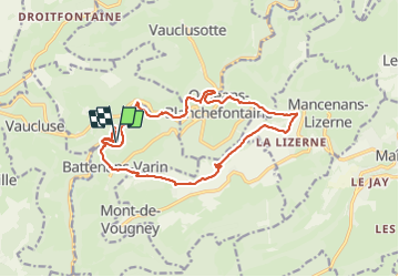
Trail Walking of 17.1 km to be discovered at Bourgogne-Franche-Comté, Doubs, Cour-Saint-Maurice. This trail is proposed by eltonnermou.

Description

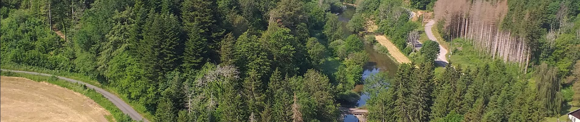
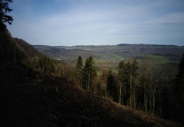
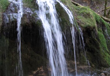
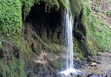
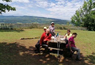
Très, très belle randonnée essentiellement en de magnifiques sous bois, avec des beaux points de vue sur la vallée du Dessoubre et du secteur des plateaux environnants ; des passages en montée un peu plus engageants (bâtons fortement conseillés). Le cheminement le long du Dessoubre en fin de parcours constitue une belle découverte.
Et comme dans de tels paysages, laissez vous surprendre par la faune et la flore.

Elevation profile

Photos

Positioning

Country:
France
Region :
Bourgogne-Franche-Comté
Department/Province :
Doubs
Municipality :
Cour-Saint-Maurice
Location:
Unknown
Start:(UTM)
326983 ; 5236015 (32T) N.

Trails nearby

Trail Walking Mancenans-Lizerne - Mancenans Lizerne, château hermitage - Photo
Walking
eltonnermou

Walking

Easy
Mancenans-Lizerne, Bourgogne-Franche-Comté, Doubs, France
13.3 km | 18.8 km-effort
3h 49min
Yes
Trail Walking Orgeans-Blanchefontaine - Orgeans Rocher du Boubet et Grottes de Waroly (IBP 89 ) 26 avril 2021 CAF - Photo
Walking
TRIMAILLE

Walking

Very difficult
Orgeans-Blanchefontaine, Bourgogne-Franche-Comté, Doubs, France
20 km | 30 km-effort
6h 40min
Yes
Trail Walking Vauclusotte - Rocher du Boubet et Grottes de Waroly - Photo
Walking
TRIMAILLE

Walking

Difficult
Vauclusotte, Bourgogne-Franche-Comté, Doubs, France
23 km | 33 km-effort
7h 29min
Yes
Trail Walking Vauclusotte - Dessoubre Pat Mimi - Photo
Walking
klopbill

Walking

Medium
(1)
Vauclusotte, Bourgogne-Franche-Comté, Doubs, France
16.5 km | 24 km-effort
7h 12min
Yes
Trail On foot Mancenans-Lizerne - Mancenans Lizerne - Photo
On foot
Danielfaivre

On foot

Medium
Mancenans-Lizerne, Bourgogne-Franche-Comté, Doubs, France
15.1 km | 21 km-effort
Unknown
Yes
Trail Walking Belleherbe - circuit Montaigu - Photo
Walking
pfaffjocelyne

Walking

Very easy
Belleherbe, Bourgogne-Franche-Comté, Doubs, France
11.9 km | 15.2 km-effort
2h 46min
Yes
Trail Walking Saint-Julien-lès-Russey - De vals en crêts à Bonnétage - Photo
Walking
tracegps

Walking

Medium
Saint-Julien-lès-Russey, Bourgogne-Franche-Comté, Doubs, France
10.8 km | 13.8 km-effort
3h 0min
Yes
Trail Walking Mancenans-Lizerne - 2020 06 12 Mancenans Lizerne  - Photo
Walking
BIDOCHONP

Walking

Very easy
Mancenans-Lizerne, Bourgogne-Franche-Comté, Doubs, France
12.9 km | 18.4 km-effort
6h 2min
Yes
Trail Walking Vaucluse - vaucluse - Photo
Walking
cherlieu

Walking

Very difficult
Vaucluse, Bourgogne-Franche-Comté, Doubs, France
20 km | 29 km-effort
6h 10min
Yes


Close
My subscriptions