Trail Walking Canville-la-Rocque - Canville la rocque - Photo
© OpenStreetMap contributors
Length
Length
9.1 km
Max alt
Max alt
40 m
Uphill gradient
Uphill gradient
84 m
Km-Effort
Km-Effort  
10.2 km
Min alt
Min alt
4 m
Downhill gradient
Downhill gradient
84 m
Boucle
Boucle
Yes
Creation date :
2023-06-05 08:19:38.013
Updated on :
2023-09-20 14:01:54.74

(0 Reviews)

Walking
Walking
2h19
Difficulty : Medium

Scan this QR Code to open this trail in the SityTrail application

FREE GPS app for hiking

Logo SityTrail SityTrail

IGN / Geographical institutes

Download SityTrail from the App Store Download SityTrail from Google Play

Logo SityTrail SityTrail World

The world is yours!

Download SityTrail from the App Store Download SityTrail from Google Play Download SityTrail on Huawei AppGallery

About

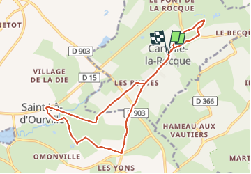
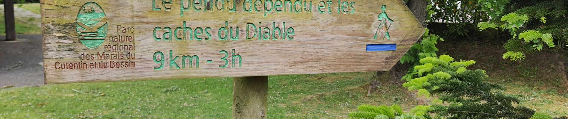
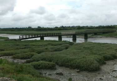
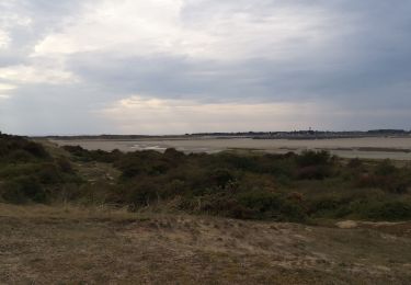
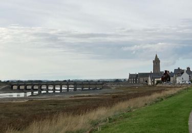
Trail Walking of 9.1 km to be discovered at Normandy, Manche, Canville-la-Rocque. This trail is proposed by Marie-Claire-mcp.

Description

Départ de l'église de Saint Malo en suivant la balisage bleu, très bien fait, mais parfois un peu caché. une superbe randonnée dans des chemins magiques.

Elevation profile

Photos

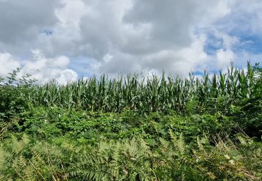
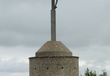
34 photos in total. Please click on a photo to see them all in the gallery.

Positioning

Country:
France
Region :
Normandy
Department/Province :
Manche
Municipality :
Canville-la-Rocque
Location:
Unknown
Start:(UTM)
599059 ; 5466591 (30U) N.

Trails nearby

Trail Walking Saint-Sauveur-le-Vicomte - St Sauveur Besneville boucle - Photo
Walking
GUIDE
chessyca

Walking

Easy
Saint-Sauveur-le-Vicomte, Normandy, Manche, France
13.2 km | 15.5 km-effort
3h 21min
Yes
Trail Walking Besneville - Besneville  - Photo
Walking
PatRando

Walking

Medium
Besneville, Normandy, Manche, France
11.7 km | 13.7 km-effort
2h 25min
No
Trail On foot Port-Bail-sur-Mer - Portbail - Photo
On foot
Privatb

On foot

Easy
(1)
Port-Bail-sur-Mer, Normandy, Manche, France
17.4 km | 18.9 km-effort
4h 17min
Yes
Trail Walking Port-Bail-sur-Mer - 20240616-Les Dunes de Lindberg  - Photo
Walking
doudet

Walking

Medium
Port-Bail-sur-Mer, Normandy, Manche, France
9.8 km | 10.6 km-effort
3h 5min
Yes
Trail On foot Port-Bail-sur-Mer - SityTrail - rando portbail - Photo
On foot
rvs147

On foot

Very easy
Port-Bail-sur-Mer, Normandy, Manche, France
11.7 km | 12.6 km-effort
Unknown
Yes
Trail Walking Port-Bail-sur-Mer - Portbail  - Photo
Walking
phil118

Walking

Easy
Port-Bail-sur-Mer, Normandy, Manche, France
2.9 km | 3.1 km-effort
1h 9min
Yes
Trail Mountain bike Port-Bail-sur-Mer - Accro Rando Portbaillaise 2012 - 55 km - Portbail - Photo
Mountain bike
tracegps

Mountain bike

Difficult
Port-Bail-sur-Mer, Normandy, Manche, France
54 km | 62 km-effort
3h 0min
Yes
Trail Walking Port-Bail-sur-Mer - Havre de portbail plage de Lindbergh boucle - Photo
Walking
GUIDE
chessyca

Walking

Medium
Port-Bail-sur-Mer, Normandy, Manche, France
10.7 km | 11.6 km-effort
2h 38min
Yes
Trail Walking Port-Bail-sur-Mer - 30/1222 Denneville  - Photo
Walking
joelinou

Walking

Difficult
Port-Bail-sur-Mer, Normandy, Manche, France
11.8 km | 12.4 km-effort
2h 40min
Yes


Close
My subscriptions