Trail On foot Saint-Cyr-au-Mont-d'Or - SAINT-CYR-AU-MONT-D'OR - Circuit des cabornes - Photo

SAINT-CYR-AU-MONT-D'OR - Circuit des cabornes

© OpenStreetMap contributors
Length
Length
6.5 km
Max alt
Max alt
590 m
Uphill gradient
Uphill gradient
299 m
Km-Effort
Km-Effort  
10.5 km
Min alt
Min alt
342 m
Downhill gradient
Downhill gradient
299 m
Boucle
Boucle
Yes
Creation date :
2023-05-30 07:01:55.72
Updated on :
2023-05-30 07:04:56.057

(0 Reviews)

On foot
On foot
2h22
Difficulty : Easy

Scan this QR Code to open this trail in the SityTrail application

FREE GPS app for hiking

Logo SityTrail SityTrail

IGN / Geographical institutes

Download SityTrail from the App Store Download SityTrail from Google Play

Logo SityTrail SityTrail World

The world is yours!

Download SityTrail from the App Store Download SityTrail from Google Play Download SityTrail on Huawei AppGallery

About

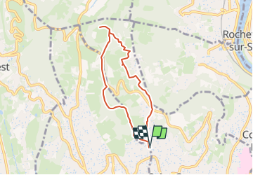
Trail On foot of 6.5 km to be discovered at Auvergne-Rhône-Alpes, Métropole de Lyon, Saint-Cyr-au-Mont-d'Or. This trail is proposed by AndreLACOMBE.

Description

Départ de St-Cyr, parking rue des Gasses vers le lavoir du même nom.

Elevation profile

Positioning

Country:
France
Region :
Auvergne-Rhône-Alpes
Department/Province :
Métropole de Lyon
Municipality :
Saint-Cyr-au-Mont-d'Or
Location:
Unknown
Start:(UTM)
640654 ; 5075841 (31T) N.

Trails nearby

Trail Walking Couzon-au-Mont-d'Or - Tour de Couzon par les crêtes - Photo
Walking
boivin101

Walking

Difficult
(2)
Couzon-au-Mont-d'Or, Auvergne-Rhône-Alpes, Métropole de Lyon, France
6.5 km | 10.7 km-effort
2h 5min
Yes
Trail Running Limonest - Monts d'Or - Limonest - Photo
Running
tracegps

Running

Medium
(2)
Limonest, Auvergne-Rhône-Alpes, Métropole de Lyon, France
21 km | 32 km-effort
2h 0min
Yes
Trail Mountain bike Collonges-au-Mont-d'Or - Tour du Mont Cindre et Mont Thoux - Photo
Mountain bike
tracegps

Mountain bike

Difficult
(3)
Collonges-au-Mont-d'Or, Auvergne-Rhône-Alpes, Métropole de Lyon, France
25 km | 33 km-effort
1h 40min
Yes
Trail Horseback riding Chasselay - chasselay florian alain  - Photo
Horseback riding
lau74

Horseback riding

Easy
(1)
Chasselay, Auvergne-Rhône-Alpes, Rhône, France
13.3 km | 17.3 km-effort
2h 16min
Yes
Trail Walking Lyon - Croix-Rousse / la Tête d'Or  - Photo
Walking
GUIDE
VANDERPUTTENMi

Walking

Very easy
Lyon, Auvergne-Rhône-Alpes, Métropole de Lyon, France
8.8 km | 10.2 km-effort
2h 23min
No
Trail Walking Caluire-et-Cuire - A_CALUIRE 69300 St-Clair - Crépieux - Photo
Walking
ANDREJAC

Walking

Easy
(1)
Caluire-et-Cuire, Auvergne-Rhône-Alpes, Métropole de Lyon, France
10 km | 11.7 km-effort
3h 0min
Yes
Trail Walking Couzon-au-Mont-d'Or - A_COUZON AU MT D'OR 69270  Croix Vitaise - Mont Thoux - Photo
Walking
ANDREJAC

Walking

Medium
(2)
Couzon-au-Mont-d'Or, Auvergne-Rhône-Alpes, Métropole de Lyon, France
8.5 km | 13.6 km-effort
3h 0min
Yes
Trail Mountain bike Lyon - Monts d'Or_02 - Photo
Mountain bike
philmascio

Mountain bike

Medium
(2)
Lyon, Auvergne-Rhône-Alpes, Métropole de Lyon, France
32 km | 45 km-effort
2h 54min
Yes
Trail Mountain bike Dardilly - Mont Verdun 2 - Photo
Mountain bike
simon.paume

Mountain bike

Medium
(1)
Dardilly, Auvergne-Rhône-Alpes, Métropole de Lyon, France
17.9 km | 24 km-effort
1h 38min
Yes


Close
My subscriptions