![](/images/other/stat-length.png)
![Trail Walking Unknown - Baden Baden - châteaux Hohenbaden et Eberstein - coliine Merkurberg - Photo](https://media.geolcdn.com/t/1900/400/3c513f58-b022-4004-aebd-44ed7ae57178.jpg&format=pjpeg&maxdim=2)
Baden Baden - châteaux Hohenbaden et Eberstein - coliine Merkurberg
Bart2015
User
![Length](/images/other/stat-length.png)
![Max alt](https://static1.geolcdn.com/siteimages/upload/files/1508320355ic_sort_altitude_max_24dp.png)
![Uphill gradient](https://static1.geolcdn.com/siteimages/upload/files/1508320355ic_sort_den_pos_24dp.png)
![Km-Effort](/images/other/stat-length.png)
![Min alt](https://static1.geolcdn.com/siteimages/upload/files/1508320355ic_sort_altitude_min_24dp.png)
![Downhill gradient](https://static1.geolcdn.com/siteimages/upload/files/1508320355ic_sort_den_neg_24dp.png)
![Boucle](https://static1.geolcdn.com/siteimages/upload/files/16400158638029165_repeat_loop_refresh_sync_direction_icon.png)
![Walking](https://static1.geolcdn.com/sitytour/trail-icons/101.png)
6h59
Difficulty : Very difficult
![Scan this QR Code to open this trail in the SityTrail application](https://capi.geolives.com/qq0zvz2zws4bq2lad0pu/sitytour/trails/3678230/qr.png?size=200)
FREE GPS app for hiking
About
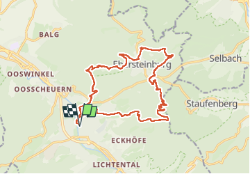
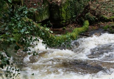
Trail Walking of 19.1 km to be discovered at Baden-Württemberg, Baden-Baden. This trail is proposed by Bart2015.
Description
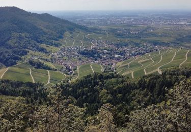
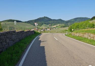
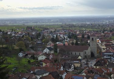
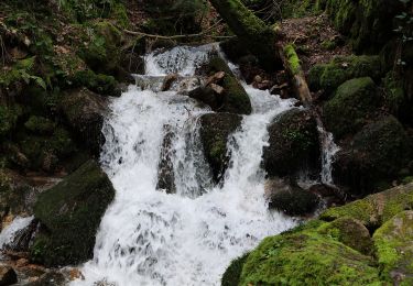
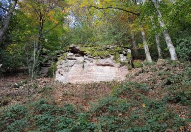
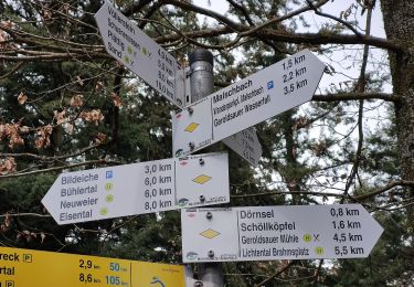
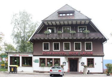
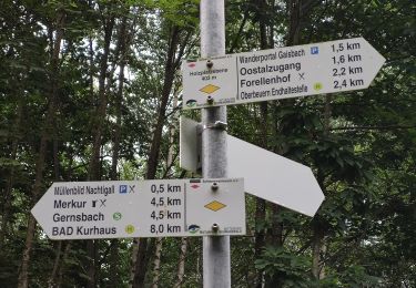
Randonnée physique pour découvrir la beauté des rues de Baden Baden, le château Hohenbaden et sa magnifique vue sur la ville. que l'on peut visiter, un peu plus loin l'impressionnant site d'escalade du Grafensprung, le château d'Eberstein non visitable (ce jour là ?), et la colline Merkurberg où il fera bon se désaltérer ... Au retour, une surprise en regagnat le centre de Baden Baden : de magnifiques fontaines ....
Bon randonnée, physique par endroit mais de toute beauté ...
Positioning
Comments
Trails nearby
![Trail On foot - Yburg Rundweg - Photo](https://media.geolcdn.com/t/375/260/9465470a-9321-4702-8d92-bf53a6692fd2.jpeg&format=jpg&maxdim=2)
![On foot On foot](https://static1.geolcdn.com/sitytour/trail-icons/100.png)
On foot
![](/images/other/stat-length.png)
![](https://static1.geolcdn.com/siteimages/upload/files/16400158638029165_repeat_loop_refresh_sync_direction_icon.png)
![Trail On foot - AugenBlickrunde Baden-Baden-Neuweier - Photo](https://media.geolcdn.com/t/375/260/d1172795-6511-4e52-b758-160061946c72.jpeg&format=jpg&maxdim=2)
![On foot On foot](https://static1.geolcdn.com/sitytour/trail-icons/100.png)
On foot
![](/images/other/stat-length.png)
![](https://static1.geolcdn.com/siteimages/upload/files/16400158638029165_repeat_loop_refresh_sync_direction_icon.png)
![Trail On foot - Schartenberg-Rundweg - Photo](https://media.geolcdn.com/t/375/260/ecc99695-d39c-4f25-835c-9ea6c2afc47b.jpeg&format=jpg&maxdim=2)
![On foot On foot](https://static1.geolcdn.com/sitytour/trail-icons/100.png)
On foot
![](/images/other/stat-length.png)
![](https://static1.geolcdn.com/siteimages/upload/files/16400158638029165_repeat_loop_refresh_sync_direction_icon.png)
![Trail On foot - Kreuzfelsen-Rundweg - Photo](https://media.geolcdn.com/t/375/260/f9dace17-edc3-438b-97fc-f5c4b4d7572a.jpeg&format=jpg&maxdim=2)
![On foot On foot](https://static1.geolcdn.com/sitytour/trail-icons/100.png)
On foot
![](/images/other/stat-length.png)
![](https://static1.geolcdn.com/siteimages/upload/files/16400158638029165_repeat_loop_refresh_sync_direction_icon.png)
![Trail On foot - Einmündung Littersbach - Bernickel - Photo](https://media.geolcdn.com/t/375/260/bea8d541-e7ea-450b-a556-e23b7df34437.jpeg&format=jpg&maxdim=2)
![On foot On foot](https://static1.geolcdn.com/sitytour/trail-icons/100.png)
On foot
![](/images/other/stat-length.png)
![](https://static1.geolcdn.com/siteimages/upload/files/16400158638029165_repeat_loop_refresh_sync_direction_icon.png)
![Trail On foot - Ebersteinburg-Rundweg - Photo](https://media.geolcdn.com/t/375/260/f643df66-7945-4966-9111-c1873db1eaf8.jpeg&format=jpg&maxdim=2)
![On foot On foot](https://static1.geolcdn.com/sitytour/trail-icons/100.png)
On foot
![](/images/other/stat-length.png)
![](https://static1.geolcdn.com/siteimages/upload/files/16400158638029165_repeat_loop_refresh_sync_direction_icon.png)
![Trail On foot - Zimmerplatz - Bildeiche - Photo](https://media.geolcdn.com/t/375/260/d36c0341-f6bb-4a42-a8d2-35e91d9bea23.jpeg&format=jpg&maxdim=2)
![On foot On foot](https://static1.geolcdn.com/sitytour/trail-icons/100.png)
On foot
![](/images/other/stat-length.png)
![](https://static1.geolcdn.com/siteimages/upload/files/16400158638029165_repeat_loop_refresh_sync_direction_icon.png)
![Trail On foot - Oostalzugang Ost - Rote Lache - Photo](https://media.geolcdn.com/t/375/260/a590b01a-ee10-4d9f-beb6-8980dc73ca0d.jpeg&format=jpg&maxdim=2)
![On foot On foot](https://static1.geolcdn.com/sitytour/trail-icons/100.png)
On foot
![](/images/other/stat-length.png)
![](https://static1.geolcdn.com/siteimages/upload/files/16400158638029165_repeat_loop_refresh_sync_direction_icon.png)
![Trail On foot - Oostal Rundweg - Photo](https://media.geolcdn.com/t/375/260/f6dc3586-d17b-471d-9820-7fdb503f90c7.jpeg&format=jpg&maxdim=2)
![On foot On foot](https://static1.geolcdn.com/sitytour/trail-icons/100.png)
On foot
![](/images/other/stat-length.png)
![](https://static1.geolcdn.com/siteimages/upload/files/16400158638029165_repeat_loop_refresh_sync_direction_icon.png)