


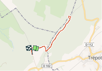

14.4 km | 19.8 km-effort


User


FREE GPS app for hiking
 SityTrail
IGN / Geographical institutes
SityTrail World
The world is yours!
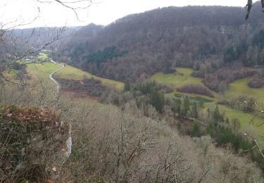
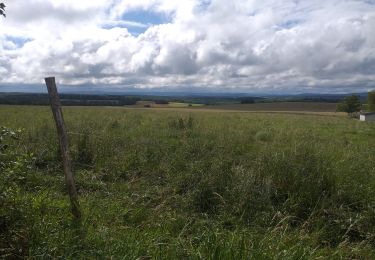
Trail Walking of 3.5 km to be discovered at Bourgogne-Franche-Comté, Doubs, Tarcenay-Foucherans. This trail is proposed by MartinBraudThierry.
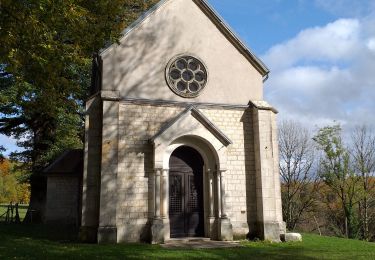
Chapelle belvédère
Walking

On foot

On foot
Walking
Walking
Walking

Walking
Walking
Walking