


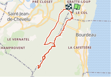

8.5 km | 14.8 km-effort

User


FREE GPS app for hiking
 SityTrail
IGN / Geographical institutes
SityTrail World
The world is yours!
Trail Walking of 10 km to be discovered at Auvergne-Rhône-Alpes, Savoy, La Chapelle-du-Mont-du-Chat. This trail is proposed by mzonzon05.
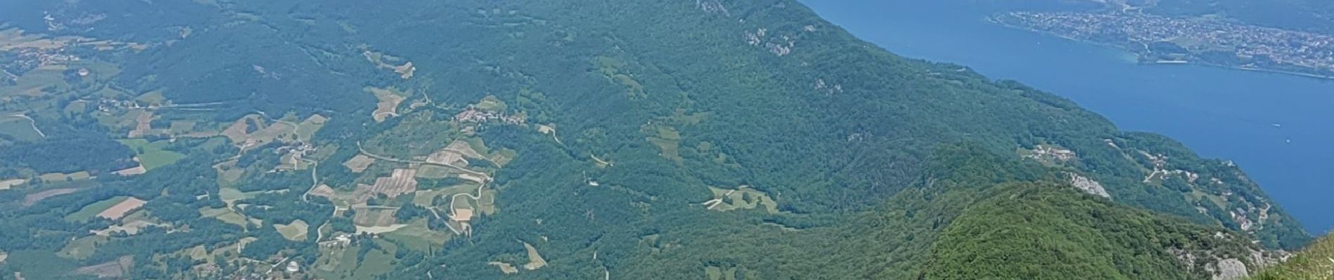
Jolie boucle. Les points de vue du Molard Noir et de la Dent du Chat sont magnifiques et permettent de voir tout Rhône-Alpes !!!
Certes il y a du monde !


Walking

Mountain bike

Walking

Walking
Walking

Electric bike

Walking

Via ferrata


sport