Trail Walking Unknown - Point of sleate  - Photo
© OpenStreetMap contributors
Length
Length
18.7 km
Max alt
Max alt
107 m
Uphill gradient
Uphill gradient
410 m
Km-Effort
Km-Effort  
24 km
Min alt
Min alt
4 m
Downhill gradient
Downhill gradient
418 m
Boucle
Boucle
No
Creation date :
2023-05-26 08:50:52.0
Updated on :
2023-05-26 13:23:28.304

(0 Reviews)

Walking
Walking
2h49
Difficulty : Medium

Scan this QR Code to open this trail in the SityTrail application

FREE GPS app for hiking

Logo SityTrail SityTrail

IGN / Geographical institutes

Download SityTrail from the App Store Download SityTrail from Google Play

Logo SityTrail SityTrail World

The world is yours!

Download SityTrail from the App Store Download SityTrail from Google Play Download SityTrail on Huawei AppGallery

About

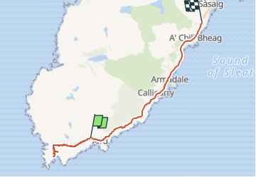
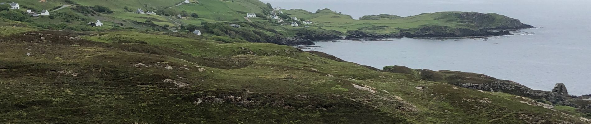
Trail Walking of 18.7 km to be discovered at Scotland, Highland. This trail is proposed by francineposkin.

Description

Extrémité sud de l’île de Skye

Elevation profile

Photos

21 photos in total. Please click on a photo to see them all in the gallery.

Positioning

Country:
United Kingdom
Region :
Scotland
Department/Province :
Highland
Municipality :
Unknown
Location:
Unknown
Start:(UTM)
319448 ; 6325181 (30V) N.

Trails nearby

Trail Other activity  - Ecosse The Jacobite Mallaig a Fort William  - Photo
Other activity
francineposkin

Other activity

, Scotland, Highland, United Kingdom
68 km | 78 km-effort
1h 47min
No
Trail Walking  - Loch kasino - Photo
Walking
matthias.snoeckx

Walking

Very difficult
, Scotland, Highland, United Kingdom
13.1 km | 20 km-effort
4h 34min
No
Trail Walking  - Loch Coruisk - Photo
Walking
cron

Walking

Easy
, Scotland, Highland, United Kingdom
9.6 km | 11.7 km-effort
2h 41min
No


Close
My subscriptions