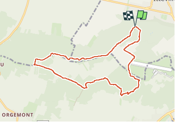
![](/images/other/stat-length.png)
![Trail Walking Itteville - Circuit de randonnée au Sud-Ouest d'Itteville - Photo](https://media.geolcdn.com/t/1900/400/74b60fba-f891-43f2-ba32-b86f7aa7cb99.jpg&format=pjpeg&maxdim=2)
Circuit de randonnée au Sud-Ouest d'Itteville
guydu41
User
![Length](/images/other/stat-length.png)
![Max alt](https://static1.geolcdn.com/siteimages/upload/files/1508320355ic_sort_altitude_max_24dp.png)
![Uphill gradient](https://static1.geolcdn.com/siteimages/upload/files/1508320355ic_sort_den_pos_24dp.png)
![Km-Effort](/images/other/stat-length.png)
![Min alt](https://static1.geolcdn.com/siteimages/upload/files/1508320355ic_sort_altitude_min_24dp.png)
![Downhill gradient](https://static1.geolcdn.com/siteimages/upload/files/1508320355ic_sort_den_neg_24dp.png)
![Boucle](https://static1.geolcdn.com/siteimages/upload/files/16400158638029165_repeat_loop_refresh_sync_direction_icon.png)
![Walking](https://static1.geolcdn.com/sitytour/trail-icons/101.png)
2h31
Difficulty : Medium
![Scan this QR Code to open this trail in the SityTrail application](https://capi.geolives.com/qq0zvz2zws4bq2lad0pu/sitytour/trails/3666716/qr.png?size=200)
FREE GPS app for hiking
About
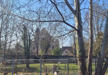
Trail Walking of 9.5 km to be discovered at Ile-de-France, Essonne, Itteville. This trail is proposed by guydu41.
Description
Très belle petite randonnée d'exploration de deux chaos rocheux avec découverte d'un abri orné de gravures probablement datées du mésolithique.
Le circuit n'emprunte que des chemins ainsi que plusieurs sentiers étroits à travers bois.
Point de départ depuis un petit parking au début du chemin d'Orgemont.
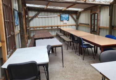
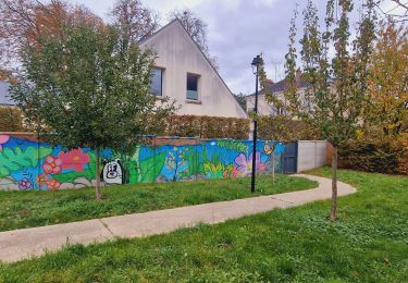
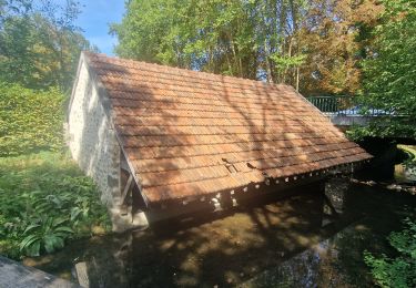
Positioning
Comments
Trails nearby
![Trail Walking Itteville - Les vieilles ailes - Photo](https://media.geolcdn.com/t/375/260/401f9abb-572c-45de-a602-03e6caf0f1c1.jpg&format=jpg&maxdim=2)
![Walking Walking](https://static1.geolcdn.com/sitytour/trail-icons/101.png)
Walking
![](/images/other/stat-length.png)
![](https://static1.geolcdn.com/siteimages/upload/files/16400158638029165_repeat_loop_refresh_sync_direction_icon.png)
![Trail Mountain bike Lardy - Autour de Lardy en VTT - Photo](https://media.geolcdn.com/t/375/260/ext.jpg?maxdim=2&url=https%3A%2F%2Fservices.sitytrail.com%2FGeolivesWS%2FDownloadMedia.ashx%3FTrailID%3D104079%26Media%3D7075_1.jpg)
![Mountain bike Mountain bike](https://static1.geolcdn.com/sitytour/trail-icons/202.png)
Mountain bike
![](/images/other/stat-length.png)
![](https://static1.geolcdn.com/siteimages/upload/files/16400158638029165_repeat_loop_refresh_sync_direction_icon.png)
![Trail Walking Ballancourt-sur-Essonne - Rando Ballancourt 15 km BM - Photo](https://media.geolcdn.com/t/375/260/8977c33c-1145-4a4f-97a7-a064e00deb0b.jpg&format=jpg&maxdim=2)
![Walking Walking](https://static1.geolcdn.com/sitytour/trail-icons/101.png)
Walking
![](/images/other/stat-length.png)
![](https://static1.geolcdn.com/siteimages/upload/files/16400158638029165_repeat_loop_refresh_sync_direction_icon.png)
![Trail On foot Lardy - Boucle Lardy par Pascale - Photo](https://media.geolcdn.com/t/375/260/fcd0ce26-70c7-4c63-8ed6-22b96bedd69d.jpg&format=jpg&maxdim=2)
![On foot On foot](https://static1.geolcdn.com/sitytour/trail-icons/100.png)
On foot
![](/images/other/stat-length.png)
![](https://static1.geolcdn.com/siteimages/upload/files/16400158638029165_repeat_loop_refresh_sync_direction_icon.png)
![Trail Walking La Ferté-Alais - Boucle Cerny - Photo](https://media.geolcdn.com/t/375/260/562ec7de-aba0-410b-b341-a4b4bf98c65c.jpg&format=jpg&maxdim=2)
![Walking Walking](https://static1.geolcdn.com/sitytour/trail-icons/101.png)
Walking
![](/images/other/stat-length.png)
![](https://static1.geolcdn.com/siteimages/upload/files/16400158638029165_repeat_loop_refresh_sync_direction_icon.png)
![Trail Walking Ballancourt-sur-Essonne - Boucle autour de Ballancourt - Photo](https://media.geolcdn.com/t/375/260/726c3226-57e6-4792-b7bd-15745463bf1c.jpg&format=jpg&maxdim=2)
![Walking Walking](https://static1.geolcdn.com/sitytour/trail-icons/101.png)
Walking
![](/images/other/stat-length.png)
![](https://static1.geolcdn.com/siteimages/upload/files/16400158638029165_repeat_loop_refresh_sync_direction_icon.png)
![Trail Walking Baulne - De La Ferté Alais à Mennecy - Photo](https://media.geolcdn.com/t/375/260/8fe2ded9-b4df-4cf6-bfbe-cc2b96524a28.jpg&format=jpg&maxdim=2)
![Walking Walking](https://static1.geolcdn.com/sitytour/trail-icons/101.png)
Walking
![](/images/other/stat-length.png)
![](https://static1.geolcdn.com/siteimages/upload/files/16400158638029165_repeat_loop_refresh_sync_direction_icon.png)
![Trail On foot Itteville - SityTrail - 3212203 - itteville - Photo](https://media.geolcdn.com/t/375/260/56ba6227-1e0d-415b-8a48-77e4f7fc1956.jpg&format=jpg&maxdim=2)
![On foot On foot](https://static1.geolcdn.com/sitytour/trail-icons/100.png)
On foot
![](/images/other/stat-length.png)
![](https://static1.geolcdn.com/siteimages/upload/files/16400158638029165_repeat_loop_refresh_sync_direction_icon.png)
![Trail On foot La Ferté-Alais - Boucle Orveau - Ferté Alais 27 km - Photo](https://media.geolcdn.com/t/375/260/7e0587a3-b381-4c51-bb59-08cb2434ad69.jpg&format=jpg&maxdim=2)
![On foot On foot](https://static1.geolcdn.com/sitytour/trail-icons/100.png)
On foot
![](/images/other/stat-length.png)
![](https://static1.geolcdn.com/siteimages/upload/files/16400158638029165_repeat_loop_refresh_sync_direction_icon.png)